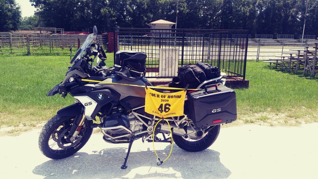
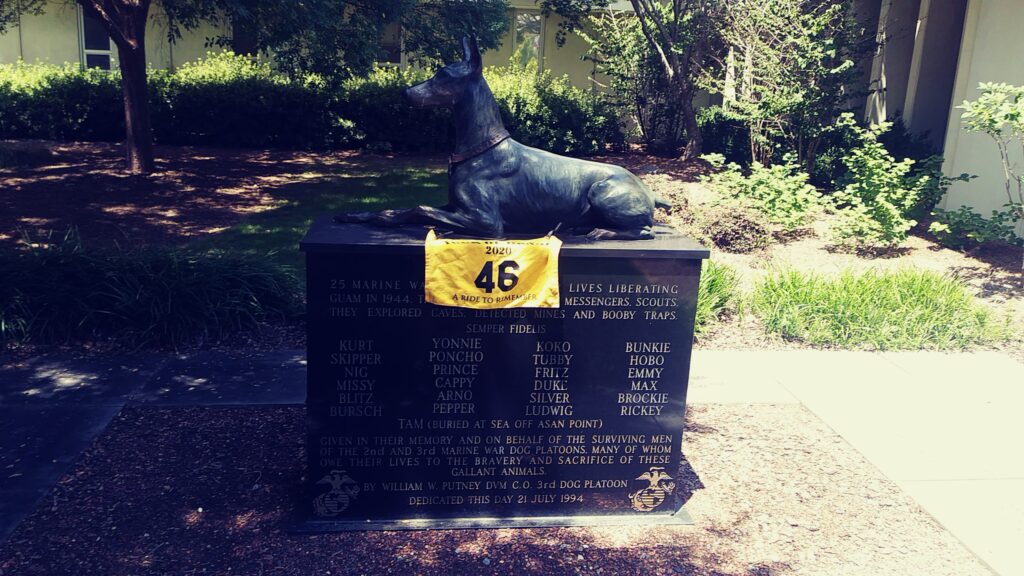
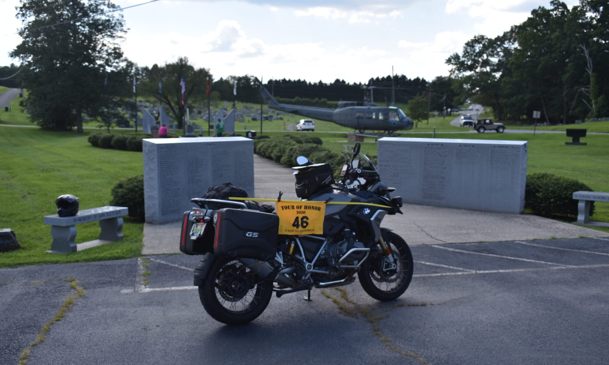
I have an appointment to get the bike serviced next week. I will drop it off on Thursday evening, the 13th, they will do the work on the 14th, then I will pick it up that afternoon. I need to get closer to 36,000 miles, I am about 1,000 miles short.
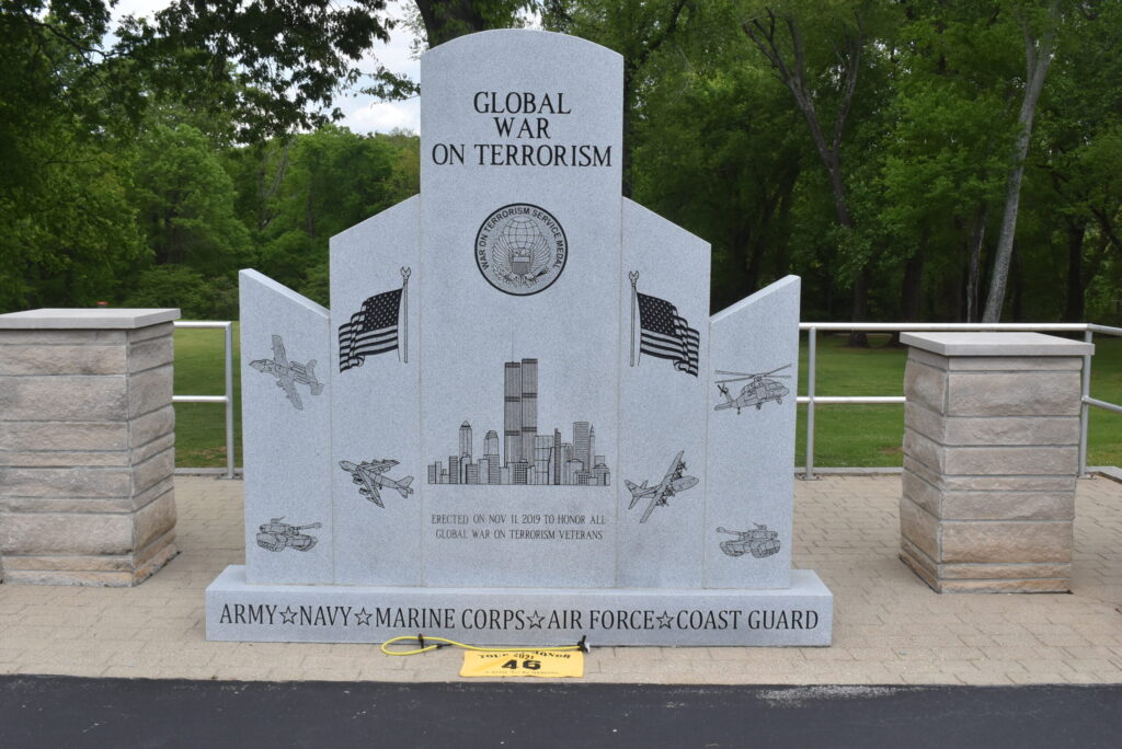
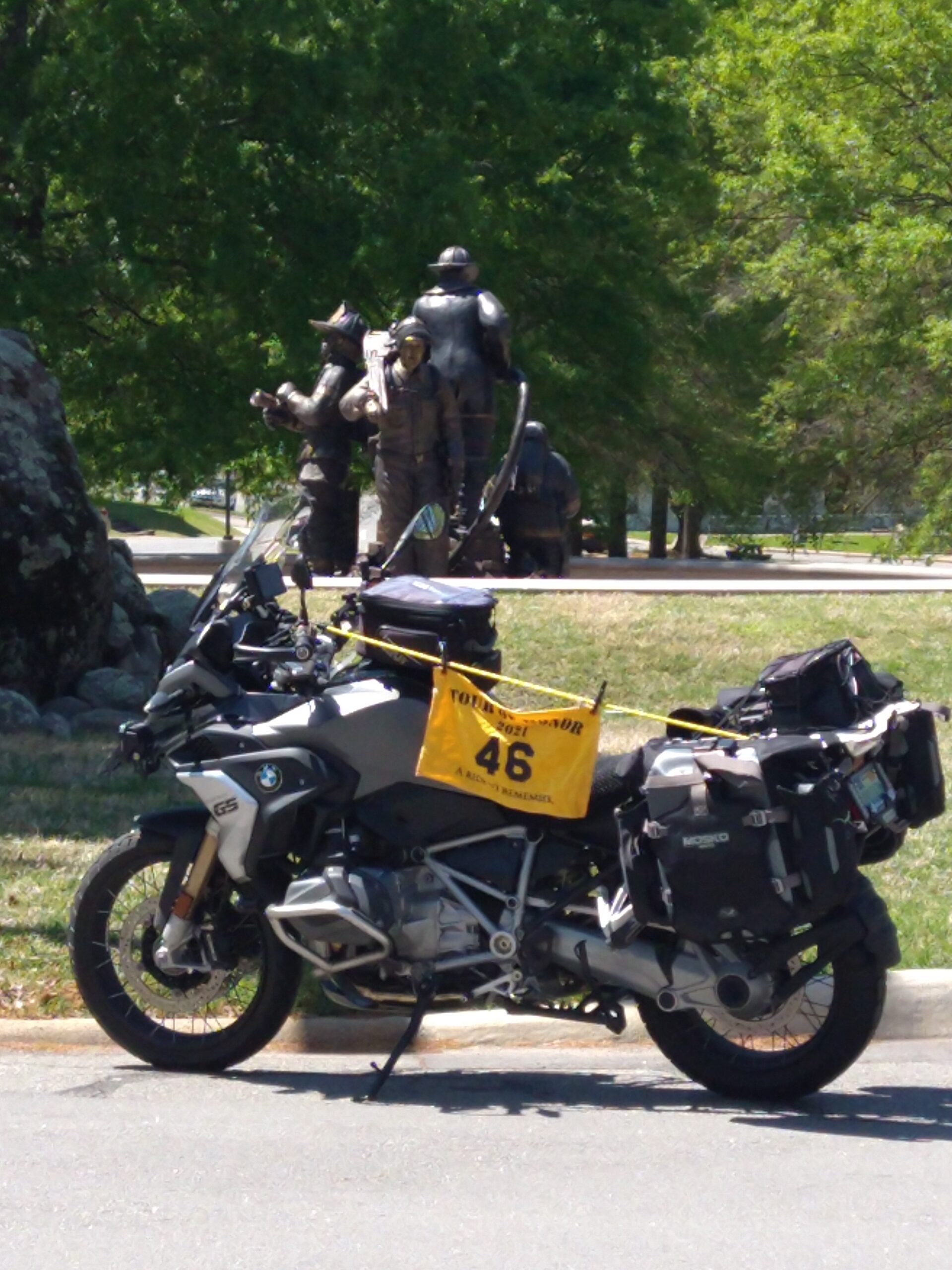
I have gradually visited the sites that are close. I check the Tour of Honor sites and the various bobus/optional sites. I decide to head to Shelbyville and go north to Murfreesboro. There are two 9/11 memorials along this particular route. I can also visit a few sites to get points for the other challenges I have joined.
I head east to Killen, then make the turn to Lexington on County Road 71. This is a well maintained road that I have used for a previous CMA ride. My first stop is the Post Office in Lexington. This will give me a second letter in the BMW challenge (spell SADDLE UP AND RIDE).
From Lexington, I hit a familiar route to Pulaski through Minor Hill. I ride along US-64 until I pass I-65. About halfway to Fayetteville, the GPS has me turn onto Barnes Hollow Rd. The name alone causes me to have a little concern. The GPS doesn’t even list it as a County Road, so I approach with caution.
As I near, I see that it is also TN-244, this eases my concerns and I make the left turn. I am glad I did! This is a pleasant road, sweeping curves, well maintained, and beautiful vistas! I cross US-431 and continue to Shelbyville.
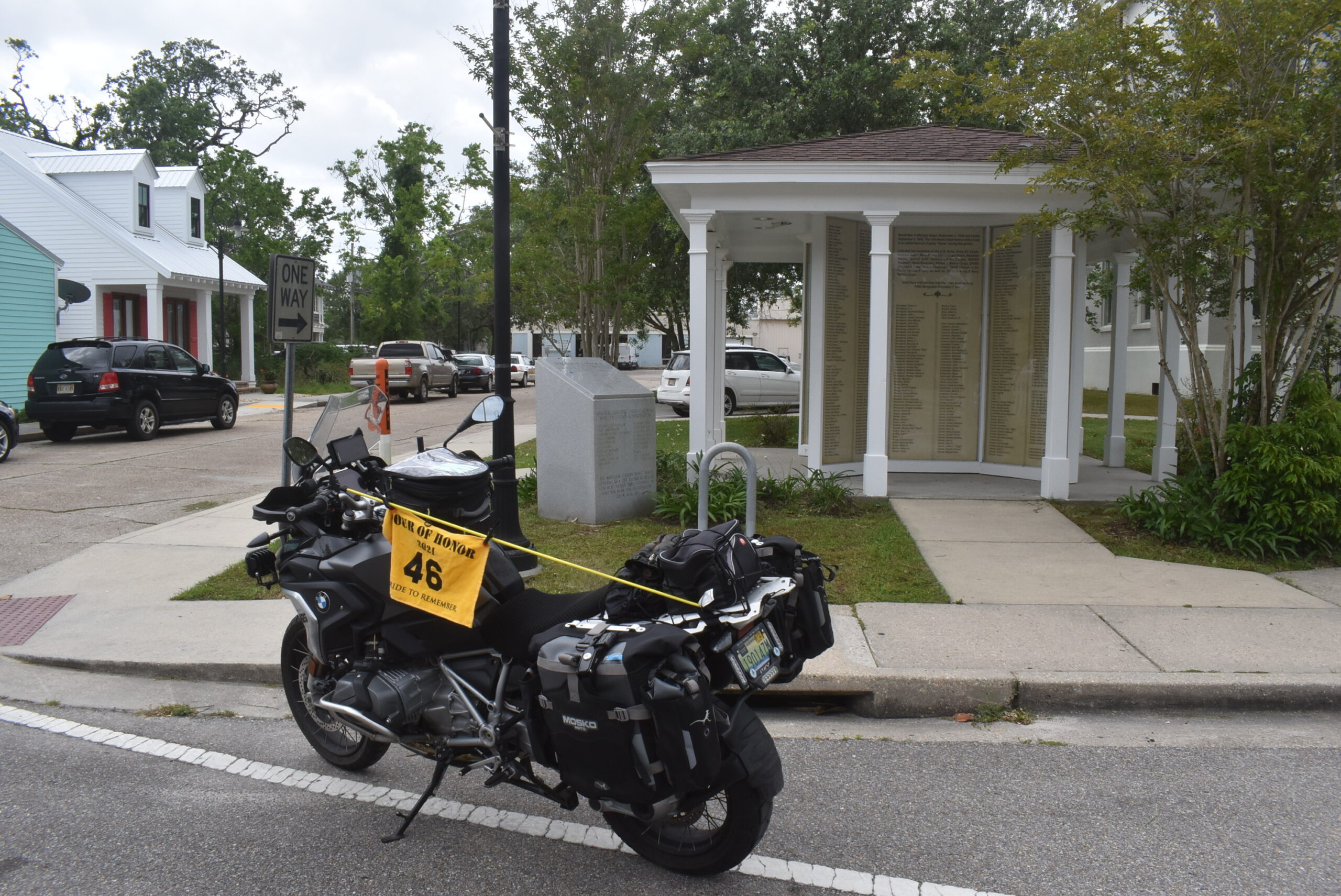
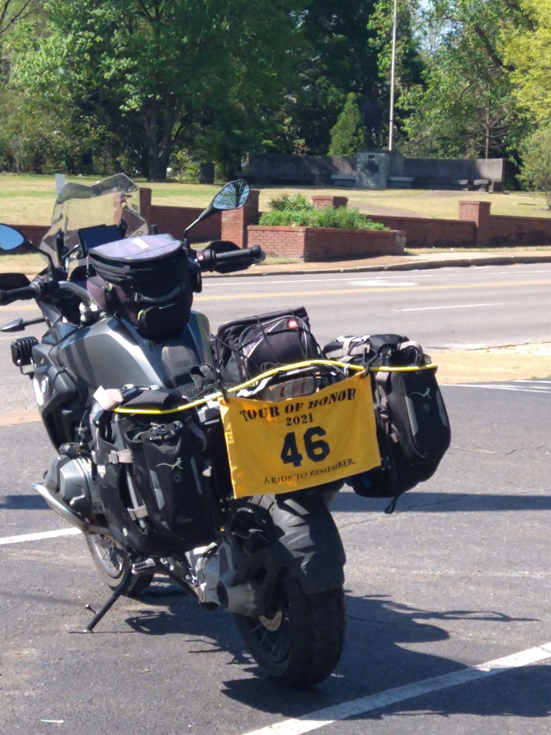
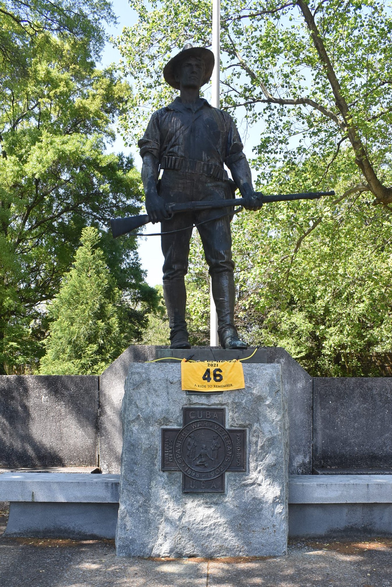
The memorial is in the corner of the area around the court house. Luckily, there is an area with large stone pots with plants where I can park the bike. I get a few pictures, drop off a poker chip in the soldier’s hand, then head on out to the next stop.
I head north on US-231. I make a gas stop and realize where I am. I had stopped at this gas station while leading a ride to Bell Buckle a few years ago. Vanessa and I took off on the road across the highway, I rode into a ditch a few miles down the road. I sprained my ankle pretty bad. “Biker boots” saved me from breaking the ankle.
Anyway, back to today. I gas up and head to the memorial north of Bell Buckle. I ride past the gate, ignoring the sign which states I need to check-in at the main office. I get some nice pictures. As I start to submit them, the app tells me that this site is supposed to be closed. I submit them via the app anyway, with a note that the area was open for visitors. I go to the main office and talk with the receptionist and the office manager. The area was recently re-opened to visitors, though you must check in at the office first or the guard may not let you in. There is a guard at the gate 24/7 (unless he is out making rounds), but the office is only open during regular business hours. This may be a limited access area.
I decide that I want to ride over to Bell Buckle for lunch. Again, I scrap plans for the later part of the ride. I get to Bell Buckle and find a parking spot just bike enough for the bike at the front door of the cafe. The wait is only 15 to 20 minutes, I don’t have any place to be in a hurry, so I wait patiently.
I talk with a few visitors to the area and walk along the store fronts. A couple of kids ask me very specific questions about the bike. One knew all the specs and was asking how it handled in various situations. The kids were in awe when I told them it had close to 36,000 miles on the odometer and was only two years old. Considering it sat for 6 months, not bad!
Lunch was out of this world! The chicken and dumplings were on the level of Mawmaw’s, the beets and okra was great, but the tomatoes and cucumbers were “slap yo momma good!” Cut tomatoes with cucumber chucks in a balsamic vinegar dressing. Yes, I got a picture. With blackberry cobbler being an option for dessert, I couldn’t pass that up. Yes, I had it with a scoop of ice cream. The cobbler was good, but the tomatoes and cucumbers were worth the trip!
Already deciding to forego the visit to the 9/11 Memorial in Murfreesboro, I choose to ride the road where I sprained my ankle. I will not let a road get the better of me. I head out of Bell Buckle toward US-231. Traffic is too busy for me to shoot straight across, so I make a right turn and go to the next opening in the median to make a U-turn. I make the right turn onto Eady Rd. I recognize the slight hills and the easy curves. As I round another curve, I recognize the spot where I rode off the road into the ditch. There was no reason other than I was not paying attention to cause the accident. I slow down and look over the area. If I were on the GS, I could have easily stood on the pegs and ridden it out. As it was, another guy eventually drove up and was able to ride the bike out for me. I rode the Harley home from there.
The road that I took that day have calming views and light traffic. That day, I was more concerned about the pain. Today, I was able to enjoy the views. I pull back into Shelbyville, realizing that I had paralleled US-231.
I do my best to explore new routes. I turn off routing on the GPS and just ride. I wanted to see where the roads would lead. Eventually, I would either get to a dead end or to a road that I knew. I stay on state roads and find myself pulling into Pulaski from the north. wind my way through town and finally find myself on US-64. I am west of Minor Hill Road, so I get to find a new option home.
I ride until I get to US-43, then head south. The problem with US-43 is that it is a four-lane road, through farmlands, but only a 45mph speed limit in Tennessee. In the few towns, the speed limit lowers to 35 or even 25, then back to 45mph. Once I get to the Alabama state line, the speed limit raises to 60mph then 65mph.
I don’t stay on US-43 very long, making the right onto County Road 47. I ride through St Florian, then pull into the gas station near the house. I notice that the SpotX quit broadcasting my location in Lawrenceburg. At least the Rever tracked me the entire ride. I turn off the tracking on Rever, gas up, then head home.
Lunch was the best part of today’s ride, though the memorials were very touching. I now need to get focused on planning the North and South Carolina ride. I will need another day ride before dropping off the bike, but I should be able to get that in early next week.
Unlike previous years, registration and prep for this year has been a bit easier. Unlike previous years where I had to wait until December 1 to sign up and get the next available number, I was able to reserve my number. Since I am the state sponsor for Mississippi, I was also able to register a few days early. I also signed up for the Ride To Meet in Boise, Idaho.
I wasn’t able to go to the Ride to Meet last year, even though I had registered and pre-paid. Seems that cancer surgery took a higher priority. Cancer also put a stop to a lot of my riding for a couple of months too. Of course, the start of the year also had me in a mental funk.
I am not sure why, but the least little thing would cause me to cancel a ride. The ride planned to start the year was to be a Saddle Sore with Jeff to visit the sites in Georgia. I wasn’t able to get to sleep. Jeff woke up at 2am and I was still awake. We thought about taking off, but I admitted that I wasn’t sure how far I would get. We decided to cancel the ride. Jeff said that once we decided to cancel the ride, I was asleep before my head hit the pillow. I slept until 8am and felt great to ride.
Due to being off the bikes for a few months, I am wanting to take things a bit cautious. I hope that later this week (today is February 6th), I will be able to get out for a few days on the bike. I have a list of site for future stops in Mississippi and want to check them out with pictures.
Next month, I will be heading to Greer, SC for a training class. I have signed up for the BMW Two-Day Adventure (off-road) Riding School. I am excited! I saw an article in a recent BMWMOA magazine by someone who took the class last fall. I know that I will learn a lot, I hope that I can remember everything and put it into practice.
My plan had been to get out before 8am and take a long day’s ride, hoping to get back home in time to meet Aaron, Lori, and Jonathan for supper. We woke up this morning, hearing the clock strike 8 o’clock. I started the coffee and popped a couple of bagels in the toaster oven. We enjoyed a relaxing breakfast. It was after 9 when I left.
I pulled out of the garage, lowered the suspension, and took off. I got to Florence Blvd and started the trackers on the bike. It was then that I decided on the route. I headed for Cox Creek, then made the right on Savannah Highway. I made the turn onto CR16, then on CR14 to Waterloo.
My first stop was at the historical marker for Waterloo, this was my first points for the BMW Coddiwomple Challenge. There are several categories, this was to represent battles where great empires fell. I get points for visiting other battlefields. Another category is visiting towns where the first letters spell out SADDLE UP AND RIDE. Sixteen towns, in any state (can ever be all in the same state) I would earn 200 points. If I get towns in 16 different states (one town in each of the states), I would earn 600 points. Each battle field would be 50 points.
I left Waterloo and headed to Iuka. I have been to Iuka many times, Mawmaw grew up there, and I remember visiting Papa Roberts’ farm on the north side of Iuka when I was five or six. My first stop in Iuka was at the Veteran’s Memorial. Next to it is a memorial for 9/11. I got the picture of the bike with the memorial in the background. I then headed to get a closer picture of the memorial. As I was doing that, a couple came up and started talking. They had retired to Iuka about two years ago. They started asking about the memorial, why I was taking the pictures, and where I was from. I told them about the Tour of Honor and explained the memorial. I then told them that my family was originally from Iuka, but I lived in Florence. We talked for a little while longer. I gave them a card with the website and gave him a poker chip, thanking him for this service in Vietnam.
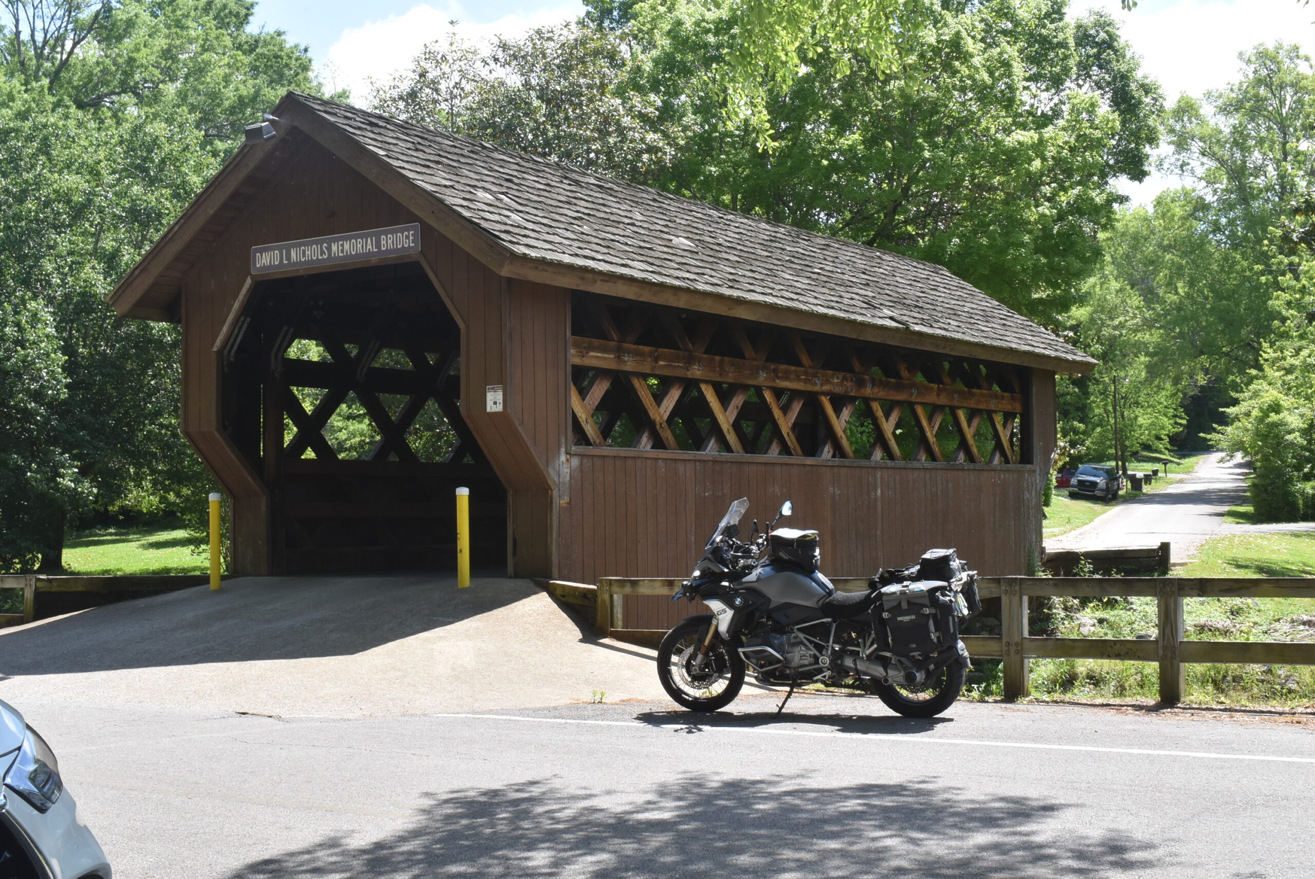
I learned that there was a covered bridge on the other side of the park. I rode around the park and got a picture in front of the covered bridge. As I was taking the picture, a car crossed the bridge. I thought that it was closed to vehicular traffic. I am glad I didn’t park across the opening! This picture would get me a point for the HOG challenge of visiting covered bridges.
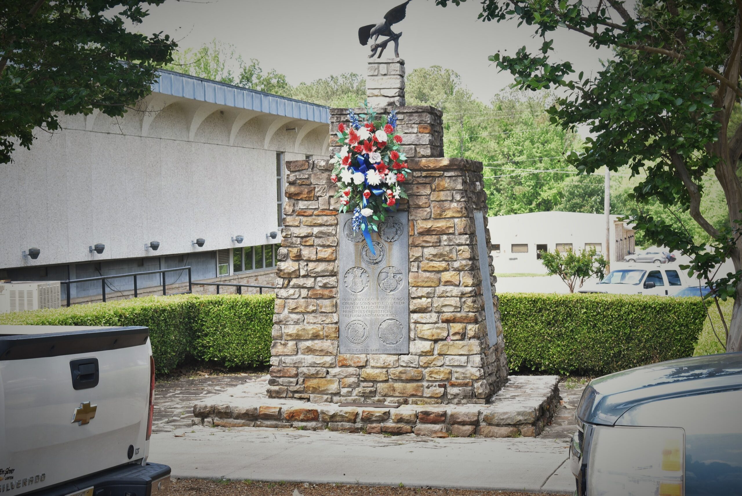
Next stop in Iuka was at the Tax Assessor’s office. The memorial here is the one where we met David a few weeks ago. I was there with the Spyder and got a picture, but I didn’t want to submit the picture with her bike. Today I was with the GS and got the pictures to submit with the Tour of Honor.
One more stop in Iuka was at the Post Office. As I was taking the picture, a guy pulls up behind me and wanted to talk about the bike. We talked for a while. He was from Iuka and had lived here most of his life. He loved the BMW and had had one many years ago. He loved that bike and regrets getting rid of it. He now has an old Harley, but wished he and his wife still had their BMWs. He kept talking about how he loved the boxer engine. We then talked about Iuka. He remembers my uncle’s family, and that they had held out from selling their farm to the Corps of Engineers to build the Tombigbee Waterway. The Corps of Engineers gave up dealing with them and rerouted the waterway. The family ended up buying all the other farms from the Corps of Engineers for prices much lower than assessed values. His stories confirmed what I had always thought.
I took off for Shiloh Battlefield. The GPS had me take a “shortcut” around Pickwick. This was a pleasant ride. I was afraid that when I got to TN-57, I would have to make a left turn at a busy intersection. The intersection was an easy turn. A few miles later, the GPS had me turn right on a road that I had never driven or ridden on before. It was a nice narrow two-lane road through the country, mixture of farms and forests along the way. Suddenly, the pavement ended and I was on packed gravel. The GS was made for this type of road, so I kept on. The next 20 miles was a mixture of pavement, gravel, and dirt roads. I topped a hill and realized I was at the rear of the Shiloh National Battlefield. I saw the sign, got a picture for the BMW challenge (another 50 points), and finished my ride into the park on pavement.
I rode to the Visitor Center. Once parked, I asked in the bookstore about getting a park pass. Again, no luck. Since Shiloh does not charge an entry fee, they do not sell passes. The recommendation is to go to Chickamauga Battlefield near Chattanooga to get my Senior-Lifetime pass.
My next stop was at Crump. I think that Mawmaw was living and working in Crump or Counce when she and Pawpaw met. In crump, I got my picture of the Cobra at City Hall. While here, I started remembering the summers in Savannah with Mawmaw and Pawpaw.
I left Crump with my next stop in Waynesboro, though I was going to ride through my hometown of Savannah. Another ride through Savannah and I have yet to stop at the memorial on Hanna Blvd. (Funny how this is called a boulevard and is only a block long. When I was growing up, this was part of the parking lot.)
I ride into Waynesboro. I have lived in Florence for five years, and spent many trips through Waynesboro and the surrounding areas my entire life, yet I never realized that this memorial was at the corner of the Court House. I got a few pictures. While exploring the memorial, a funeral procession drove past. They circled the courthouse/town square a second pass before riding on. Once the traffic has cleared, I start my ride home.
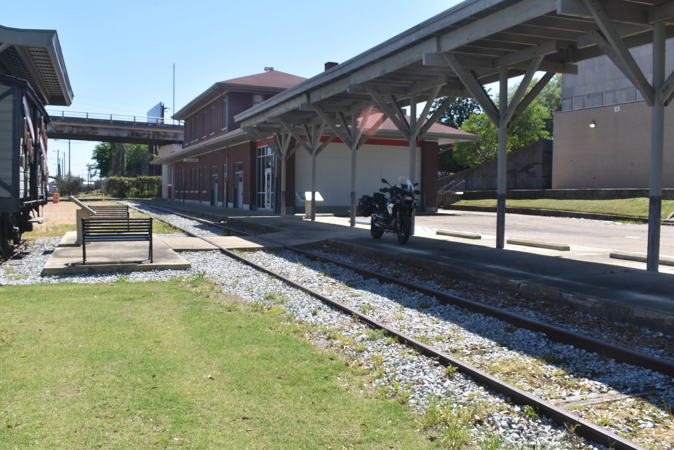
I ride along TN-13 into Collinwood. I park at the old train station and walk to the POW/MIA Memorial. I sit and have a snack while reading the various markers. I take a walk to the Visitor Center and explore parts of Collinwood. My planned short stop at the Visitor Center becomes an hour of talking with the docent. He lived in Memphis while I was in Memphis, actually living a few blocks from me when I lived on Gordon.
I finally get back on the road to head home. I ride TN-13/AL-17, making a turn onto CR-8, then CR-61 to St Florian. I fill up with gas before heading home, pulling into the garage a few minutes before 4pm.
I was actually out of the house and headed to the gas station before 8am. It was a few minutes after 8 when I left the gas station and headed on my trip. I had spent a little time last night writing down the estimated arrival times at each of the sites. Leaving the gas station, the GPS had already calculated that I would beat my estimated time to the first stop by 10 minutes.
I was about 20 minutes early getting to the site in Tupelo. No traffic on the Natchez Trace, nor in Tupelo before 10am. A few one-way streets around the courthouse area makes getting a decent picture an easy chore.
Tupelo, MS
The estimated time to Flora was for 1:45, even with a longer than expected gas stop, I was able to beat the time by 45 minutes. The location made another picture an easy task.
Getting to Flora so much earlier, I decided to add the Vicksburg Battlefield to my stop. I wanted to pick up my lifetime pass, and they would have it since you have to pay to get into the park there.
I arrived at the park shortly after 2pm. Something looked odd about the place. As I neared the booth, a sign said that the pay booth was closed and no fee was required. I didn’t think much of that, thinking it must have been a special event for the day. I drove up to the Visitor Center when I realized the front was covered with a chain grate. I asked one of the people if the visitor center was closed and they said it was closed. One guy mentioned that the Park Ranger had taken his passport to get it stamped and should be back in a few minutes. I waited for the Park Ranger and asked him where I could get my pass. We had a nice chat, seems that most of the National Park Visitor Centers are closed and not accepting payment. There are a few and he tried to find one close to here. No luck.
I made my way to Jackson for the Merci Boxcar. The exit ramp for downtown was closed, so there was a detour. I think I would have been willing to try my luck in a construction zone instead of a war zone. The streets were awful. I had to dodge street grates, or should I say the openings in the street where there were supposed to be grates!
I got to the center with the boxcar, riding up the back of the building to get a picture. There was a chain across the driveway, so I had to exit the same way I came in. I got a couple of pictures and will have to look them over when I get home. Then I realized that the camera battery is low.
I thought about heading around the Old Capitol to get the picture of the Doughboy carvings, but the roads were just too bad for me to consider it today.
I made my way back to the interstate and headed to Meridian. I found the Doughboy there that I have visited each year, almost like seeing an old friend. A few blocks later I was at the hotel.
You meet all sorts of people when you travel. I will just leave it at that. Route planned for tomorrow and loaded into GPS and phone.
April 26
Another first night on a trip with a good night sleep. I had planned to get the bed by 10pm, but kept working on last minute things that crossed my mind. It was closer to 11pm before I turned off the light.
I grabbed some eggs and sausage for breakfast. I only took one sip of the hotel’s coffee and regretted not doing my own.
I got loaded and started off about 30 minutes ahead of my scheduled start time. I was a couple of miles up the road before I realized that I hadn’t started the cell tracking app. I did start the SpotX when I left the hotel. I found a place to pull over to start the app, then got moving again.
First stop was in Quitman. I parked between the courthouse and the Port Office. I got my pictures and was back on the bike fairly quickly.
Back roads that were fantastic which led to I-59. I stayed on the interstate until I got Hattiesburg. I wound my way through town and got to the 9-11 memorial. It was either last year or the year before when this site was one of the Tour of Honor sites. I looked over the list of names. When the memorial was installed, they had printed the names on paper between two pieces of plexiglass. Over the few years the memorial has been here, the names are starting to fade. To me, it is a grim reminder that over time, the memory of the event will start to fade.
I didn’t understand why it was going to take so long from Hattiesburg to Columbia. It was only 30 miles and divided four lane most of the way, but GPS said 45 minutes. Nope, took over an hour. This stretch of Mississippi has more stop lights than people! One stretch had people backed up at a couple of lights waiting for the next light to change to clear the next intersection. Once I got clear of Hattiesburg, it was clear roads to Columbia. Across the street from the memorial was a huge parking spot. At first I thought the road was a lot wider before I realized it was a brick parking lot.
Leaving Columbia, I got caught in a caravan of log trucks. I don’t like being behind semi-trucks. It isn’t that they don’t go fast enough, many will go the speed limit or faster. The problem is usually the wind buffeting that I experience when I follow behind them. The problem with the log trucks is the debris that them comes off the logs. I was dodging limbs for what seemed like forever.
Once I got to Liberty, I had to park across the street. I made a left turn and the trucks all seemed to be going straight at that intersection. I was happy. I got a few pictures and was ready to start rolling again.
The lot I had pulled into was sloped, uneven, and a lot of loose gravel. I tried to backup to turn around. Then the back tire was in a pothole and I couldn’t push it back any more. I looked around and decided to drive across the small patch of grass and leave via to next door neighbor’s driveway. During the whole time, two trucks made the left turn and I ended up behind them. I was able to get around them within a few miles.
Once I crossed into Louisiana, I experienced a new issue. I would get behind a car or truck. In no-passing zones, they would do 10-20 miles an hour under the speed limit. As we would get to a passing zone, they would speed up to 10-20 OVER the speed limit. With the roads being nice and twisty, trying to find a stretch long enough to get around was a challenge. There wasn’t a lot of traffic, just not many placing to pass.
In contract to Mississippi having more stop lights than people, Louisiana could use a few more stop light in rural areas. A heavily used state road crosses US61 (which has a speed limit of 65mph and has a lot of traffic). The truck in front of me needed to turn left, just like me. I was about ready to make a right turn and go until I found a turn around area when the truck worked his way to the area between the lanes. I followed and was able to get around him when we got into the other lanes.
Being around him was short lived. I had to stop at Jackson for the Tour of Honor site. I pulled in and worked to get pictures. I had noticed what looked like a dark cloud as I neared this site. It was the Louisiana state bird in mating season, the gnat! They were so thick that the they covered the windshield and the helmet face shield. When I stopped, they found their way into my helmet, even a few worked their way to my nose.
Once rolling again, I was quickly in Baton Rouge. The billboard noted that the Baton Rouge Police are among the lowest paid in the nation, “enter at your own risk.” I kid you not! I wasn’t excited about driving in downtown Baton Rouge, but it was lunch time.
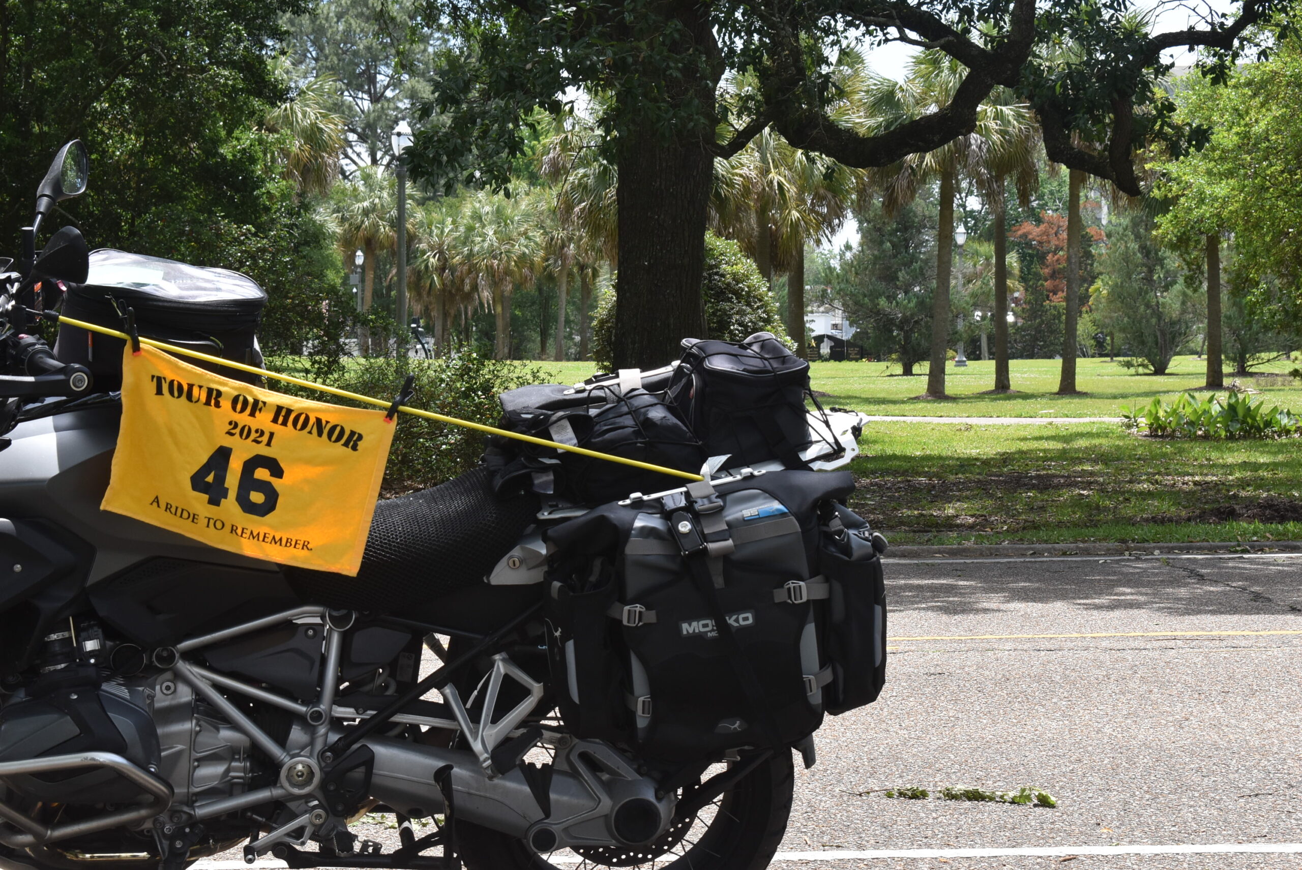
I was able to ride toward the state capitol. The round about that I used two years ago had the road I wanted to use blocked. I headed back the way I came in and found a parking spot. As I was looking through the area, I could see the Gold Star Family memorial thought the trees. I got a picture of the bike with the memorial in the background, though it was hard to see. I went over to the memorial and got a picture with the bike in the background, also hard to see. I submitted them both, and Eric has already sent a note that they were both great pictures.
I headed for the Merci Boxcar a few blocks away. I waited at a red light, but there was no other traffic behind me, so the sensor never picked up that I was there. I waited until traffic was clear and made the left turn.
The Merci Boxcar was on display behind a fence. There was no parking beside the fence, so I just turned on the flashers and got a couple of pictures. This makes my second Merci Boxcar, Mississippi and Louisiana. I will visit Arkansas and Alabama in the coming weeks.
I quickly got out of Baton Rouge and headed to Gonzales. The memorial there had a little park. Since this was my last stop for the day, I took a few extra minutes to look around. I found what might be another 9-11 memorial. I got several pictures and working to get the exact GPS location to submit to Eric for their review. I decided to make my reservation in Harvey, LA, southern part of New Orleans. I get a reservation and hit the road.
I managed to hit New Orleans during afternoon rush hour. Had a white Bronco weaving at slow speeds with few cars at a time getting around. Brought back memories of OJ Simpson. The GPS leading through the streets of New Orleans has a challenge. With roads on top of other roads, it is rough to see when the turn is for your street, the street above you, or the street above that! I got checked into the hotel right on schedule.
Disappointing hotel. No Wifi, no breakfast (we get a discount at a deli in the casino next door, but the don’t open until 9am), and though Google showed a couple of nice places to eat, only the deli is open during the week. The price is in-line with other hotels on this trip and is nothing special, a room with a TV and a bed. I have a coffee maker in the room, but I will only use it to heat water for my own coffee in the morning.
April 27
I slept pretty well last night. I woke up a few times, each time thinking that I had overslept, but was fully refreshed. First time was about 3am, second time was about 4:30am. Once I woke up about 5:45, I decided to get going.
I went through all the stuff I had packed. I took a shower and repacked all I had. Funny, I seemed to have more space.
I went to the lobby to verify that there was no breakfast. The desk clerk told me I could go to the casino and pick up something at the market, but it didn’t open until 9am. I loaded the bike, got my hotel receipt, and took off. I left at 7:00am, an hour ahead of schedule. A quick look at the weather showed chance of rain late morning/early afternoon in New Orleans. The early start should help me avoid the rain.
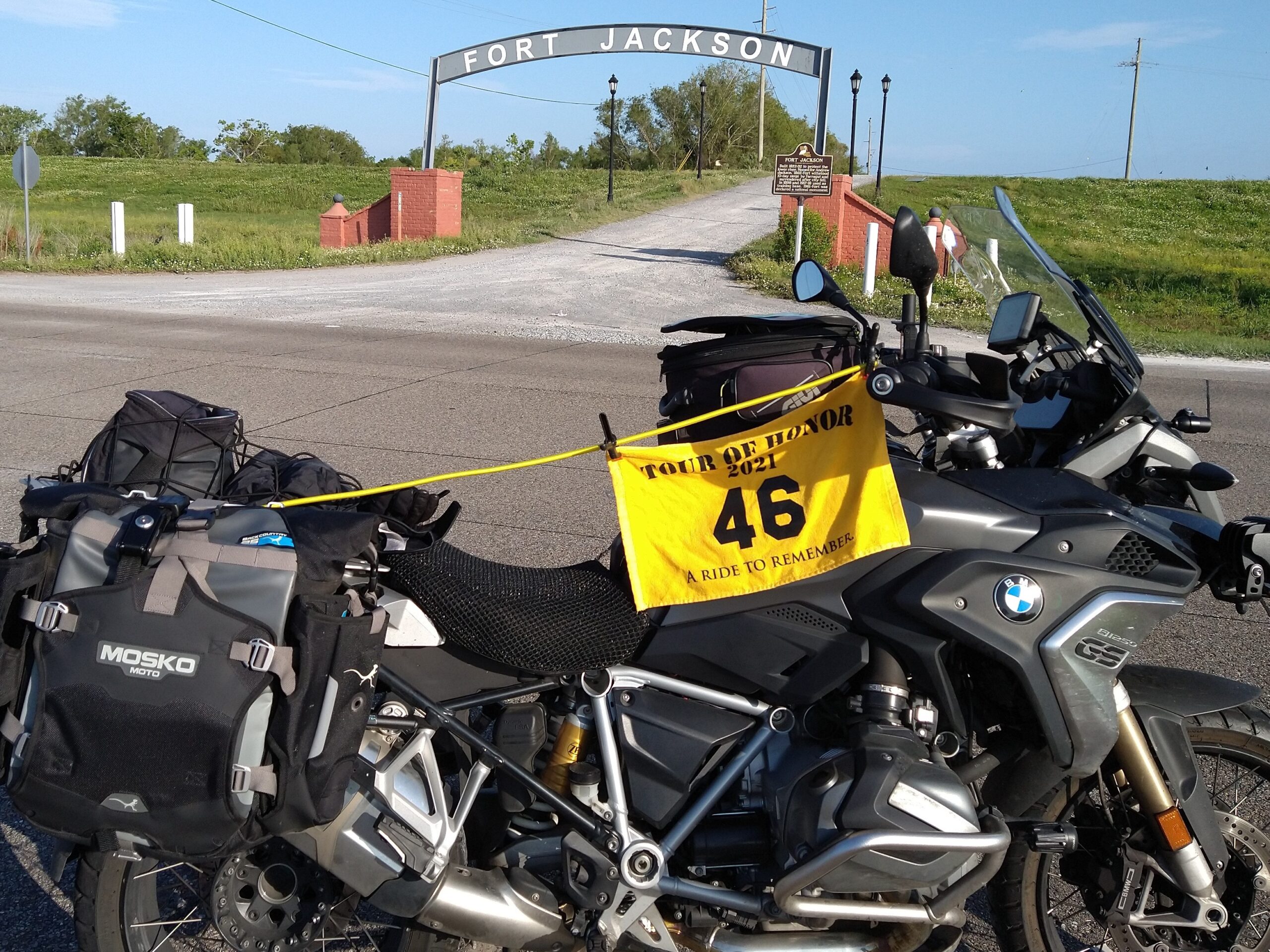
I headed south to Buras, LA, the memorial for Fort Jackson. It was a great ride, though I did slow down while behind a school bus and passed through some school zones.
I got to Fort Jackson entrance, the area looks like loose gravel. I decide to park in the gap in the median of the highway. I get a couple of good pictures and make the turn to head back up toward New Orleans.
I stop to gas up before getting into New Orleans. The gas station is at a light on the left, so I make the turn into the gas station. Getting ready to leave, I don’t trip the sensor to get a turn light. I make a right turn and go to the next opening in the median and go to make a U-turn. With gravel in the road, I have to swing wide and work to make the turn without running over the edge. I make the turn by inches.
I had set the GPS to use interstates. This would keep me from going through New Orleans and all the stop lights. Leaving early this morning, I got to New Orleans earlier than originally planned. This meant I was there at the end of the rush hour. But I still got to enjoy some off the traffic on the interstate. I got to take some slow travel due to a truck fire. The cab shell was destroyed.
I exited the interstate and headed to the neighborhood where the Tour of Honor Memorial is located. I pass many run-down houses, though people are still living in them. I pass homes that are being renovated. Many of the streets are one-way, making traversing an additional challenge. I find the memorial and get some pictures. As I leave, I notice people. There are older people sitting on the front porches, younger people walking their dogs, even a couple of college age ladies riding their bicycles.
I had added Slidell to my list at the last revision. There was a Masonic Lodge, a 9/11 Memorial, and a Huey, all within a few blocks of each other. As I pulled into the park with the 9/11 Memorial, I notice an old train station on my right. I make my way to each and get some pictures. I had opted for a different angle for the 9/11 Memorial. The suggested picture focuses on the iron beam from the Tin Towers. I focus on the fireman carrying a child, with the iron beam in the background. I have this particular picture as the background on my computer.
A few blocks away is the Huey at the American Legion. The helicopter is behind a fence to keep people from getting too close. As far as the condition, this one is about average. I have seen a few which looked like they could be put into action on a moment’s notice. Others are just pieces, sometimes not even together, with rust being the main component.
Next stop is Bay St. Louis, MS. The memorial this year is at the other side of the courthouse from the memorial of two years ago. I park close to the memorial and get pictures. I have now visited all of the Tour of Honor sites in Mississippi, but only submitted six of the seven. The other one was visited on the bride’s Spyder, I want to submit it with the GS.
I leave and head east on US-90. This takes me along the gulf coast. There appears to be a storm in the distance. The waves and the winds are making boating challenging. It is nice to see people with large kites enjoying the wind, it is blowing me around a bit. Though it is less than 30 miles, it takes almost an hour to get there. Between the traffic and the traffic lights, I am forced to enjoy the gulf coast.
The next stop is Biloxi, MS. Last year was my first year visiting this particular Gold Star Family Memorial. This year, I remembered the area and was able to find a good parking spot to get some good pictures. I got to get a close-up of the memorial and to leave a poker chip. A couple is checking the memorial, so I wait until they clear. I drop the poker chip and take a few more pictures.
I thought that my next stop would be the hotel, but I realized that Ocean Springs is right along the way. I continue eastward on US-90. Traffic is picking up with each mile, but I just relax and pull into the Civic Center. Last year I had parked in the front, only to find that the memorials are in the back of the park. Today, I make my way to the rear parking lot and get my pictures. I walk around for a few minutes to relax and make my hotel reservation for the night.
I had planned to stop at The River Shack to get my picture in front of it, but I am tired and don’t want to push myself. I hop on the interstate and I get to Tillman’s corner quickly. Once checked in, a quick supper nearby and ready for bed.
April 28
After putting the laptop and everything away, I set the alarm for 6:00am, then turned off the lights. Next thing I remember was the alarm going off! I hit snooze, but managed to get moving before the alarm went off again.
I got everything packed and loaded on the bike. I was ready to leave by 7:00am. Last night, I had parked the bike under the canopy of the entrance, backing it against the building to be out of the way. The only problem is that if someone is in the entrance driveway, I am blocked in. As I finish loading, a lady pulls in front of me. I got to check out, she is still there when I get back. Her passenger, and elderly man, is coming with a luggage trolly, with a shopping bag. Just one shopping bag. The bag is loaded with drink bottles and other things. I decide to get some juice and anything that may be there for breakfast. I watch the couple decide how to load each bottle into the car. Then he moves the trolly and goes to the front desk. Moving the trolly and them closing the back of their car, I can make my way out.
I had edited the route to use the interstate to get me past Mobile, then backroads. The lady at the hotel desk had mentioned when I checked in that there was a major event going on at the USS Alabama Park. This led me to decide to scrap visiting there this morning. I can make another visit to Mobile to spend a day there.
I leave the hotel and hop on the interstate. Traffic, but it is moving. As I get near the split to go north on I-65, the traffic staying on I-10 stops. There is an accident on the way into downtown Mobile. I make the exit onto I-65 and soon I get to US-45. No more interstate for this trip. With a few exceptions, most of the remainder will be on 2-lane roads.
After about 15 minutes on US-45, I pull over for gas. I know I will have to make one more stop along the way. There isn’t a lot of traffic out, though I do catch a few school zones. Soon I reach the intersection with AL-17 and head toward Chatom, AL.
I pull into Chatom and quickly find the memorial. I search for a parking spot close, and find one that is close to being level. I lean a little to my right to put the kickstand down on the left side. I realize that it is too close total vertical for me to get off on the left side. If I stand on the pegs, the bike will lower, which will make the bike lean to the right, and it will fall over. I put my right foot down and start to ease my left foot over the bike. My foot is almost over the bike when the bike starts to lean to the right. Before I can catch it, we are both on the ground. I positioned myself to make sure the bike didn’t fall on me, but I still hit the ground on my back. My head bumped the pavement, putting a scratch on the back of the helmet. I laid on the ground for a minute, then get up, take off my helmet and gloves, then access the situation. I try to pick it up, but the angle has too much weight for me to pick up at this angle.
While I decide what to do next, I go ahead and get a picture of the bike with the memorial. Yep, the bike is still on its side. A few minutes later, a gentleman walks past. I ask if he can give me a quick hand to pick up the bike. I have the kickstand down, and it is easy to pick up with two of us. Though we have it up, if we let go, it wants to lay back down. I ask him to just hold the bike up by pushing it toward the kickstand. I hop on and I have everything under control, so the gentleman leaves.
“Everything under control,” or so I thought… The bike is nose down to the curb and it is uphill to head out. If I had backed into the parking spot, there would have been no problems. But I now have the bike upright, but gravity is still wanting to fight me. Another gentleman walks up and offers to give me a push. His help is just enough to get me backed up. I go to the top of the hill and park the bike on level ground. As I get off the bike to go get my helmet and gloves, the gentleman has already brought them to me.
We talk a bit and he tells me that he talked with another guy a few days ago who was also taking a picture of his bike and the memorial with his yellow flag. I spend a few minutes telling him about the Tour of Honor. I mention that there is supposed to be a 9/11 Memorial nearby, at the base of a flag pole. I show him the picture and we both agree that there isn’t a place within site that matches that picture. I hit the GPS coordinates in the app and it brings up a map, centered on the location. He looks at the map and his eyes light up. He knows that place and it has a couple o memorials. At first, I think that I will just scrap the site and head on to the next one. He convinces me that it is close and worth the 15-to-20-minute diversion. He points down the street and says to turn right, the memorial is at the fire station at mile marker 6. “You can’t miss it!” I joke that he shouldn’t challenge me like that, I can miss it.
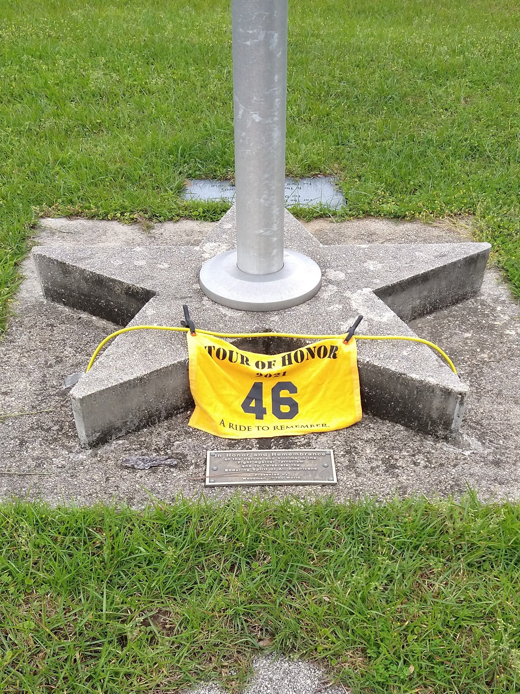
I leave him with a card and a poker chip, then follow his directions. One of the few times that “you can’t miss it” is actually true. I could see the fire station well before I got to it. I park in the parking lot (which is level!) and see several memorials. The one in particular I want is just a plaque at the base of the flagpole. I walk over and see a plaque, but not the one I want. I don’t see any other flagpoles, then realize that I was standing on the plaque. The first plaque was when the flagpole was installed and dedicated, the second plaque was for the 9/11 casualties and the first responders who helped. I get some pictures then head back into town, with the vague thought that I might see that gentleman again.
I head to Carrollton. I have visited this particular doughboy the last two years, but not the first year I did the Tour of Honor in 2018. This statue is part of a display with two other statues, located on the lawn of the courthouse square. Only problem is that parking is challenging to get close since there is no parking on the courthouse side of the block. Last year, my timing was right and I parked against the curb, got a quick picture, and was rolling again without having to shut off the bike. This year seems to have a little more traffic. And I already escaped one event earlier today as well as a meeting of a Carrollton Police Officer about a month ago on my Iron Butt Ride. I got lucky on that ride, but did spend time talking about bikes, jobs, and life in general. Today, I park across the street and get a picture of the bike with the statue in the background. As I hope back on the bike, I realize that I have parked (legally I might add) in front of the Carrollton Police Department. I actually had hoped to see that officer again, but I wasn’t going to go knocking on the door!
With just a light breakfast, I am starting to get hungry. Now I start looking for places to eat. I ride up to Reform, nothing really drawing my interest. As I leave town, the GPS has me taking a County Road. I check my gas gauge and the low fuel light hasn’t come on, but it could at any time. I make a U-Turn back to Reform to fill up with gas. I don’t want to be off on a secondary road, not knowing how well it is travelled, only to run out of gas.
Once gassed up, I gladly take off on Loop Rd, then making the turn onto County Road 27. I spend the next 20 minutes enjoying a narrow, winding country road. Suddenly, I am in Millport, AL on AL-96. This road is familiar! I follow the GPS’s directions and make a right, then find AL-17 again. I make the left and I am back on roads that I remember.
The GPS indicates that there are a few places to eat, but none directly on the route. One appears to be close to the road, but it looks to be someone’s house! It did have a sign, but not sure I wanted to take the chance. (Looking it up on Google Maps, I should have stopped there. Maybe next time)
I pass through Vernon and see the standard chains of McDonald’s Taco Bell, and Sonic. I do see an ice cream shoppe, but the parking brings back nightmares of earlier today. I know there are at least two places in Sulligent, so I keep going. As I get close to town, I see another ice cream place, Polar Bear. A semi-truck blocked my view of the place until I was past it. I think about it for a few minutes, knowing that there is still Bama Boys BBQ ahead. I decide to save Bama Boys BBQ for another trip. I find a place to make a U-Turn and head back. At first, I think I will just be getting some ice cream to hold me over until supper, but I see people sitting inside. I park the bike and stroll in.
I find a table and a young lady brings me a menu. It is a good sign of good food, a simple sheet of paper with the menu. They managed to cram a lot of items on the menu, only a few things mention ice cream. I narrow down to an 8oz cheeseburger and a side of slaw. While I wait, I ask to add a strawberry milk shake to the order. It didn’t dawn on me that 8oz is a half pound! The cheeseburger came and it was much bigger and thicker than I had expected. Not only that, it was awesome! I heard the blender going that was making my milk shake. Some places start all their milk shakes with vanilla ice cream, then add flavoring. Not here, they started with the strawberry ice cream. I only ordered a small milk shake, and enjoyed every drop of it.
I brought home a copy of the menu to review for next time in the area. They have PoBoys, steak sandwiches, and a full bar open whenever their doors are open, except on Sunday. Not sure about Bama Boys BBQ, but this is a place where I would gladly bring others on a ride here.
It was back to familiar roads. I changed my plans, deciding to pass on Red Bay and Iuka for another ride. I was ready to get home.
Last night, I had a dream where I almost ran into the back of a log truck. I woke up before I hit it, and don’t remember whether I ran into the back of it, or if it rolled back into me. Either way, I did remember the truck. At the intersection of US-43 and AL-13, I see a log truck stopped ahead of me. As I neared it, the dream came clearly to my mind. I stopped several car lengths behind the truck, ready to swerve around it if it started to roll back. One it turned onto US-43/AL-13, I took the opportunity to get up to speed and pass it as soon as I could.
From here, it is all four lane roads, mostly divided four lane until I turn into my neighborhood. I stopped for gas at CircleK, turning off all my tracking devices, then made the mile ride home. MaryJo was still at the library, so I opened the door and pulled the bike in. Unloaded the bike, a nice hot shower, and took Blue outside.
Four days on the road, three nights, 1,500 miles, and plenty of memories and pictures.
Glad to be home. I have just under 35,000 miles on the bike. After the incident today, the thought of a bike that is more stable when parked in gaining some interest. I will check with adjusting the suspension settings on the bike to see if that can help.
Relaxing tonight and going to head to bed, my own bed, early.
Initially, I had route planned to visit the remaining six of the seven sites in each of Alabama, Louisiana, and Mississippi. As the date and time neared for this ride to start, the weather looked like it wasn’t going to cooperate. Tornadoes headed along the entire route. I decided to break the ride into two parts, spending the Saturday at home.
So, the final plan for this ride was to visit five of the seven sites in Alabama over two days. First day will be a ride to Auburn, second day would complete the loop to head back home. The goal is to get home on Friday night before the storms hit.
Day 1 – April 22
Though I had packed last night, I packed more than I should have packed. I needed some things out of my bags to start my day, specifically some medications!
After breakfast, both ours and Blue’s, I got ready to head out. I try to set 8am as my start time each day on the road, though I seldom make it when leaving the house. I pulled out of the garage shortly after 8am and headed to the gas station. I gassed up the bike and reset the trip odometer, then headed out. I had the feeling I had forgotten something. Yep, I forgot to turn on the trackers! I got to the left turn light at Helton just as the turn light went yellow. I used that time to turn on Rever and the SpotX. Got the phone put away and the gloves back on just before the light turned green.
My goal was to see if I could follow the planned route without deviating. I crossed the river and made a deviation right away. Instead of headed to AL20 on Wilson Dam Road, I decided to take one of my favorite local backroads, even though I had gotten a speeding ticket on this route a few weeks ago, my first speeding ticket in close to 40 years! I turned onto River Rd, then headed toward Ford City. I made the turn onto CR150 and immediately started checking my speed. What would be the odds that the same officer would be on the road ahead? I wanted to see if I really could stay close to the speed limit. I made it to AL20 at North Courtland without a ticket, I didn’t see any police, but even if they had been there, I would not have gotten pulled over. I STAYED AT THE SPEED LIMIT!
I got back on the planned route and followed it most of the day. The few deviations were around parking lots or when I came to roads that were not roads that I should have ridden.
The first stop was Trussville. This was a memorial in the cemetery, and the cemetery was next to a funeral home. The area of the memorial had been dedicated to military. Some had granite etching of the person, I don’t know if they all died in action. The area had spaces for cremated remains as well as graves. I got a few pictures and went into the funeral home. I admitted that my entry into the funeral home was a potty break, but I did talk with them afterwards about the Tour of Honor. They are participants in the Wreaths Across America.
Trussville, AL
I rode through the suburbs of Birmingham. Mountain Brook, Leeds, and a few others. NICE places, reminded me of McLean. Big houses with gates driveways and brick fences. One difference was that they were in the woods, partially hidden. Driveways were very steep since the area was very hilly.
My next stop was west of Montgomery, in Clanton. The GPS location noted that it was across the street from where it actually is located. I walked around looking for it and then realized it was on the side of the street where I had parked. There were several memorials, and I eventually found the one that I needed.
Clanton, AL
I refueled as I was leaving Clanton. Outside of town, I noticed all the destruction before remembering that Clanton had been hit hard by recent tornadoes. Houses which looked fine until you saw the other side, which may either have the roof torn off or part of the house gone. A few spots had just the rubble of houses. One truck had a huge dent across the hood where a large tree had fallen on it.
Next stop was Wetumpka, a small town north east of Montgomery. A year ago, it had been devastated by a tornado. I had ridden through there shortly after they had gotten hit, the ride today was a lot different. I remember the church which had half of it totally blown away. Today it had a new fence and the building had been restored. I rode to the memorial next to the court house. The roads in this town are very hilly. I found a place to park, but the ground was not level. When I finally was able to get off the bike, it was almost perfectly vertical! I wasn’t able to get off by standing on the pegs, that would lower the bike frame and the bike would lean to the right (away from the kick stand). I added my poker chip to one which was already there, 717. I deviated from the GPS route because the road went up a steep hill, had a stop sign at the top of the hill, and I would have to make a sharp left turn up another hill. Nope, I will find another way around.
Wetumpka, AL
The back roads from Wetumpka to Auburn had so little traffic. But when there was traffic, it was logging trucks going 35 miles an hour! As I entered Auburn, a turn I needed to make was up a steep hill, off camber curve, in traffic. As I made the turn, I downshifted past second but didn’t get to first. I had almost stopped rolling before I could kick it into first gear. I made the turn, though a little nervous, I didn’t panic.
I found the K9 memorial at the Veterinary School at Auburn. The memorial in between two buildings, with trees and bushes surrounding it. Hard to get one picture with both the bike and the memorial. I took two pictures, and have already received notice that the site has been credited to me.
Auburn Veterinary School
The hotel was only a couple of miles away, three turns and I was pulling into the parking lot. Nice hotel. Though the first room did not have a working AC, they switched me to the next room over. I had supper at a new Mexican place next to the hotel. It was rather good. I walked back to the hotel and am now about ready to crash.
Tomorrow, I will head to Tuskegee and Centreville, AL to visit those Tour of Honor sites. I will then head to the 9-11 memorial in Tuscaloosa. If it looks like the rains will hold off, I will head to Tupelo and Iuka before heading home. If the skies to the west don’t look good, I will just head home from Tuscaloosa.
Day 2 – April 23
Last night was a rarity. Though I didn’t get to sleep as early as I wanted, I slept very well. I woke up once about 1:30, but quickly went back to sleep. Woke up at 7am, showered, breakfast, and on the road by 8:30, about 30 minutes later than I had planned.
I rode back roads to Tuskegee. The GPS sent me through a neighborhood, then back to the main road, before sending me to the Veteran’s Center. I got my picture there and was back on the road.
Tuskegee, AL
The GPS wanted me to turn on a road, which was a farm road, through a pasture, and there is a closed gate. I decide to keep going straight. The GPS adds 30 minutes to my ETA to the next stop. I alter the directions to allow interstate, the GPS quickly takes away those 30 minutes. I more than make up the time once I get on the I-85. Speed limit is 70, you have to do 80 or more to keep from getting run over, and that is just the slow lane.
Once past Montgomery, I-85 ends and I continue straight instead of getting on I-65. I enjoy the not being on the interstate. The traffic there is more than I want to deal with. As I near Centerville, I see a lot of recovery activity going on. They are still cleaning up from the tornadoes that came through a few weeks ago. Damage here was even worse than what I had seen yesterday in Clanton. There, houses were damaged; here, the house were demolished. I could see a car was still under a pile a debris from a destroyed home. Trees were cut and lined along the road for someone to pick up.
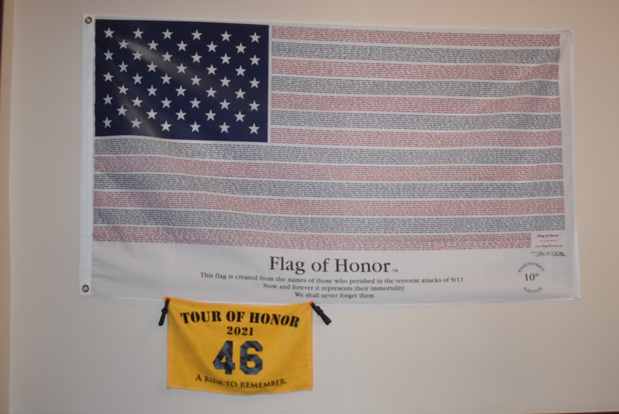
I pulled into the parking lot at the courthouse in Centreville. A couple of memorials were there, so I checked the phone app to make sure I got the correct memorial. I noticed that there was also a 9-11 memorial inside the courthouse. I decided to try my luck. I spoke with the County Clerk, who let me in and escorted me to the flag honoring the victims of 9-11. We chatted a bit and she had been in Florence last week for a conference. They had stayed at the Marriott and eaten at 360, the restaurant that rotates above the river.
Centreville, AL
I headed on the Tuscaloosa. The roads were great, nothing more that I can say about them. Traffic picked up as I got closer to Tuscaloosa. I made my way to the Fire Academy and found the memorial; this had been the memorial my first year. There are several memorials, the specific one this year was the piece of iron from the wreckage of the Twin Towers. I spoke with a firefighter who was attending the academy, he was from Indianapolis.
Tuscaloosa, AL
I looked to the west and saw that the skies were darkening. I did a quick check of timing if I were to go to Tupelo or to head straight home. I checked the weather forecast and timing. I decided to just head home. I rode through Tuscaloosa, I made it through the traffic and was headed home on US43.
I made it home with a late lunch waiting for me. Overall, a very nice ride. Five Tour of honor sites (Centerville, Clanton, Trussville, Tuskegee, and Wetumpka), two 9/11 memorials (Centerville and Tuscaloosa), and one K-9 memorial (Auburn).
Weather forecast for tomorrow is still undecided. One forecast is two storm fronts, each lasting three to four hours, with about 8 hours between. Another forecast if much more devastating and lasting all day. I will just stay home and plan for my ride on Sunday.
After breakfast, I got ready for a ride. The idea is to ride to Huntsville and Trussville, knocking out two Tour of Honor sites in Alabama.
It being Sunday morning, not a lot of traffic on US72 nor in Huntsville. I followed the GPS directions and parked to head to the Gold Star Memorial in Huntsville. I walked around the park without any luck. In the Tour of Honor app, this site didn’t even have a sample photo since it was recently dedicated and no one had submitted a picture. I eventually gave up and decided to head to the Tour of Honor site.
From the photos on Google maps, there should be parking in front of the memorial. I turned onto the street of the memorial and was able to park right in front. I had to stand in the middle turn lane to be back far enough to get a picture of the bike, the memorial, and the Doughboys in one picture!
I saw the path behind the memorial and decided to take a quick stroll in the park. I found the Gold Star Family Memorial right behind the Tour of Honor memorial. I got the GPS coordinates and the picture for the Gold Star Family Memorial.
My next stop was to be Trussville. This would have given me two Tour of Honor sites in Alabama. I started south on US231, but decided to head home. My route home took me through Princeville. I was able to get a picture of the Huey and the Gold Star Mother memorial there. I took a break in the Mexican restaurant next door, I will have to give it a try for a meal one another trip.
I made a stop at the Cobra in Florence’s Veteran’s Park. While there, I spotted a potential 9-11 memorial. I took some pictures and sent it to Eric for his approval.
Once home, Eric sent a note that the submissions didn’t have the pictures attached. I took additional pictures and hit the submit button. The pictures were attached to the email, so I deleted the unneeded picture and everything went well.
Eric sent me a note that I had been the first person to submit the Gold Star Memorial in Huntsville. There was not a sample photo, and he wasn’t sure about the exact GPS coordinates. I sent Eric the GPS location. It would be neat if they used my photo for that location.
I got a note from Eric a few days later that the 9/11 Memorial in Florence has been accepted! And my picture is the sample photo in the app.
Final statistics for this ride was one Tour of Honor site, two Hueys/Cobras, two Gold Star Family Memorials, and a new 9/11 Memorial.
Looks to be a few days of great weather, nothing planned during the week, why not take a ride? Instead of waiting and letting Arkansas get in my head, I decided to tackle it early this year. Only having one Tour of Honor site, which I visited with Jeff on April 1, this would make Arkansas my kick-off for the year. I spent a few days to develop a route and decided to try to follow the route as closely as possible.
Day 1 – April 11
The first day’s plan was to get to Little Rock. I had set the GPS that I would check into the hotel, then visit the sites in Little Rock. First, I would visit a couple of sites in Memphis.
The GPS wanted me to head up to Savannah, then across US64. I thought about taking the southern route to Memphis via US72. The southern route would take me through Iuka and Walnut, where I could visit those sites (Iuka being a Tour of Honor site for MS, Walnut having a Huey which I have visited each year). Since I had wanted to follow the GPS, I opted to head to Savannah.
Early Sunday morning, I am ahead of the church traffic, but I know that I will be hitting Memphis as churches will be letting out. There is a Huey (actually a Cobra) in Crump, just past Savannah. It is on my left and I will have to cross the road. I knew it was there, but hadn’t put it in the GPS routing. I keep thinking about stopping, but didn’t slow down.
A quick side note…
My bride and I had met up with another rider (Dave) the other day. He is from North Carolina and was Rider #1 a few years ago. We talked with him over lunch in Iuka, actually, we spent more time listening. Very enlightening and gave me a different perspective. Though the goal of most Tour of Honor riders is to visit as many sites as possible, many like to see how many bonus sites they can visit too. I have liked to keep track of total sites I visit (Tour of Honor sites and the bonus sites). This year, Dave is focusing on the Tour of Honor sites and the 9-11 Memorial. Though he may miss many other bonus sites, unless they are within a couple of blocks of his route, he will bypass them. The reason that Dave is adding 9-11 memorials to his goals this year is because his was killed in action in Afghanistan. This caused me to rethink my reason for the Tour of Honor.
And back to the story…
I bypass the Huey/Cobra in Crump and continue on my route. I follow the route until I get closer to Memphis. The route is set to avoid interstates, but that will put me through busy streets with stop lights and churches letting out. I opt to hop on the interstate. This stretch of the interstate is one that I haven’t ridden in many year, over 30 years if my memory serves me right. I get within a few blocks of the memorial in Memphis.
The memorial is at the corner of two busy streets, even on a Sunday. I park in the parking lot across the street. The picture of the bike with the memorial in the background does not do the memorial justice, so I walk across the street for a closer picture.
The memorial is honoring those who fought in the Spanish-American War. I think that it was my great-great-grandfather who had fought in this particular war. I looked at the statue and wondered if he that was how he looked. My grandfather fought in WWII, his father (my great-grandfather) had fought in WWI. I knew my grandfather, and have seen pictures of my great-grandfather, but no pictures of my great-great-grandfather.
I lived in Memphis for ten years, and had traveled through this intersection many times. I don’t remember this memorial when I lived here. Doing a little research as I was writing this, the statue was erected in 1956 and dedicated in 1961. Over the years, the park had gotten overgrown. A few years ago, effort was made to clean up and repair any damages, taking it to its current glory.
A few blocks away is the Charging Doughboy in Overton Park by the art college. The GPS wants me to make a U-turn in the middle of this intersection. Since this is close enough to the house for a day ride, I skip this site today and head on the Little Rock.
The route was planned to avoid interstate, but there are few crossings of the Mississippi River that are not an interstate. I hop on I-40 into West Memphis. Once I get past West Memphis, I decide to get off the interstate, riding along US70 which parallels the interstate until I get to Little Rock. “Best laid plans of mice and men…”, I only ride US70 a few miles. The farmers are out in full force getting their fields ready for planting. I get back on the interstate and head into Little Rock.
The ride on the interstate took over an hour off my estimated arrival plan into Little Rock. I skip the hotel check-in stop and go straight to the State Capitol for two memorials. One of the Tour of Honor sites and a Gold Star Family memorial are across the drive from each other. I was able to find a parking spot between the two sites.
I set the rally flag on one side of the bike and get a great picture of the bike with the memorial, even though the sun is behind the memorial and affecting the picture. I get pictures on the phone to submit and on my camera for posting on the web.
God Star Memorial in Little Rock, AR and Tour of Honor AR4
I move the flag to the other side of the bike and get a picture of the bike with the Gold Star Memorial in the background. The memorial isn’t clear in the picture, and I like to see this one up close anyway, so I walk up the hill to the memorial for more pictures. I visited this site in 2019, the day it was dedicated. That was also the day that I broke my foot in Fort Smith.
I look over the route and the timing, I decide that I should just head on to the next town, Hot Springs. I skip the next stop which is a few minutes away. Then it shows that the next stop is even closer. I had skipped the Doughboy memorial which I have not visited in any of the previous years, “Das Boots.” I try to add it back, but no luck. I skip the next stop which is the hotel in Little Rock. The GPS now shows that the next stop is about an hour away. It is only 2:30, so I may try to get past Hot Springs.
There is a stretch of four lane roads in the mountains of Arkansas. Higher speeds, twisties, and not a lot of traffic. No traffic in Little Rock either. Where is everyone?
I pull into Hot Springs and ride though the outskirts of town, eventually making the turn to downtown. I found everyone as I got a block from the memorial in Hot Springs. Streets were packed with cars, trucks, RVs, motorcycle, bicycles, and people. So much traffic, I can’t focus on trying to find a place to park. The memorial is on the corner of the intersection, with a dedicated right turn lane. No place to park there. I make the right turn and check the street parking for a place to try to get a picture. I follow traffic and make a right on the way to one of the visitor centers. No parking on this street, though it is about a half mile from the memorial. A sign states that no vehicles over 30ft if taking the right turn ahead. I know that means tight turns. Once I pass that road, there is a small place for people to turn around, that right turn is a one way loop which comes out where I am not sitting.
I turn around and check the hotel situation in town. There are older, historic hotels in the two or three block area of downtown. I find a hotel about 3 miles away, and it has a steak place sharing the hotel’s parking lot. Reservation made! I will try this memorial in the morning before people are out and about.
I get to the hotel, call home, settle in for a few minutes, then head over for a steak. I check the restaurant’s estimated wait times and see that I am between the Sunday lunch crowd and supper crowd. I walk in and get a seat right away. I have four people tending to me, the manager, assistant manager, kitchen supervisor, and the waitress. My steak looks so good that the couple in the table near me decide to order the same thing. They had been sitting there enjoying various drinks. Steak was good, very good. I thought about dessert, but know I would hurt if I did.
I get back to the hotel and notice they have a basket of rags specifically labeled for motorcyclists to use to wipe down their bikes. A real nice touch. I take one, wet it, then clean my windshield and helmet visor, before returning the rag to the bin for the used rags.
I work on editing tomorrow’s route. Since I got an hour farther than I had originally planned. This change may help me get father tomorrow too, making the last day home even quicker. I set the plan to get to Mountain Home for tomorrow night.
Day 2
I get up and out early. I skipped breakfast, though I did enjoy my own coffee this morning, using my new coffee press.
I stop to fill up the tank before leaving town. I pull into a gas station and stop at the pump. There are four pumps, no one else around, yet someone pulls right up behind me at my pump. I go in to pre-pay, pump my gas, then get my change and receipt. After making my notations about the stop and resetting the trip odometer, I get ready to roll. The car is still waiting behind me, and not very patiently.
I get up to the memorial and notice a bicycle lane along the curb. Though cars that make the right turn tend to ease into that lane, I stop close to the curb with my flashers on. I get a few quick pictures. The best picture with the memorial and the bike can barely see the bike. That is the picture I submit. This particular memorial is dedicated to a Park Ranger who killed in the line of duty, he had been killed by bootleggers.
I leave town and head toward my next stop, Ola, Arkansas. My opinion of Arkansas has been tainted the last two years. Two years ago I broke my foot. Last year seemed like I spent more time waiting for construction flagmen than time riding. This year, though I did pass through a few construction zones, I enjoyed the twisty two lane roads. No traffic and beautiful vistas.
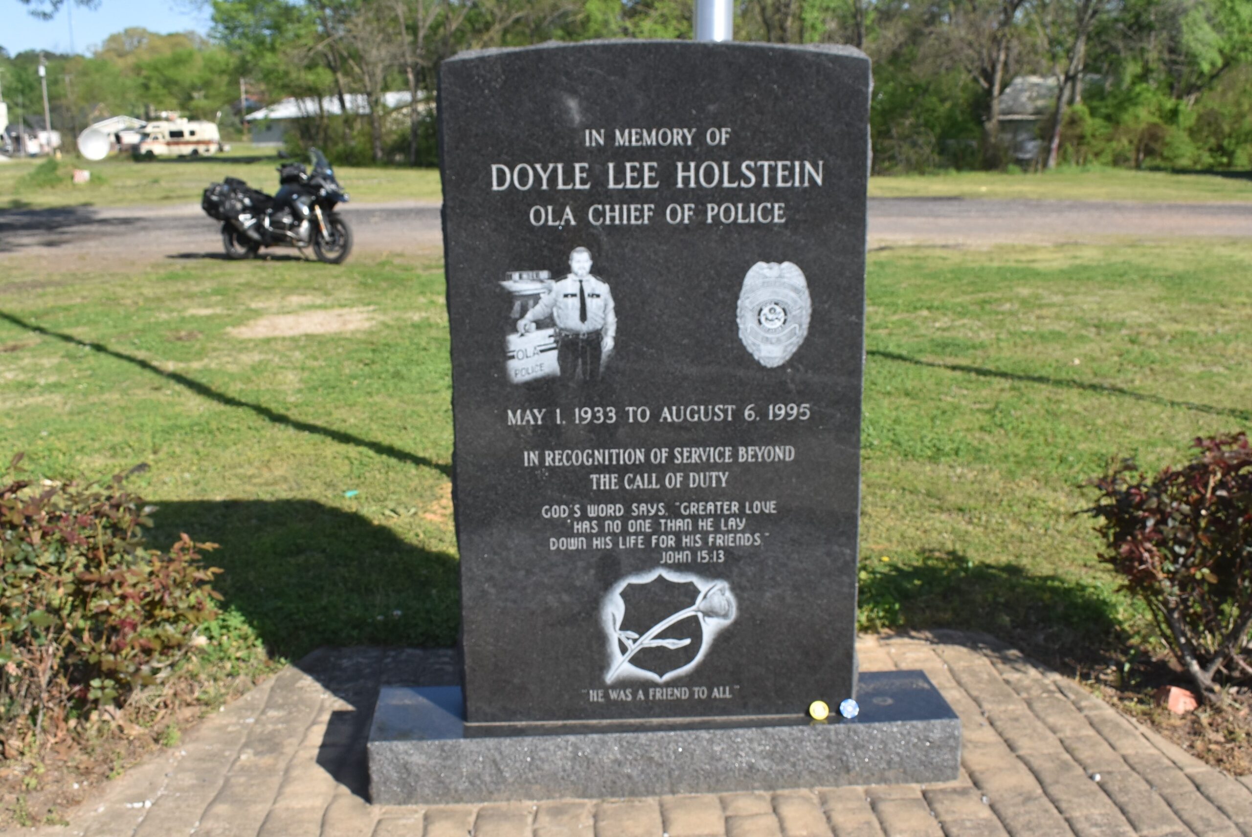
The hour and a half from Hot Springs to Ola was too short. Ola is a small town, with one four-way stop. This intersection has the Tour of Honor Memorial in one corner, which has a vacant lot behind the memorial. I pull in and take my time getting the pictures. This memorial is dedicated to an officer who had been killed in the line of duty.
Today’s route is set to avoid interstates. The closest I come to an interstate is when I pass under the interstate east of Fort Smith. The mountain roads are much nicer that the roads through the farmlands.
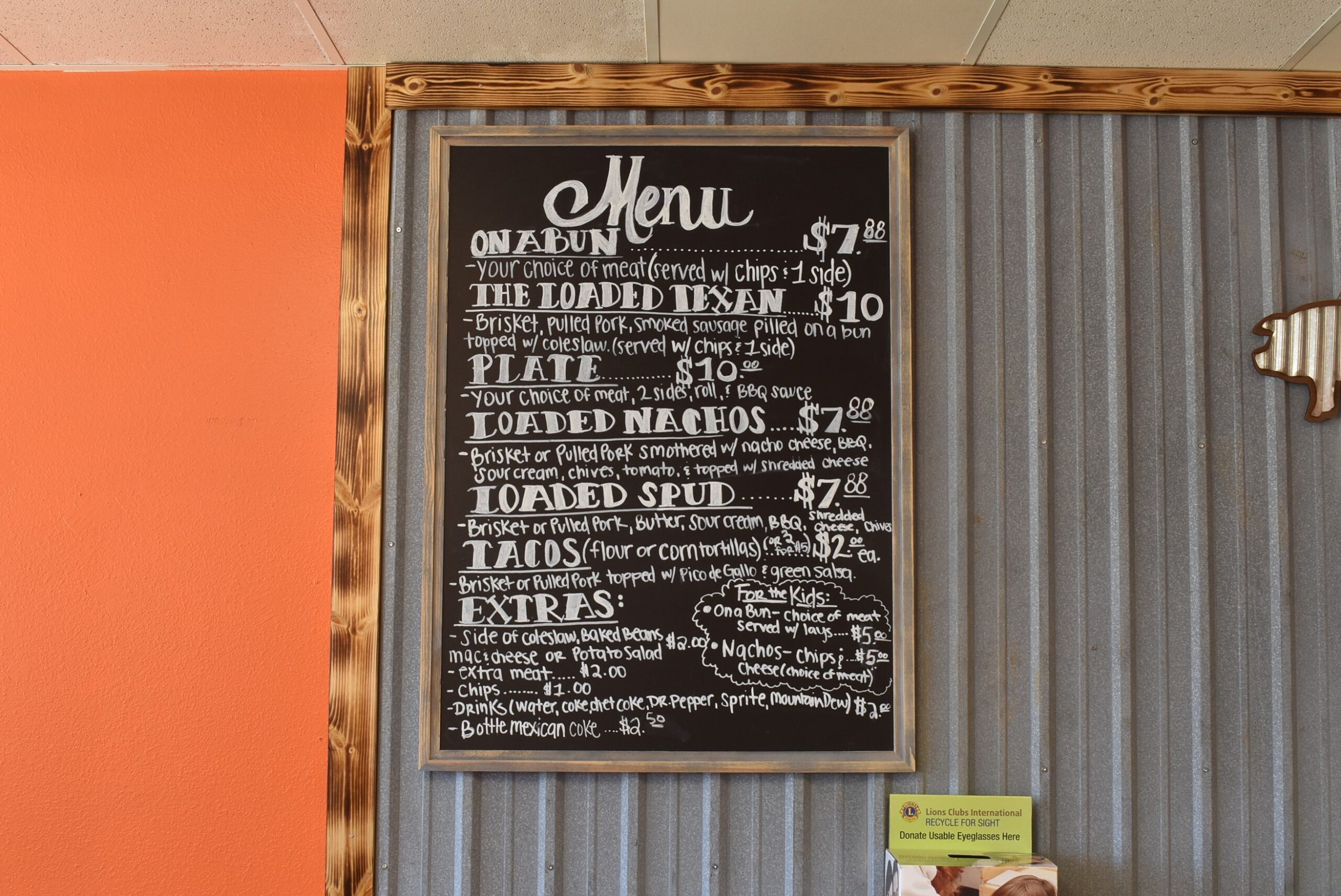
Getting close to lunch, I was getting hungry. I start looking for a place to eat. I see a place that was probably great based on the number of trucks in the parking lot, but I wasn’t able to slow down to make the turn quick enough. A little while later, I enter the town of Elkins. The name struck me since there was an Elkins, VA that I passed through many times when living in Virginia. I see a Mexican place, but it looks closed. I then see a little strip of shops, one being a BBQ place. With no one behind me, I make the quick stop and turn left into the parking lot. The name is unique, a good sign that it will be good. The sign over the entrance is on at an angle, yet another indication of good food. I enter and look over the menu, which in written on a board above the counter (a third sign of good food). I ask the owner what he would prefer, he suggests the brisket sandwich. I see his drink cooler is full of cokes (sodas and pops to people in other parts of the country), I get my drink from the bike.
I notice the decor and comment that he must be a baseball fan. He says he is. I say that a true BoSox fan, eh? He clutches his chest as if having a heart attack and laughs. (The decor is of New York Yankees.) We chat while I stocks and takes other orders. What had planned to be a quick 30 minute stop has turned into almost an hour. A very pleasant hour! He coaches youth baseball, closes early on Tuesday and Thursday for practice. We talk about him starting the business, how he and his wife prayed about whether to do it or not. So few people would talk about praying for their business in public, much less to a total stranger. I tell him about the Tour of Honor, giving him a card with the website and a poker chip. Rarely do I share my Spotwalla site, but I gave him that link too so he and his son can keep track of me and my travels. Fantastic lunch and visit at G’s Meaty Buns!
G’s Meaty Buns – 479-435-4838
As I pull onto the road and see the Fayetteville city limits sign before I shift through all the gears. I follow the GPS directions toward the Police Station. The route selected by the GPS has me turning a sharp left, at a busy intersection, with me on a blind hill. Gee, thanks. I catch an opening in the traffic and make the turn, getting to the memorial a few minutes later.
As I start to park in a parking spot, a car pulls in behind me, waiting for me to leave or move over for them to park. After the honk the horn, I decided to move since they must have important business or this is a restricted parking. I move to the side of the road closer to the memorial. The guy in the back seat gets out and talks with me for a bit. The driver and front seat passenger head into the police station. I explain to the guy what I am doing and about the Tour of Honor. He tells me that his father had been killed in the line of duty when he was younger. He walks over to the memorial for a minute. I wait until he finishes his time there before taking my pictures. He is wiping his eyes as he goes back to the car. I get my pictures and leave a poker chip. Odd thing about the guy was that he was wearing a BLM T-shirt. I chose not to discuss the irony of the situation.
The sites the rest of the day are nowhere near interstates. I have no option except to enjoy the back roads. Again, the riding to day is making me rethink my impressions of the past two years in Arkansas.
No more Tour of Honor memorials for today, but I do have a Huey planned along the route. A mix of two lane and four lane roads. I am enjoying these roads, and staying at or below the speed limit.
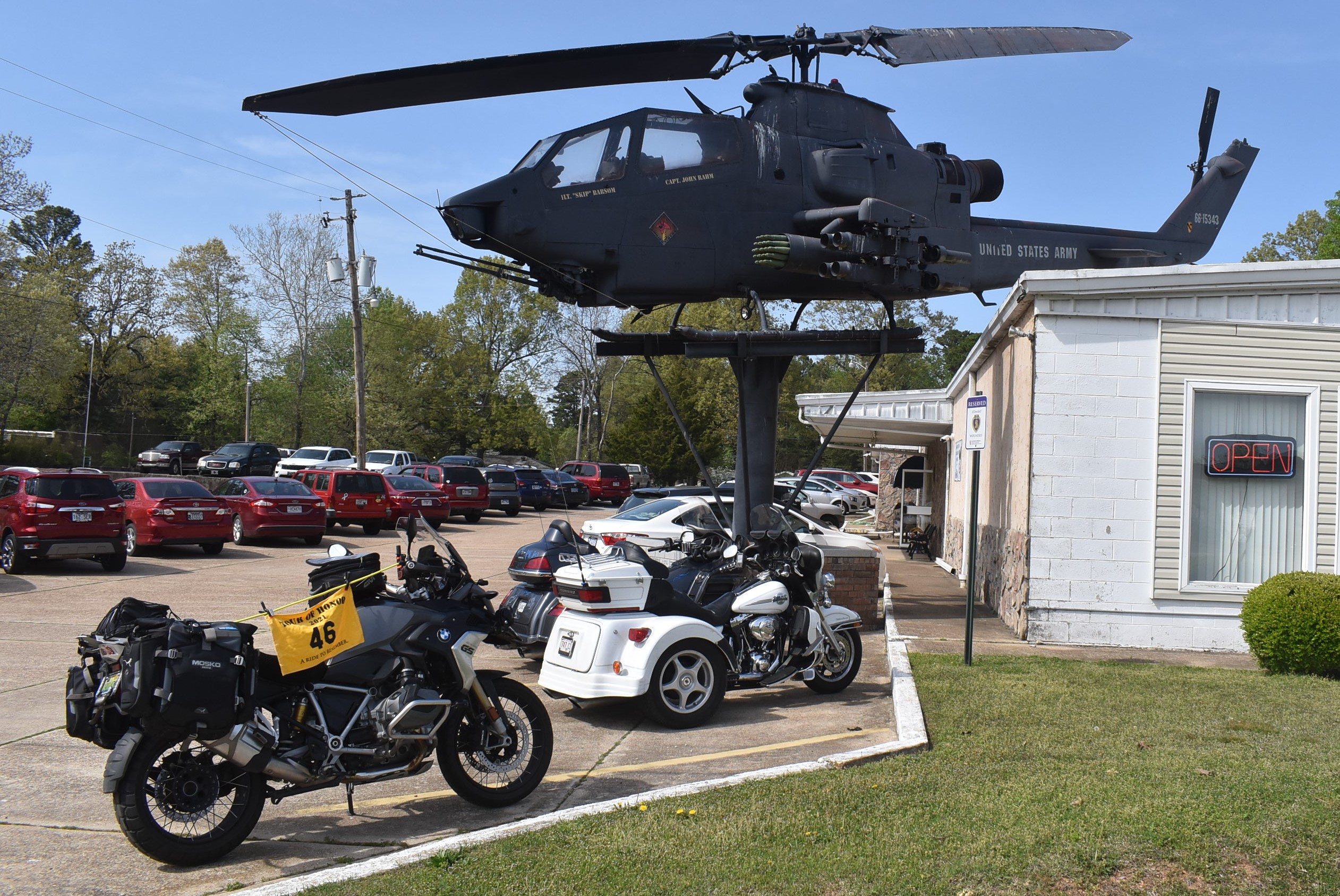
The GPS has me turning left on a side street, but I see the Huey in the parking lot in front of me. I pull into the full parking lot of the VFW, sharing a parking spot with a Goldwing Trike. As I am getting ready for my pictures, the VFW Commander walks up to me and asks if I am a VFW member. I explain that I am not, so he offers to sign me in as a visitor. I explain why I am there and ask about the full parking lot. Seems that today is BINGO day, with a $1000 pot. He tells me about the Huey and its history. He had served in Vietnam in the same area where this particular Huey had been shot down. The pilots had been killed before they could get out of the cockpit by enemy soldiers. This particular Huey had been shot down several times, being repaired after each incident.
As I get ready to leave, he warns me that the next town, Lakeview, is a speed trap. There is a speed limit sign of 45mph in clear view, shortly afterwards, there is a speed limit sign partially hidden that states 35mph. The police strictly enforce the 35mph. He says that it is 35mph, not 36mph! Fair warning.
I follow the advice of my new friend at the VFW. Sure enough, if you aren’t paying attention, you will miss seeing the 35mph speed limit sign. A block away, the police officer isn’t even trying to hide. I kept my speed below the 35mph.
I get into Mountain Home, making a hotel reservation once I pull into the parking lot. I relax a few minutes, then head to check in. When checking in, I ask about a place nearby with good food. They recommend the bar and grill next door. It was good!
After supper, I plan the route with a couple of options for tomorrow.
Day 3
I am not sure, but I must have been in one of the higher elevations in Arkansas. We had a storm come through last night, but I was back in the room and asleep before it hit. The breakfast area had a college golf team getting breakfast before they hit the road to head back home. I enjoy a cup of my coffee again this morning.
I have a couple of options for today, two sites are for Dougboys that are south of the main route, but they will take me near Blytheville which has a diner that may be an option for lunch.
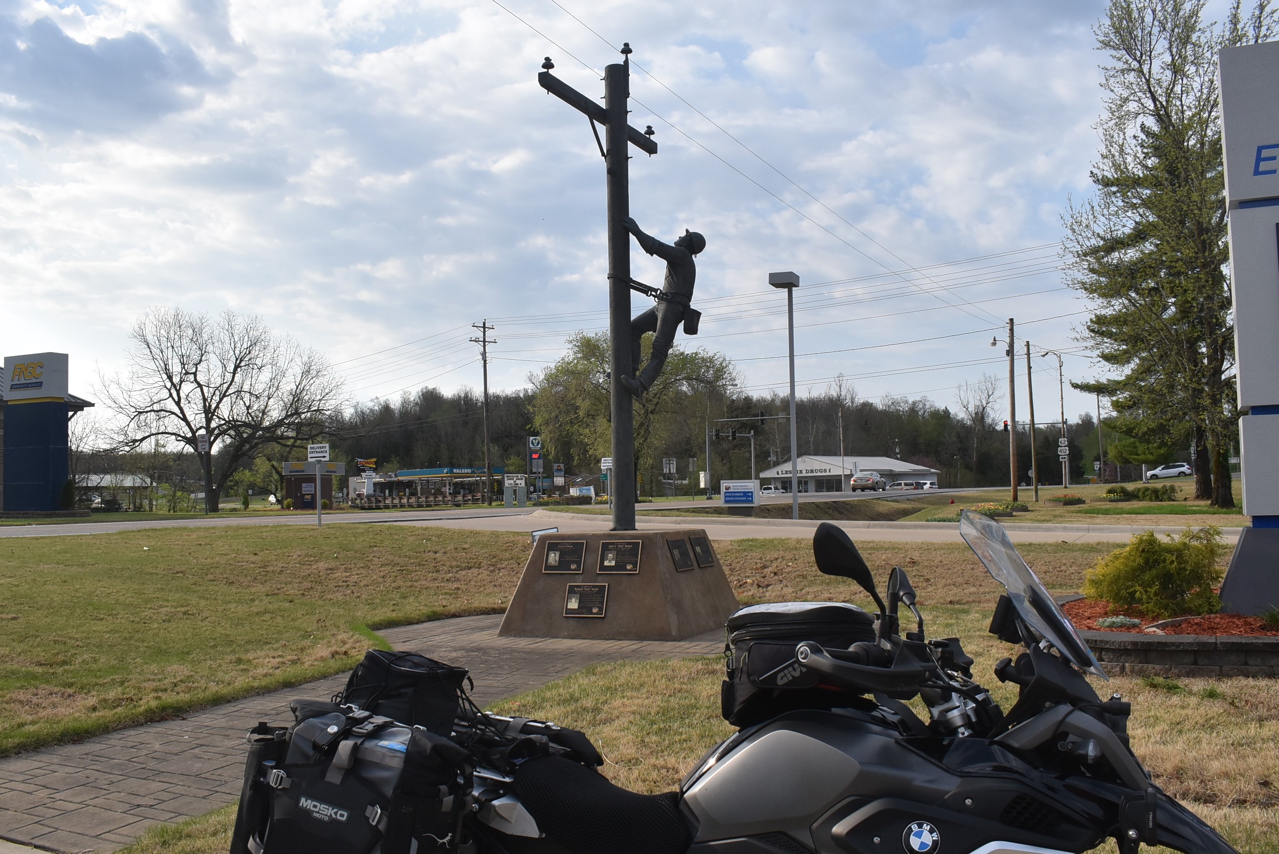
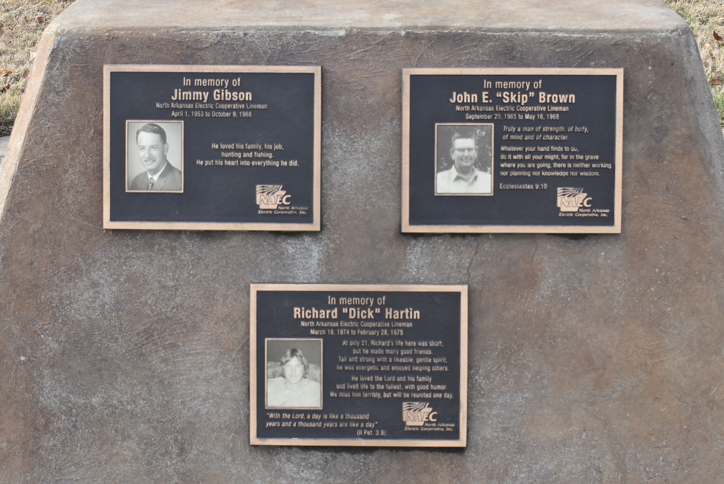
I make my way to Salem for the North Arkansas Linemen Memorial. I thought about a friend who works for one of the Electrical Coops in Virginia. I should send him a copy of these pictures.
I gas up before leaving Salem. Much like yesterday morning, someone pulls up right behind me as I stop at the gas pump. Is this an Arkansas thing? I was able to pre-pay at the pump, but the pump was not printing a receipt, so I had to go inside. I come out and the lady is tapping her steering wheel and revving the engine for me to hurry up. I move the bike before making all my notes of the stop. I forgot to reset the trip odometer, not realizing it until about 30 miles down the road.
I noticed the trip odometer had not been reset when I see a warning on my display. The warning was that my front tire was low on air. I pull over to the side of the road and check the tire. As I am doing this, a pickup pulls over to check on me. We talk for a bit as I check my front tire. Air is less than 1lb low, not enough to set off the warning. The display isn’t showing any reading for the front tire, so the sensor is having a problem. One of the guys in the truck warn to expect some serious rain in a bit. I notice that the skies are dark behind me. I tell him that I am headed to Tennessee and he lets me know I should be fine, just keep moving to stay ahead of the storm. At this stop, my headset quit working, it wouldn’t sync with the bike. This means no phone calls in or out.
That warning must have been a signal. The winds started to pick up and the skies kept getting darker. I saw staying ahead of the storm, but just barely. In my mirrors, I could see the wall of dark blue/green behind me. I had thought that the winds in Georgia were strong, the winds today were even stronger. If I let off the gas, the bike would stop and start rolling backwards. At full throttle I was only able to get up to about 50mph. There was nothing around me to slow the winds, flat farm land as far as I could see in every direction.
As I rode through Imboden, I passed the diner where I had breakfast last year. Reminiscing, I missed my turn to go to Pocahontas and the Doughboy there. With the storm behind me and heading my way, I decide that is a memorial I will try to visit later this year.
As I got into Rector, the buildings were able to help ease the winds. This was another memorial to fallen police officers. There was a car parking in the parking spot next to the memorial, so I had to get creative to take the required pictures. I managed to get a couple and was ready to tackle the winds some more.
AR6, Rector, AR
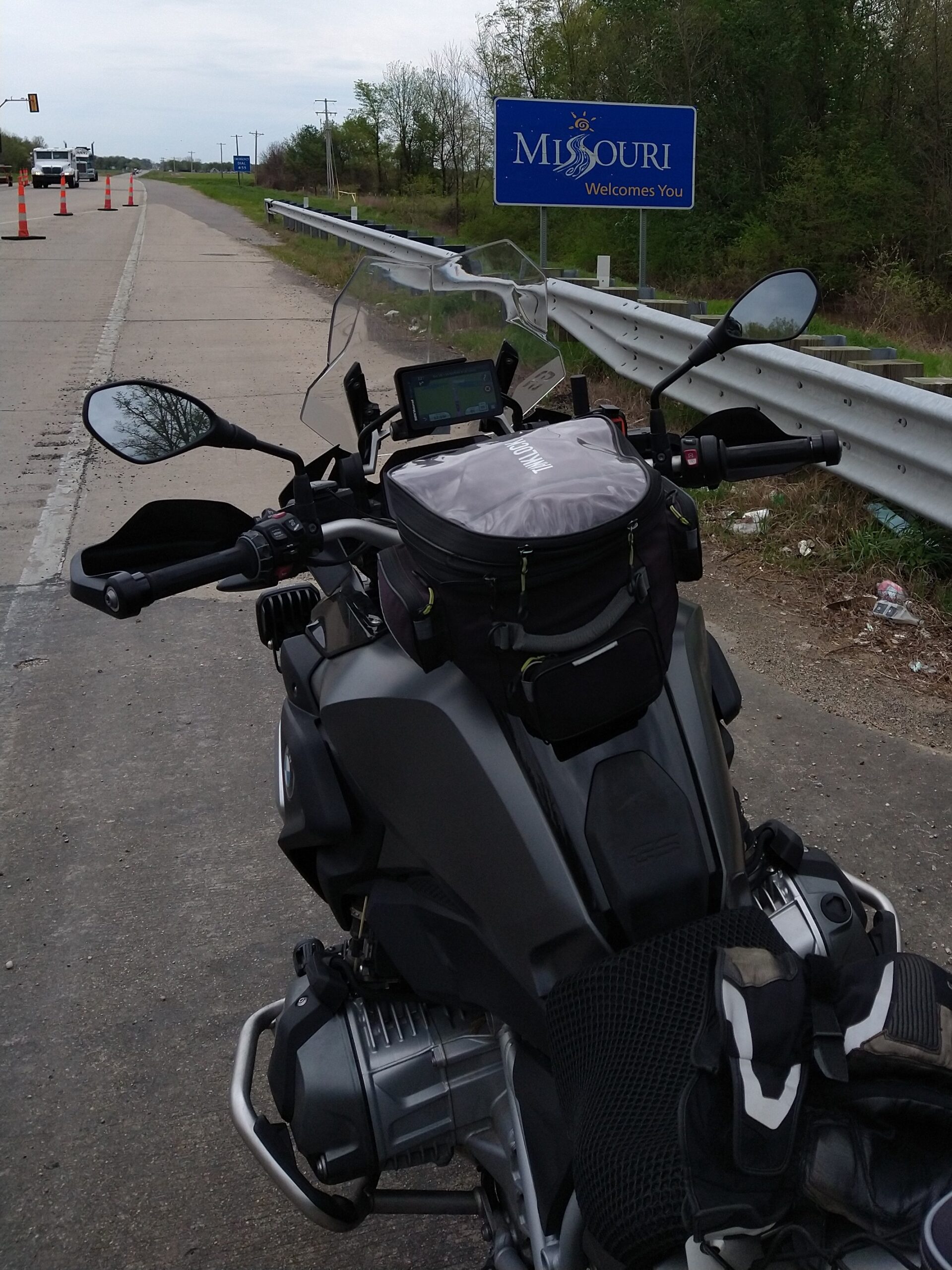
I decided to skip the Doughboy memorial in Manila and lunch stop that was recommended to me. I headed toward Missouri and the Mississippi River. As I approached the Missouri state line, I pulled to the side of the road to get a picture of the state sign.
I pull into Kennett, MO, the home of Sheryl Crowe. I pull over for a potty break and check the headset to see if I can get it working again. Nope, no luck. I try calling home, but only leave a message.
I am still fighting the winds as I neared the Mississippi River. I see the bridge and notice how high it goes. This will be challenging as there will be nothing to help block the winds. Oddly, as my front tire touched the bridge, the winds stopped. I crossed the river without any wind buffeting, even from the semi trucks on the bridge.
I pull into Dyersburg and gas up. I decide to pass on the Doughboy in Jackson. I am close to US45. The way the roads crisscross, merge, and split, the next turn will actually be as I turn onto Cox Creek near the house.
Even with the winds today, I still enjoyed the ride in Arkansas. The scenery was awesome. I visited six of the seven Tour of Honor sites in Arkansas, a Gold Star Family Memorial, and a Huey.
About the middle of last year’s Tour of Honor Challenge, the call went out for State Sponsors. I was hoping that Alabama would be needing a State Sponsor, but did notice that they were looking for one for Georgia. With Jeff in Georgia, I mentioned it to him. I also sent a note to the organizers that I would also be willing to sponsor Georgia if they didn’t feel comfortable with Jeff since he was a “rookie.”
He got an e-mail a few days later congratulating him on being selected. Then the work began. During our ride last September, he asked if I would join him to visit some potential sites to give my input. I was glad to help.
I gave him my input on various sites, and some things that I enjoy about sites I have visited in the past. He took all that information and submitted his proposals to the organizers by the deadline. A few weeks later, he called to tell me that his top seven sites had been selected! He had gotten write-ups, locations, and pictures ready in only a few months.
Over the winter, we talked about the upcoming year. Though I had an idea where a few of the sites might be, I never asked where they were (I actually didn’t WANT to know!). He also spent the winter riding more. Being in Georgia, he had a few more warm days that I did in Alabama. He was excited and ready for April 1!
In February, he asked about meeting on March 31 to head out at 12:01 AM on April 1 to compete for a trophy in South Carolina. Since Jeff has not completed an Iron Butt ride, he also wanted to do an Iron Butt Tour of Honor Saddle Sore Extreme. This particular ride, in addition to the 1,000 miles within 24 hours, you have to visit all seven of the sites within a state. South Carolina might be a bit small to get the 1,000 miles, and would require planning that I wouldn’t feel comfortable trying to plan in a matter of minutes if we were to compete for the trophy. Besides, We could always do the Iron Butt later.
A few days later, he knew that as State Sponsor, he could not compete for a trophy in his home state, but could he do the Iron Butt ride? I assured him that there was nothing to prevent him from doing that. Since he hasn’t done an Iron Butt ride, he needs to understand the planning that goes into it. Once he has done a few, then hopping on the bike on a moments notice to take an Iron Butt ride wouldn’t be as difficult.
He then asked if I would be willing to take him on his first Iron Butt ride together. He asked if I wanted to try for a trophy in Georgia. I gave him an emphatic “NO.” I have specifically not asked for the site locations to honor his integrity. Even if I did visit them and could qualify for a trophy, I would not claim it, just because it didn’t look right and others might think that I had insider information. Again, putting his integrity at risk. He asked me to help him with routes.
By last weekend in March, we had a draft route planned. I knew about where the memorials were, and did not release the planned route as public in case anyone else saw the route and realized what it was.
We were keeping a watch on some serious storms that were forecast for my ride to meet him on Tuesday and Wednesday. I was looking over the cities and asked about changing the starting location. We talked it over and decided to meet nearer to his house. This reduced the miles, though still above the 1,000 mile threshold, as well as reducing the time.
I left home on Tuesday morning. I would ride until I either got to our meeting place or I hit rain that required me to stop. I managed to stay dry the entire ride to our meeting place. I put in 500 miles in 10 hours with less than an hour of interstate.
We met up Tuesday night for supper, then again on Wednesday morning for a ride in the area. I needed to get a gas stop in on March 31 to note my ending mileage for the BMW 2020/2021 mileage challenge. This would also be the starting mileage for 2021/2022. I had about 7,000 miles when I started April 1 last year, the mileage on March 31 was 31,000 miles! 24,000 miles in a year. Not bad considering that I didn’t get to do nearly as much riding as I had planned due to COVID and other commitments.
About time to get a later lunch or early supper. We plan to head out about 1am from a place near where he lives. As of right now, we have it narrowed down to two options.
… to be continued …
April 1
We went to bed about 5pm. The goal was to get some sleep before taking off between 1am and 2am.
The best made plans of mice and men… To make a long story short, I couldn’t get to sleep. Jeff woke up and midnight. He asked if the sites were released. I checked the app and they were there! We could go.
Jeff noticed that I wasn’t excited. I explained that I had not been able to get any sleep, I had been awake for 18 hours. We talked and decided that it might be best to scrap the ride for now.
Once my head hit the pillow, Jeff said I was out and snoring.
I woke up a little after 8am. We talked about options, even considered taking off right away for the Iron Butt ride. Final decision was to take two days to get to Florence.
Jeff needed to stop by his office and his house before we left for Florence. Then we hit the road. A quick gas stop in Jesup and we were off. As we left Jesup, we were heading almost due west, into a strong headwind. Riding was a challenge, letting off the throttle had the same effect as hitting the brakes.
One of the places that I wanted to stop was in Lumber City. A Bar-B-Que place called Stinson’s which is a RTE-X-USA stop for this year. We pulled into the lot and parked. I knew I was going to have an issue getting out, but angled the bike to make it easier to get out of the rut.
We just ordered a sandwich since we had our own drinks already. Since it was early for lunch, I expected a little wait. But there was a line and a backlog in getting orders filled. We waited about 30 minutes for our sandwiches. Not having an agenda for the day, we didn’t mind the wait. Once we had our lunch, it was good. Worth a wait, if I had been hungrier, the wait would have been frustrating.
As we were finishing our sandwiches, a truck pulled up and parked close to the bikes. The guy had a problem getting out of the passenger side of the truck, he couldn’t open the door all the way without hitting my bike. And they managed to pull in at such an angle that I could not back out. Jeff rolled his bike back, then I rolled mine back and forth until I could get it turned around. Then we started rolling again.
We continued west to McRae-Helena, one of the sites in Georgia. Jeff had been leading the way since he knew the best place to park for the pictures. The winds were getting stronger, curves were getting to be a challenge.
Jeff lead to the memorial and we pulled into the vacant lot across the street. We got out our flags and looked for the best angles for the pictures. He never realized how busy this little street would be. We eventually got a break in the traffic and got the pictures.
We didn’t have any set plans for tonight’s stop. Just a leisure ride and stop when we were ready. Warner Robins was the minimum, Auburn was the maximum. We made a couple of left turns to get back on the main highway, making the left turn lights in perfect timing. From here, I led the way. The winds never eased up.
As we got into Warner Robins, Jeff’s low fuel light came on. We stopped at the Museum of Aviation at Warner Robins Air Force Base. We got the picture outside of the sign and inside with the Huey.
A quick fuel stop, then I had to make a stop at the Little League Region Headquarters to get a few pictures. I wanted to get a better picture for the website that I have set up for the umpire association. It was about 3:30. We could stop at the local hotel where I have stayed several times, which has a nice Tex-Mex restaurant and bar next door. Or we could go about two more hours to Columbus/Opelika/Auburn area and hunt for a place there. It wasn’t a hard decision, we headed over to the hotel nearby for burritos and margaritas.
April 2
No pictures for today. We didn’t get in a rush to leave. The hotel’s breakfast wasn’t much more than coffee. We made coffee in the room using the coffee press I had brought with me.
We loaded the bikes. As we were getting ready to go, a family walked past and commented on the bikes. We talked with them for a minute, then Jeff asked if they would like us to pray with them. (We have been wearing our CMA vests the last few days.) The said yes. Jeff and I went to pray over their truck before we left. We said a prayer over our bikes before we took off.
I had seen on the map a place along the way where we could get breakfast. The winds were minimal today. We kept a watch for places to eat. I was not in the mood for a chain restaurant. It was about 10:30 when we pulled into Opelika. Jeff said he needed to eat, we pulled into Cracker Barrel. The wait was at least 30 minutes and the place was packed. We waited a few minutes, I checked that the pub we had visited a few years ago was opening at 11:00. We mounted up and headed over. We only waited a few minutes for them to open.
Jeff needed gas, I was fine. We stopped a few blocks away for him to fill up. If I could make it another 80 miles, we would be within his range to make it home from the next stop.
We made it to Lincoln, AL for a gas stop. I had about 5 miles left on my tank. 5.2 gallons of gas into a 5.3 gallon tank. We would both be able to make it home from here.
150 miles later, we pulled into the gas station near the house. Filled our tanks and headed home. MaryJo was waiting with the garage doors open and supper waiting.
Got up REAL early, had a cup of coffee and my leftover breakfast from yesterday. I already had the bike packed last night, so I was out the door shortly after 7am. A quick stop to top off gas and I was rolling!
I wasn’t expecting any new roads until after Gadsden, but I got a surprise. A truck was across the road with both front tires and back tires in the ditches. He apparently had tried to make a turn off the side road onto US278, but didn’t make it. There were only a few cars in front of me, so I passed them and turned onto the road the truck had come from. The GPS said that I could make that turn and be back on the main road in just over a mile, off I went! The road made a sharp turn to the right, but the GPS pointed for me to go straight. That road turned to gravel and looked like it was someone’s driveway, I wasn’t taking that chance. I kept a watch for a road where I could make a turn, but no luck. I came to another biker who was heading in the opposite direction. I asked if there was a way out in the direction I was heading. He said that he was also trying to get around that truck. I wound my way for about 20 minutes and finally came out back on US278, only a few miles from where I had made my turn. I think that the truck may have already been cleared of the road. Oh well, I did find a neat new road.
I made my turn onto AL77 and took off for LaFayette where the K9 Memorial was located. I had tried to find this one earlier this year, but was on the wrong road. I got to try out my skills on a loose gravel road. Not something that I am great at, but the BMW handles it a lot better than the Harley did. Someone had left a poker chip, so I tossed one of mine to the marker.
K9 in LaFayette, AL
I exit the way I entered and made my way to Auburn University. There is another K9 Memorial at the Veterinary school. Someone had left a poker chip here too, so I added mine to the collection.
K9 in Auburn, AL
My stop for the night is Mobile, and no planned stops along the way. I hop on I85 and head to Montgomery. Traffic is moving, except for a lane closure due to a fire in the median. Speed picks up quickly from there. I make the turn onto I65 from Montgomery. A few minutes into the ride here, traffic slows to a crawl. About 30 minutes later, we finally see what has been the problem. It looks like a small mobile home had caught fire and was being towed down the interstate. And from the back, it looked like it had been hit too, since the front looked smashed in on one side. They made the exit from the interstate and we were rolling at full speed.
Originally, I had planned to get to Mobile shortly after 4:00pm. With the detour on US278 and the slow stretch on I65, it was after 5pm when I pulled into the hotel. Tamika was outside on a smoke break when I pulled up. She commented that she hadn’t seen me in a while and thought that I didn’t like them anymore. She said that she didn’t remember seeing my name on the reservation list. We chat outside for a few minutes while I make my reservation. Then I tell her that I now have a reservation and that I was making it while we talked.
I walked over to the Mexican place nearby. Fajita salad and a margarita for supper. The salad was one of the best that I have had. There was a lot more meat that on usual salads, and not overloaded with lettuce. I would put this margarita in the top three. Good flavor, not over powering of either lime or tequila. I will have to have one here again when I visit new time.
Did a review of my route for tomorrow. I may cut out one site, but it will still be a long day.
August 5
Up early and on the road. Topped off the gas in the bike and was rolling by 6:30am. This gave me the incentive to get past New Orleans’ morning traffic. The route didn’t get me close enough to downtown for that it be a major concern, but there was a little traffic. Once past New Orleans, I saw a sign about road construction. I thought it was 6 plus miles. The “plus” part was three decimal points! No, that can’t be right, My eyes are playing tricks on me. A few miles up the road, I see a construction sign for 3.7 miles. Ok, I can see tenths of a mile, I have seen that before. A little while later, I see a sign for construction for 3.087 miles. I slow down to make sure I saw that right. I did. The question I have is: Who in their right mind is going to try to be that specific in the distance of construction. That is a thousandth of a mile, about 5 feet!
I get into Houma, LA and head to the K9 memorial. GPS tells me it will be on my left. I notice a series of memorials on my right, but nothing but a vacant lot on my left. I park on the side of the road and walk along the various memorials. I see the K9 memorial on the side of the street where I am parked, the opposite side from where the GPS coordinates have me looking. (I sent a note to Eric and he has updated the GPS coordinates on the website for others.)
K9 in Houma, LA
I make my way to Cut Off, LA and the Veterans’ Memorial there. I had visited this site last year, even though it was not on the list of sites. I drop off a poker chip and get some pictures.
The roads in southern Louisiana are pleasant. Hard to keep talking about nice roads, I feel like I have used so many of the superlatives. From Cut Off to Thibodaux, it was mostly a backtrack from getting to Cut Off. From Thibodaux, I spent time in farm land, small towns, all while avoiding interstate. I get the Plaquemine and a Sherriff pulls out of a parking lot and follows me at a distance. As I make each turn to the memorial, he gets closer. As I approach the memorial, he is directly behind me. I pull into the parking lot of the memorial and find a Huey. The Sherriff makes a turn and heads out to another part of town. I park under the Huey for a picture, then walk over and preview the memorial. I see that I can park on the street in front of the memorial, though it isn’t the exact same angle of the sample picture of the Tour of Honor. They did accept my photo, so I must have done good enough.
I see the time and I would be trying to get into downtown Baton Rouge as people are starting to leave. I expect that there will be too much traffic and I scrap that site, heading to Ville Platte’s Huey. I passed up on this site last year due to a storm. This year, I get to the site THEN find the storm.
I stopped to top off the gas before hitting the interstate. I see the skies darkening. I see a gap in the dark clouds and hope that the road will get me into that gap. As I hit the interstate, I know that I am going to get wet. I stop to put on my rain jacket, then ride into the rain. The rain lasts only 5 to 10 minutes, then the skies are clear. But the rain is following me. I decide to get to the hotel and see what the storm does.
The storm never hit the hotel, but not sure if it hit Alexandria. Doing the planning for tomorrow, I see that the Huey in Pineville is only available from 9am to 5pm. I would have missed it today anyway, and I will be long gone before 9am tomorrow. I decide to add Ball’s Huey and the LA1 (Alexandria) to the previously planned route for tomorrow. I run into a problem in that none of the cables will work to program the GPS. I manually remove the previous route and recreate the new route on the GPS. The biggest advantage is that I can hit interstate avoidance on and off as I want.
August 6
I was up early and ready to hit the road. I had a lot of sites on the list to visit and I didn’t have time to waste.
I already knew that I was not going to visit the Pineville Huey since it was at the museum which would not open until 9am. I don’t plan to be anywhere near Pineville at 9am.
I made the short ride to Ball, LA to visit the Huey at the Veterans Park. No real place to park, so I just stopped on the edge of the road. I got a few pictures and a guy from the local town government asked if I was out of gas. I explained what I was doing and gave him a poker chip. He told me about a new memorial that they had recently dedicated. I got a quick picture, then headed out.
I made the ride to downtown Alexandria. This memorial is at the police department. Several markers with “End of Watch”. Not often I get to park in front of a police department, ON PURPOSE! I enjoyed this but left before the shift change or people started asking questions.
Oddest “round-a-bout” that I passed through. Sort of a round-a-bout, but one road enters at 55+ and others must yield to them. Only way to resolve this would be to add a stop-light.
I had set the GPS to avoid interstates. I spent all day enjoying the back roads of Louisiana. I have seen deer on this trip than I can remember.
I saw one Cobra today that really has fallen into disrepair. Between rust, moss, and a door broken off, it needs some TLC. There was an M-60 tank that was in much better condition.
On the ride today, the GS starting doing crazy things. At first, I thought that there was some sort of electro-magnetic interference, but that would have impacted other items. When I stopped, I cleaned the screen and rebooted the phone. Things were better the rest of the day.
I was on a mission to visit the K9 memorial in West Monroe. The GPS had me turning, then it started recalculating and the time to next site added about 45 minutes. I then realized that I had passed the memorial. I turned around and headed back to the site. At first, I thought that this was at a church, as I was leaving, I realized it was at a library, named for the handler.
My last stop of the day was at Monroe Tour of Honor site. This was at a museum. I got a few pictures, then went inside. I wished that I had more time to explore, but it has been a long day and I am ready to get some rest.
I checked into the hotel and parked next to the room. This was different from my hotels that last year or so since this has doors to the outside, not doors all in a hallway. I unloaded the bike, made a call home, and relaxed a few minutes.
I went back to Froghead Grill for supper. I got a chicken walnut salad, then had the brownie sensation for dessert. Once I finished the dessert, a family walked past and asked if it was as good as it looked. They mentioned that they did not expect me to finish it. I told them it was fantastic and I only finished it because I wasn’t a quitter!
August 7
My last night on the road, and I get my best night sleep. I was out last night about 10:30. I woke up at 5:30 for a bit, then finally awake enough about 6:30 to get moving. Since the bike was right outside my room, I took my time about loading it. Once loaded, I walked to the office to check out. I topped off the fuel across the street from the hotel, then hit the road.
Less than 2 miles from the hotel to the Natchez Trace. Too many people feel that once you have ridden the Trace, there is no reason to keep riding it. For those with that opinion, they are not looking at the right thing.
There was little traffic in my direction, once past Jackson, there was a few miles with a long stream of cars heading into Jackson. I think that the roads are going to be empty, then I see 6 police cars from various areas along the side of the road. There were 2 pickups, and a LOT of skid marks in the road. There were about 15 people (not counting the police) standing on the side of the road. One of the police officers had a video drone and was viewing the skid marks. I assume everyone was ok since there was were not any ambulances.
Thinking that one police incident deserved another, an hour or so later, there were 2 police cars which had 2 other cars on the side road. As I rode past, one person was being guided into the back seat of one car, and another customer was waiting with his hands behind his back.
Those two incidents were the extent of all the police that I saw today. But there was plenty of wildlife. I have seen fawns and does this entire trip. Today I saw a few turkeys, vultures, and some other large birds. There were a few carcasses of other critters.
Leaving this morning, the temps were right at 70 degrees. In the sun, it was great. I forgot that once I got on the Trace that there would be a lot of shade, which meant it would be a bit chilly. Not unbearable or requiring me to stop to put on a long sleeve shirt, but cool enough to notice. The temps today topped in the mid 80’s.
The skies were mostly clear, a few clouds to just add some color. The trees and farms kept the air so crisp. It is hard to explain how beautiful it was.
I was getting 57mpg before I exited the Trace. Then I picked up speed to get home. Total time from Clinton to home was about 5hours, that included the time to fill up when I got to the Circle K.
This year has been a unique year for the Tour of Honor. Only my third year, but it was different than the previous year.
After getting registered with my 2019 number, I was ready to go when April 1 came around. I had spent the off season recovering from surgery and got my release in March. That gave me some time to get on the bike before the sites are released. I was going to try for a trophy in Alabama this year.
Then COVID hit. States started closing in mid-March. The Tour of Honor organizers cancelled trophies, as well as restricted visiting sites in state which were under a lock down status. Then, just before the April 1 start date, the Tour of Honor was delayed. The sites were released, which was nice so people could plan while they were not able to ride, but when could we ride? Alabama never fully shut down, and even though I had the site list, I couldn’t get credit for visiting. At least I could do a recon run to some of the sites fairly close.
May 1 came and we were allowed to visit sites in states which were not closed, but you could not cross a closed state to get to another state that was open. Not a problem, I would ride in Alabama.
Jeff got his bike and we got him signed up for the Tour of Honor. He came to visit over Memorial Day and we did some riding. A friend allowed him to ride their bike. We had a great few days. Then started planning for July and September.
The plan for July had been to ride from Jeff’s house to Key West, visiting the Florida sites along the way, then heading across to Louisiana. We would then visit the sites in Mississippi and Alabama, before heading back to Georgia. That got cancelled when I had to be at the Lodge Installation. I rode to meet Jeff, and we rode back to Florence. Rains came, but we still managed to visit some sites in Mississippi and had a great time. We both learned a lot on those rides.
Our Ride to Meet for September in Gettysburg was cancelled. We got refunds and the hotels automatically cancelled our reservations. Jeff and I had planned to attend. We decided to try to set up a regional Ride to Meet. A few people sent nasty messages, but we ended up meeting some new friends at our mini Ride to Meet.
As a recap, I managed to visit all 7 Tour of Honor sites in: Alabama, Arkansas, Georgia, Louisiana, Mississippi, and Tennessee. I also visited sites in Kentucky, Missouri, and North Carolina. A total of 46 Tour of Honor sites (I struggled to get number 46, but it was apropos since I am rider number 46). I visited 5 Gold Star Memorials, 12 K-9 Memorials, 30 Doughboys, and 42 Hueys/Cobras. Well short of my goal that I had set for the year, but I think everyone was short of their goals.
What will I do next year? Don’t know and right now I am not even going to try to guess what I will accomplish. I will spend some time this month (December 2020) getting goals for 2021 for a lot of things, The Tour of Honor being one.
I did get registered this morning, and have #46 again. I had reserved it earlier in the year, so I wasn’t rushing to get registered at 11pm last night (midnight EDT when registration opened). I ordered more poker chips and also signed up for the Ride to Meet in September 2021. We will see what happens.