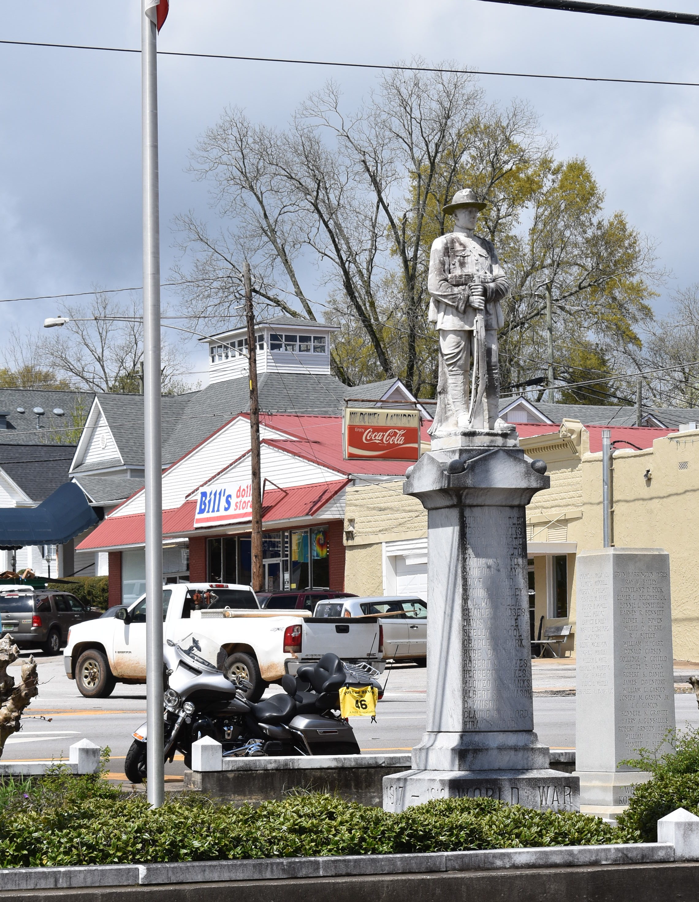
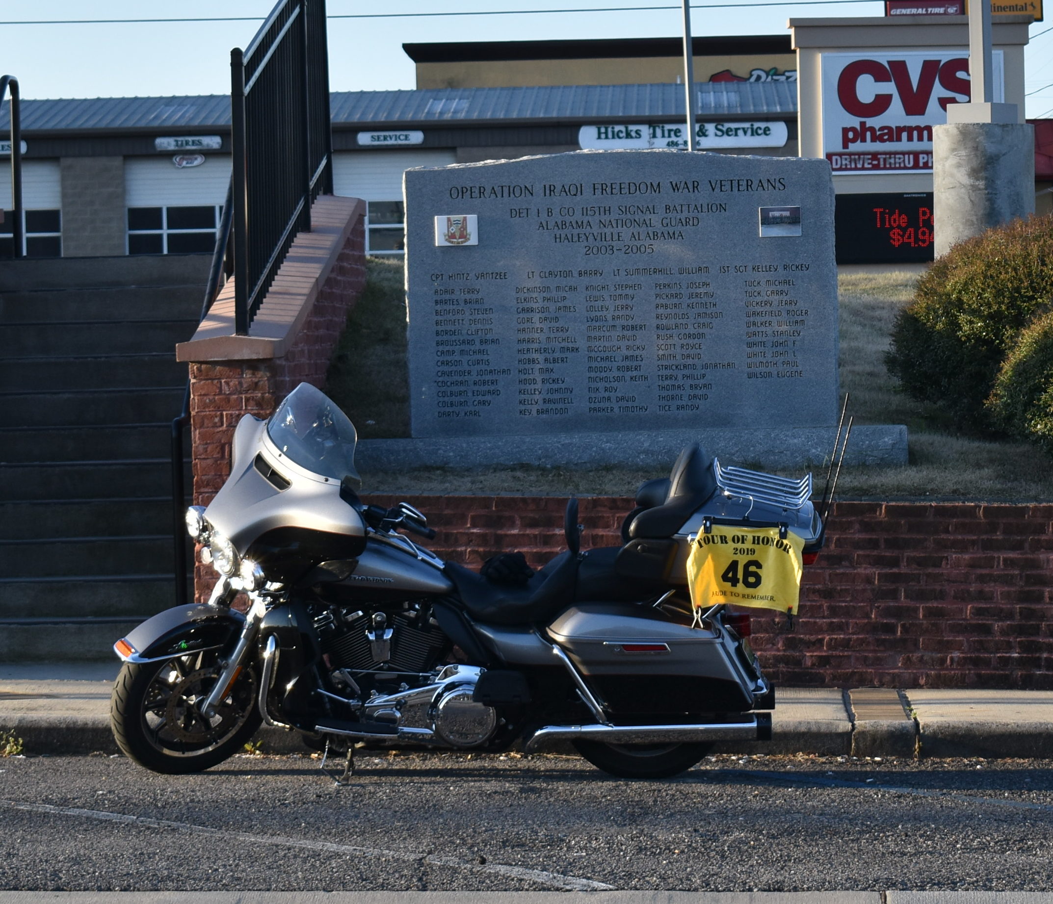
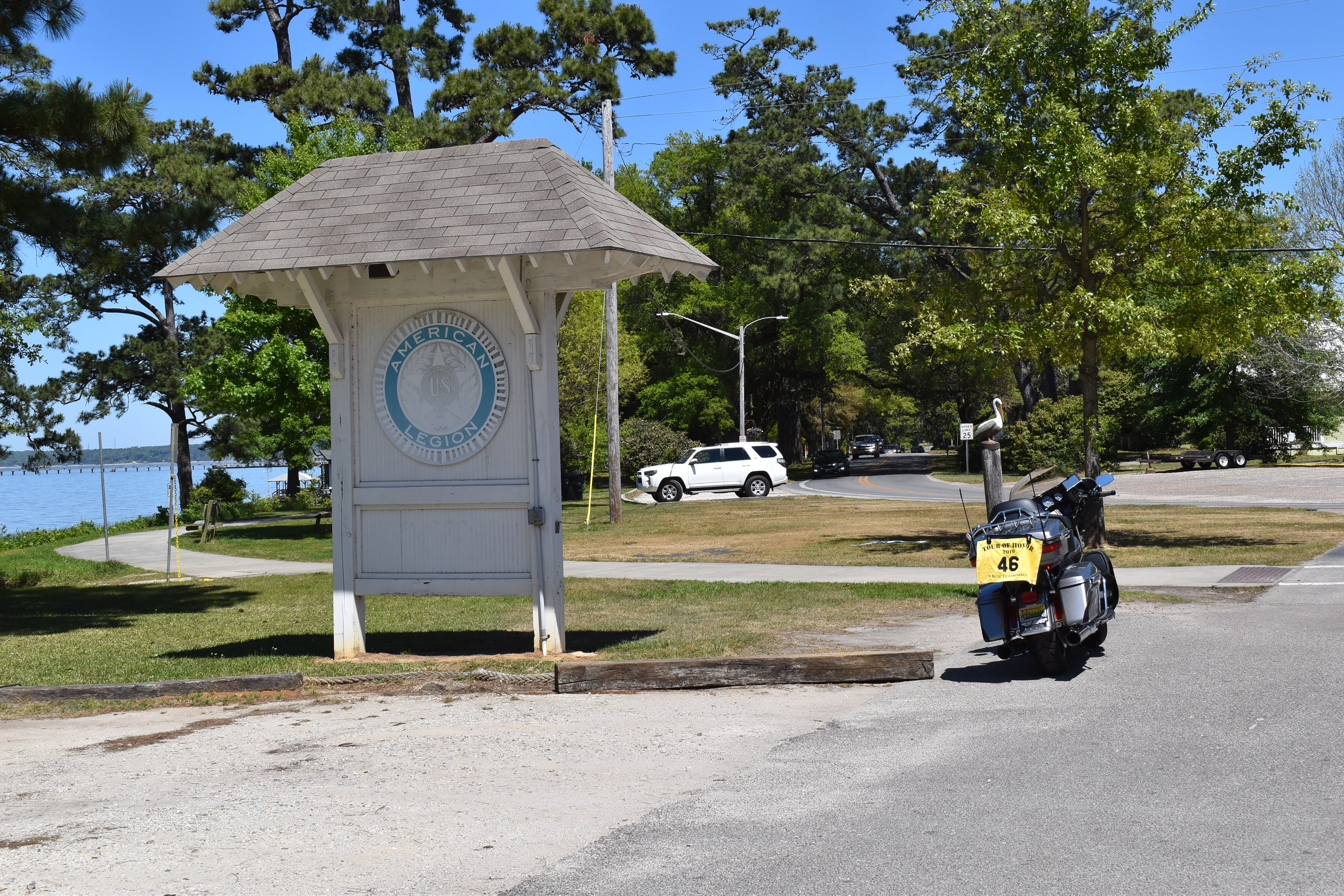
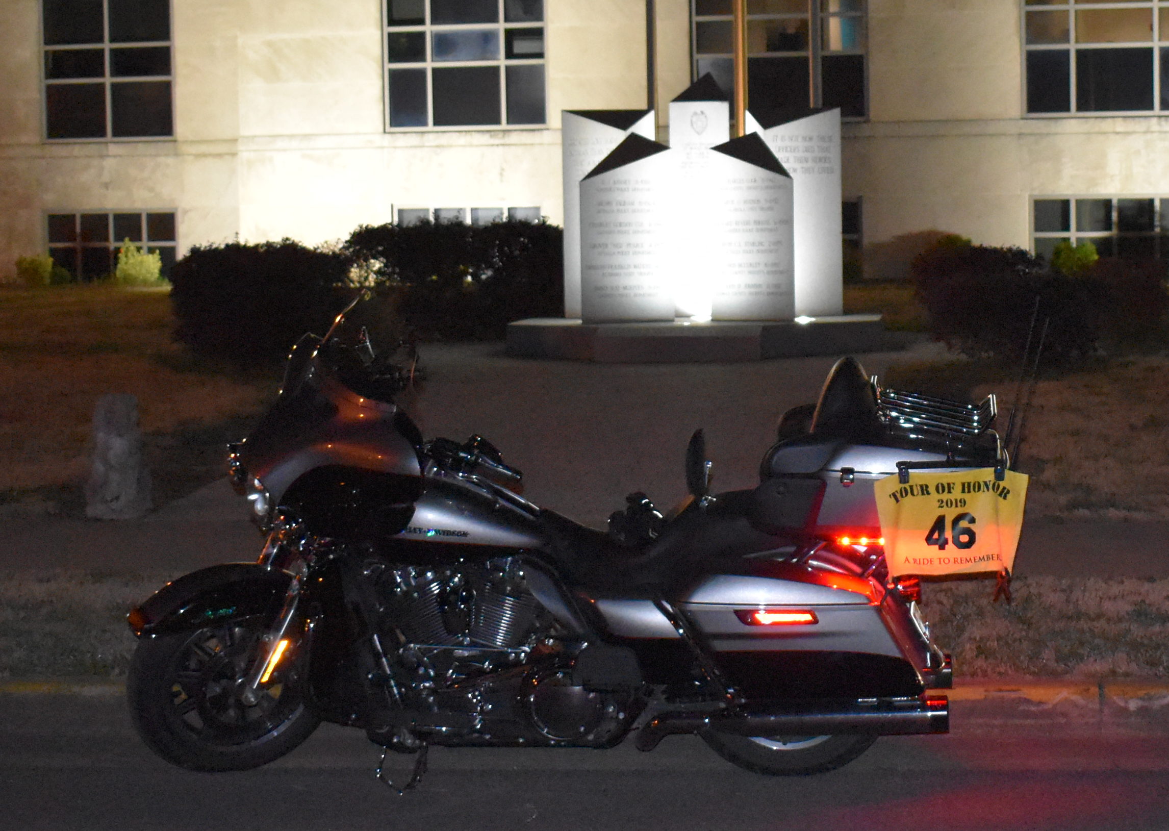
I have been recuperating from my DC Trip, getting a few things done in town and at home, and took a look at a potential new member of the stable. I only have the day for a ride, and need some miles. So, off I went.
First, let’s talk about the new member of the stable. I have a goal to complete the Ultimate Coast to Coast to Coast Insanity. It isn’t for the faint of heart, nor for those that are completely in their right mind. This particular challenge is an Iron Butt challenge. The challenge is to go from Key West, FL to Prudhoe Bay, AK, then return! the challenger has 30 days to complete each leg, a total of 60 days for the entire ride. Not only is it not for the faint of heart, this isn’t something that either a Harley or a Can-Am would handle. So, what to do?
Introduce the BMW R1250GS. I’ll go into the details and the story about what led us to this bike in another story. However, with a new bike, it needs a ride to break it in, right? The break-in miles is 600, then it will be due for its initial service. I decide to get that done as soon as possible so I can start putting serious miles on it (i.e. a SaddleSore 1000 or Bunn Burner 1500).
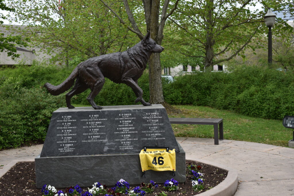
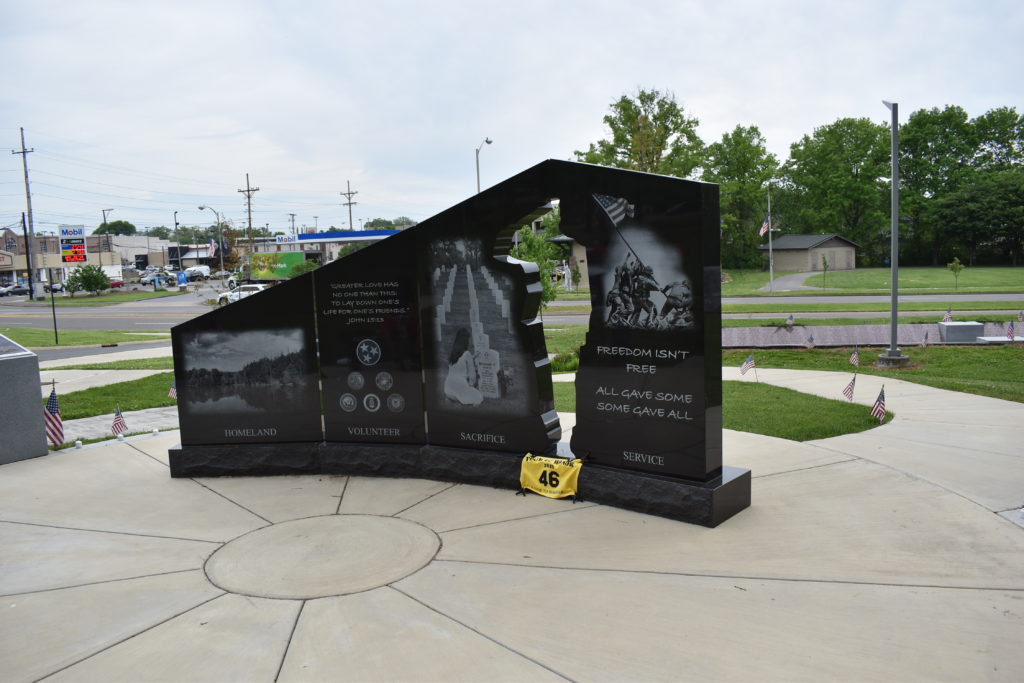
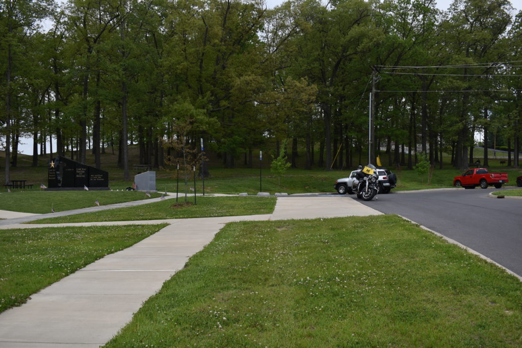
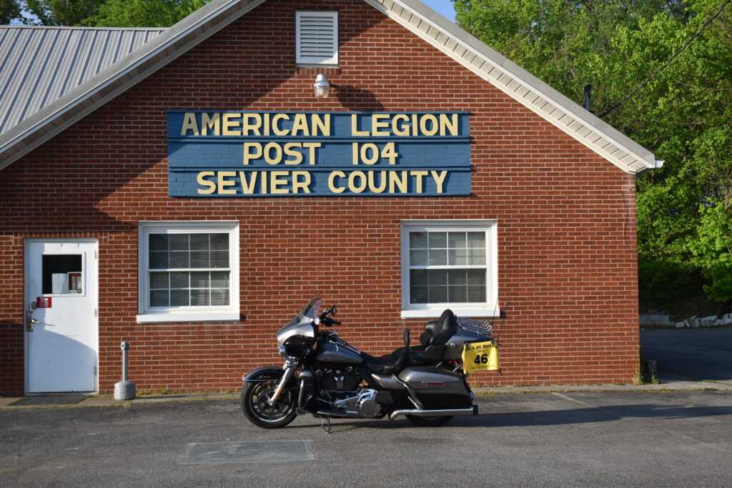
I have visited three of the Tour of Honor Sites in Tennessee, two on the far east side of the state and one nearby in Boliver. There are three more in the northwest part of the state, and one more in Jasper, near Chattanooga. I decide to tackle the three northwest of me. I also plan a few bonus sites along the way. This should give me about 500 miles and will also give me a chance to check out the new Tour of Honor app on the Android phone. I’ll still take pictures with camera for posting on the web, Facebook, and my records.
I planned to be on the road by 7am, but was enjoying a nice spring nap. I was on the road by 8am. Nothing planned for the evening, so there isn’t a major problem if I don’t get home as early as I had hoped.
This is the first ride on the GS, other than the ride of about 90 miles home from the dealership. I gas up at my regular starting point, CircleK at Darby and Cox Creek. My first stop will be to visit a Doughboy in Jackson, TN’s Hollywood Cemetery. A place I visited last year. Many roads on the way to Jackson are familiar to me.
I take off on Savannah Highway. Nice little twisties that I have driven for many years. I make a side trip to visit the Neill Cemetery in Olivet where my grandparents are buried. Then on to Jackson. As I pass through Adamsville, I make the right turn onto CR224 to CR199 and Finger, TN. Last year on my way back from Jackson, the GPS had a similar route planned, but it was closer to a logging road that the route this year. The GS is a lot lighter than the Harley, and much more nimble. Though I don’t have off road experience, I feel that I could handle a gravel or dirt road better with the GS than with the Harley, so I trek onward. I make the right turn onto US45 and head into Jackson.
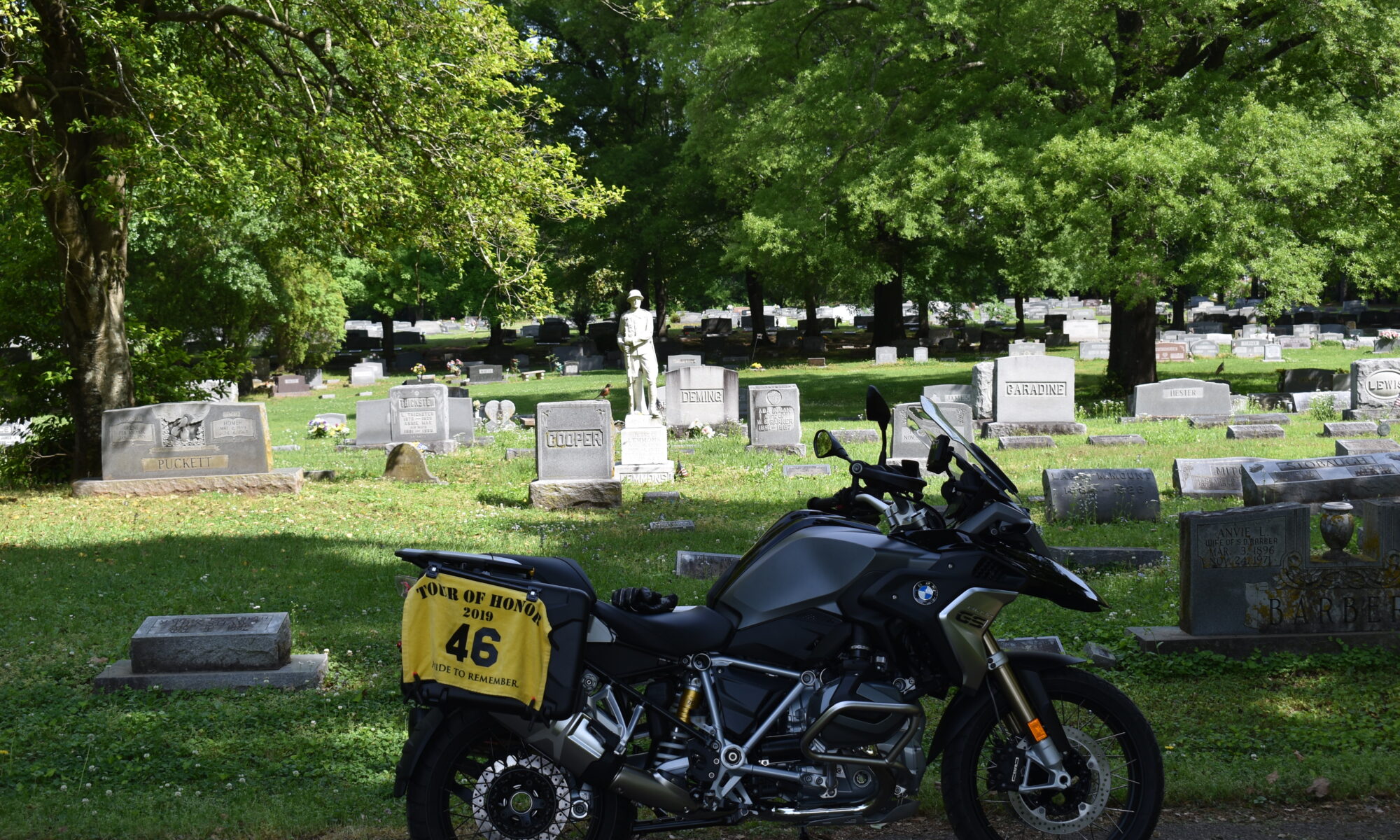
Hollywood Cemetery is an older cemetery. Very quaint with roads that don’t get much traffic now days. The cemetery seems to be filling up, and people don’t come to visit generations back. I remember that the GPS location last year was in a different area of the cemetery than the marker I need to find. My memory of how to get to the location is spot on! I get a picture of the bike with Mr Lemmon’s headstone in the background using both the camera and the new Tour of Honor phone app. I submit the picture using the phone and put everything away. I see that the GPS is still telling me I should be on the other side of the cemetery. I make a note that I should tell the scorer(s) about the variance. As I leave my parking spot, I realize that the road has changed to gravel, yet the GS is is taking this change with ease. I don’t want to get too confident, but I am starting to like this bike. Since the GPS is still trying to get me to the other location, I press the “skip next waypoint” button.
I make the turn onto Hollywood Dr, then onto US45 heading north. I get close to Humbolt and the GPS is telling me to turn right, but I know that I should be turning left. I pull off the road and rest the GPS. Seems that when I skipped the next waypoint, it had already skipped the one in the cemetery and I skipped the one that I wanted to visit. Quick reload of route, an hour added to the route since I was off my planned route and had to double back to Ridgely (TN5). I enjoy some roads that give me a chance to see how the bike handles faster speeds. A few chances to pass people to test quick acceleration. Everything is great. I reach Ridgely and follow the route through town. I know that the algorithm in the GPS doesn’t know the actual roads, so many times I get to see the neighborhoods. I reach the memorial and park on the side of the road. Pictures taken and I walk to get a closer view on the memorial. I submit the photo using the app and head out to Union City.
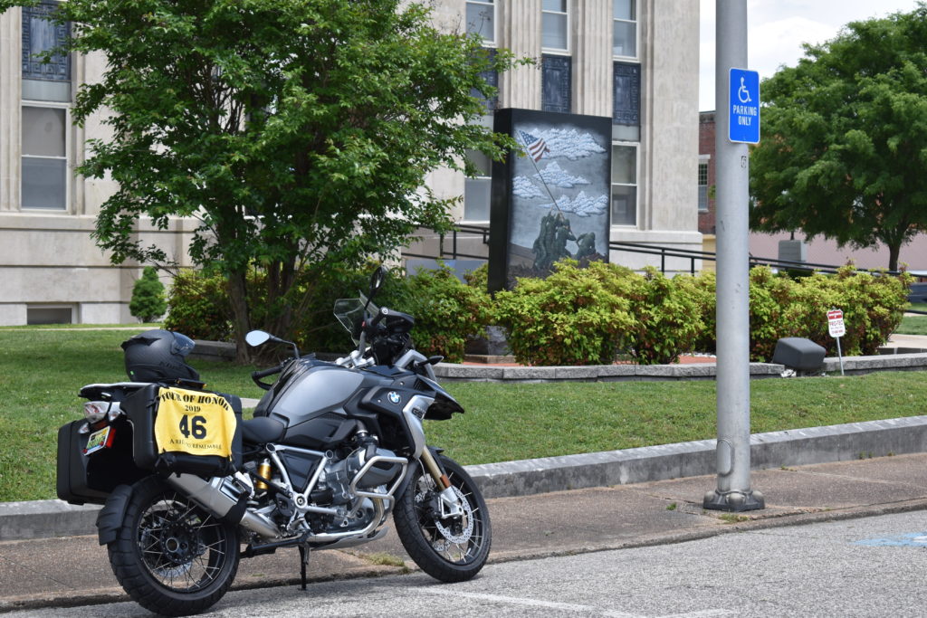
My dad was born in Paris, TN, but he lived a few years in Union City. The cemetery in Union City is the resting place for several generations back of my family, including those from the Civil War. I head toward the courthouse square. It is lunch time and only a few cars are in the area. I park right in front of the memorial for the picture. I like this one which commemorates the flag raising at Iwo Jima. I also get a picture of just the memorial (TN7). There is another memorial nearby and I take a few minutes to look at the other one. Pictures taken and submitted, ready for my next stop, Fort Donelson.
A little family history. In the early 1800’s Aaron Greene Allmond lived in the area of Union City. When the Civil War broke out, he had four sons. Legend has it that two volunteered for Tennessee units before the taking of Fort Donelson, while the other two were “drafted” into Ohio units after the taking of Fort Donelson. History shows that the two units fought in direct contact at Shiloh. This means that the four brothers were fighting each other. Good news is that all four brothers lived through the Civil War and are buried in Union City. I am a decedent of Aaron Greene Allmond, Jr. After the Civil War, he became an iterate preacher, going from town to town preaching. His grandson, Ira Hugo Allmond, who was my grandfather, was a Church of Christ preacher. Two of my uncles were preachers, a couple others were elders, all in the Church of Christ. I was the “black sheep” of the family.
I think about this history as I make my trek to Fort Donelson. I arrive at the Visitor Center to get my passport stamped. I talk with the ranger who tells me that the battle was more than just at the fort, it was actually the entire area. Some of the fighting even branched as far Union City. This helps to explain how the family was actually split. I get my passport stamped and ride over to the park entrance to get my picture at the sign. Since this isn’t one I have to submit as I make my visit, I don’t submit it. Next stop, Clarksville, TN.
My last visit at the Veteran’s Home in Clarksville was educational. Educational for both me and the daughter of a resident. I think I followed the GPS to Clarksville, but there weren’t many options for me to alter the route. I pull into the parking lot up to the Doughboy. There must have been a party recently. The Doughboy has been lei’d! Guess he was the life of the party. Pictures taken and submitted. Next stop, Charlotte, TN (TN2).
Leaving Clarksville, I realize I have hit town as the day shift if leaving the nearby Army base (Fort Campbell). Though there is some traffic, nothing like what I was used to when we lived in Virginia. A few turns and I am enjoying back roads again. I see the sign welcoming me to Charlotte, then make the left turn to head to the county courthouse. This memorial is actually at the Historic Dickson County Courthouse, the new courthouse is across the street. The courthouse square was empty except for a couple of cars in front of the bank on the other side of the square. I take a few pictures, submit, and ready to head to my last stop, a Huey in Dickson.
It is s short ride from Charlotte to Dickson, both sites are only a block off the main road that connects the two towns. I remember that there had been a road adjustment that hadn’t been picked up in the GPS or any of the on-line maps. I ignore the turn instruction from the GPS and go an extra quarter mile to the light. I make the left turn, then another sharp left turn. The entrance to the VFW is a very sharp right turn, heading up a steep hill, with loose gravel in the middle of the turn. A mild panic sets in as I start that turn and I stop. I think that Harley may have gone down if I had been riding it, but the light weight of the GS helps me keep it up. I remember about the “hill assist” feature. I set the brake, clutch in, first gear, deep breath, look up the hill and around the turn, ease out the clutch, and up the hill I go. Too easy, I could get used to this, but don’t want to rely on this. I park next to the Huey and take the pictures. I submit everything in the app and take a break for a minute. Since I have not had the headset on, no phone calls have disturbed my ride. I send a text to my bride to let her know I was only my way home. I will be home later than expected, but I will be there safe.
As I check out the e-mails, I see that some of the submissions through the app didn’t get sent. A couple of the scorers had sent me a note letting me know that I didn’t include the photos. One site did get the photo, but none of the others. I send the scorers an e-mail to confirm that I will resend all the photos required that I took with the camera when I get home to send from the PC.
I fill up as I leave Dickson. New bike is getting much better gas mileage than the Harley. The thought crosses my mind about trading the Harley for a BMW RT or K1600. But I have riding Harleys for a long time, do I really want to make the switch. I leave Dickson, cross I-40, and aim the bike for Columbia. I see the signs for the Natchez Trace ahead and decide to that route home. Setting the cruise at 50mph, I can focus on the road and scenery, not having to constantly be aware of the speed. This bike has a tendency to let me pick up too much speed. Sun is starting its downward trend, leaving long shadows everywhere. A glance to my left and I see my silhouette, just the bike and me. That sure looks pretty. I pass a few deer along the side of the road as well as several groups of turkey. I remember the comment Dave (my salesman) made about the horn he has on his GS and I laugh. I think about the upgraded lights, how they will really help when the time comes to tackle an Iron Butt ride on the GS. At Collinwood, I leave the Natchez Trace and head to Florence. Only a short ride until I am home, supper is waiting.
I live in Alabama. I retired from doing a 30 year sentence in DC. I actually enjoyed my job for the most part. But, due to the cost of living, I would not be able to enjoy retirement if we stayed in the DC area. We looked outside of the immediate DC area without any luck. Since my parents are tin Alabama and Tennessee, we settled in Florence, Alabama. We left behind many friends. More importantly, my sons were still there.
When I got a call that my grand-baby was sick, I started planning a trip to the DC area. I had needed to plan out a route for the local Harley chapter to ride to Winchester, VA and had been stalling on that for a better time to go. We decided that I would ride the bike to see the grand-baby, as well as my sons and their wives.
Being on a tight schedule, I was only going to look for Tour of Honor sites and bonuses that were withing only a few miles off my planned route. While in DC, I would plan one day to visit DC and another to visit Quantico. To no surprise, nothing ever goes as planned.
I spent Monday planning my route and various options. I would keep my Garmin as my primary GPS with the Harley GPS to just show me the surrounding roads. I got all my routes and waypoints loaded into the Garmin and was ready for to head out Tuesday morning.
A quick breakfast with my bride and I was on my way. I made my stop at my normal starting point. Noted all my mileage (I have gotten into that habit so it will be second nature when I take an Iron Butt Ride) and turned on my Spot so my bride could keep track of my location.
My first night would be a stop in Abingdon, VA. This is the planned stop for the chapter ride to Winchester. Spending the night at the proposed hotel would give me a chance to meet the manager and talk about a reduced rate for a block of rooms. On the ride there, I would pass next to the cemetery where a GoldStar Memorial is located.
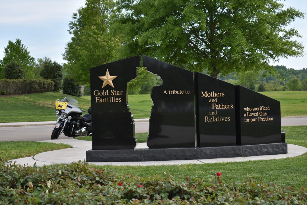
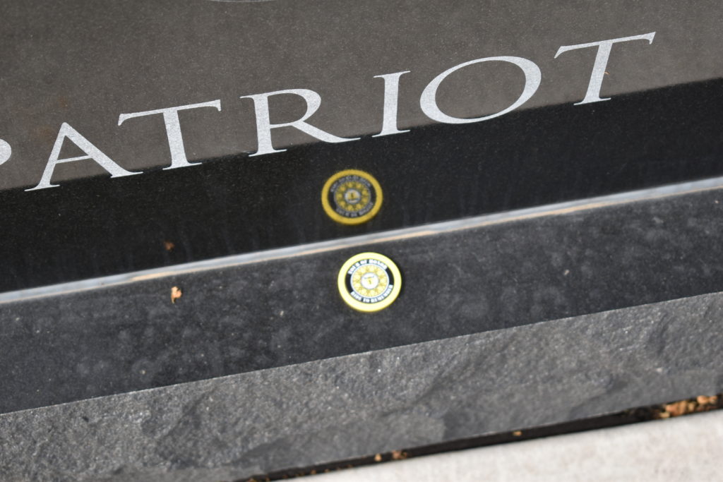
By the time I had approached Knoxville, afternoon traffic was starting to pick up. For the most part, I was going against the traffic, but there was still traffic noise. As I pulled into the cemetery, I could see the GoldStar Memorial close to some parking. Parking close to the memorial for a picture, I pulled out my rally flag and camera. I got a few pictures at different angles then walked to the memorial for a closer look. What do I see? A poker chip for 2019 Rider #1! As I look around, I realize how quiet it is. There is traffic on the road next to the cemetery, but it is eerily quiet in the cemetery.
I load up and head for the interstate to get to Abingdon for the night. It is between an hour and a half and two hours to get to Abingdon, The time goes quickly and I check into the hotel in plenty of time to have a relaxing supper at Papa Tom’s which is next door to the hotel. My new diet has me eating a lot of salad (not a problem since I enjoy salads), so I order a steak fajita salad. Just enough spice to accent the flavors, but not so spicy that all you taste is the heat.
Wednesday morning I take off on my planned route for the chapter ride. I could go north on I-81, but I hate I-81. Truck traffic, steep inclines and declines, and it isn’t that exciting of a ride. I have always enjoyed Rt42 from Blacksburg to Harrisonburg, but trying to find a route on the west side of I-81 difficult due to few options that can be affected by weather (rain, snowm fog, etc.). I didn’t want to go US-19 since it was mostly 4-lane, I would rather find a route that goes through the countryside. I know that once I get to Saltville, the roads are all pretty good, nothing that would cause concerns for a group riding together. Getting to Saltville is where I seem to have the problem. I decide to ride out of Abingdon on US-19, then turn right on Poor Valley Road. The maps don’t show any issues, directions seem to be pretty straight forward. As I ride, I notice that the road is a little narrow. Not a big deal if only motorcycles on the road, but a few sharp turns that would cause a problem with on-coming vehicles. I pick up Rt42 in Saltville as planned. I follow Rt42 on to Eagle Rock for lunch at Maw and Paw’s. For as small as Eagle Rock, there is a LOT of business in this little diner. For parking, I had to park a block away at the Post office.
Every so often, Rt42 would vanish as another road would take its place, then it would reappear a few miles away. Without a GPS, a person could get lost here. I manage to follow Rt42 as planned until I get to Harrisonburg. From here, I am fine with Rt42, US-11, or even I-81 into Winchester. I turn onto I-81, then I-66 so I can get to my son’s house before I have too much traffic in his neighborhood. As I pass my old neighborhood, the traffic on the west bound lanes look like a parking lot, luckily I am heading east bound. I pull into my son’s driveway shortly after he got home.
Weather for Thursday and Friday had been forecast as heavy rains. By Wednesday, the Thursday forecast for the chance of rain had dropped to below 50% with temps in the 70’s and 80’s. I call an old friend to see if he wanted to meet for lunch. I head to the National Museum of the Marine Corps for a few Tour of Honor bonuses.
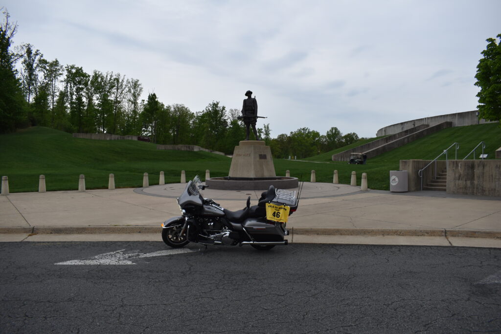
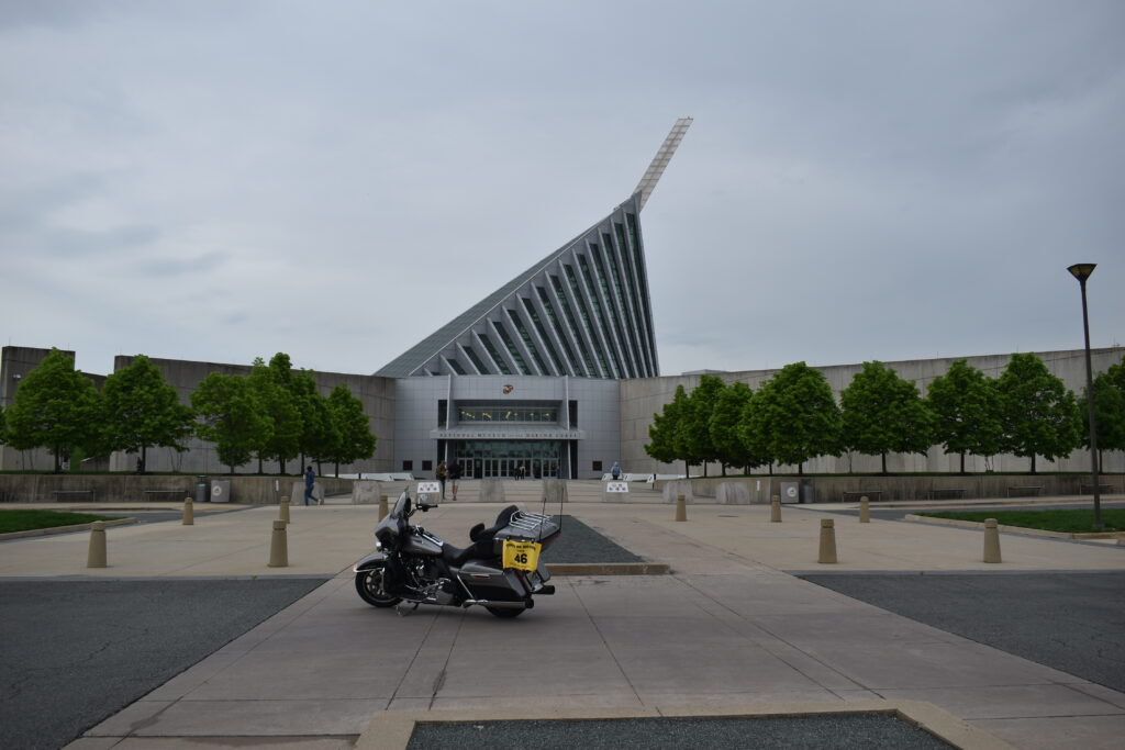
Many of the bonus sites aren’t in a location where I can get a picture of the memorial with the motorcycle in the same picture. This means that I will need to have a picture of the motorcycle with out side the museum to prove the bike was there and I will have to take a picture of the memorial with the rally flag while inside. I get a quick picture of the bike in front of the museum. I like to think it was a decent picture. A security guard tells me I have to move and can’t take a picture there. I move behind a tour bus to get a quick picture of “Iron Mike” then settle into a parking spot.
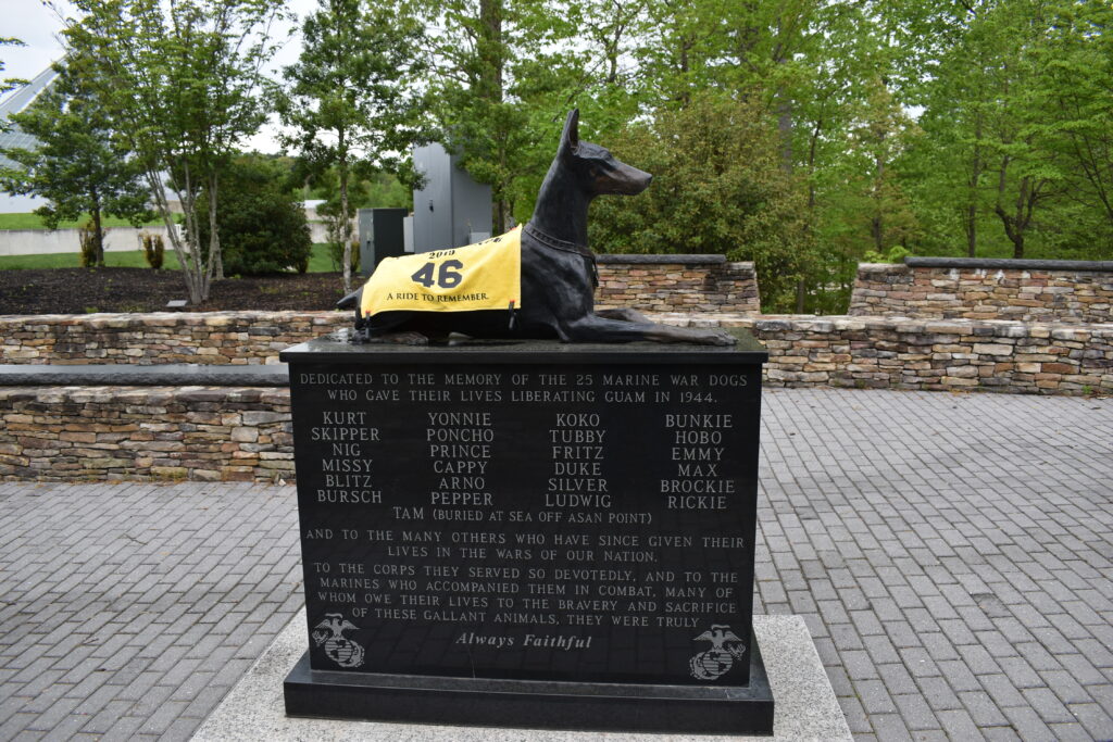
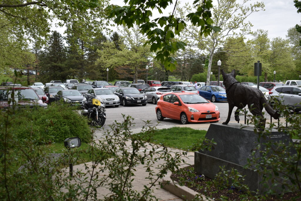
Before going in, I walk the trail. I know there are two K9 memorials along the trail. I find “Kurt” near the Chapel. A couple of pictures and I start trying to find the second one. The map indicates that it is near the overlook, but that the only way there is to drive around the grounds. I eventually find a trail and take a hike up the side of the hill. There I find “Caesar.” A few more pictures and I head into the museum.
Inside the museum I am on a mission to find a Huey and another K9 memorial. I head to the Vietnam area since most Hueys I have found in the past have a history in the Vietnam era. I go through the sections once, then a second time with no luck. I ask one of the docents about a Huey helicopter who confirms it is in the Vietnam section. But, he gives me a little more information, “look up.” Doh! Sure enough, it is hanging from the ceiling and I had walked under it, TWICE!
I ask about a specific K9 memorial. He explains that the particular display is not due to be set up for about another month. I ask him about one that I had seen in the past, the guard dog from Quantico what been stuffed by a taxidermist and had been on display, but I wasn’t sure where it would be. He explained that he is new, and doesn’t remember seeing that display either, but there is a K9 display around the corner. I find a display of a K9 service dog during the Vietnam era. I take the picture and plan to submit it even though it is not on the list. I spend a few more minutes at the museum before I have to head to meet my friend for lunch.
I pull into Occoquan and find parking in front of Madigan’s Waterfront. This place is right on the Occoquan River, fresh seafood, and FANTASTIC people. The Crab cake sandwich is huge, but I settle for the salmon salad. Great conversation catching up with friends while enjoying some good food. If you are ever in the area, Madigan’s Waterfront is a place to stop. (No, Chris did NOT comp the meal or even give me a discount, it really is that good.) I head back to my son’s while reminiscing about the roads I used to travel on a daily basis.
Friday was supposed to be heavy rains all day, so I don’t make any riding plans and take the time to clean some of the bugs off the bike and look over route options to get back home. I had committed helping the boys build a shed for the other son, so that was my Saturday. Saturday evening we were all going to cook out and spend time with my grand-baby. Sunday I planned to go to church then head into DC for some Tour of Honor sites.
At the last minute, my plans for Sunday get changed. We didn’t finish the shed on Saturday, so the boys and I put in a couple of hours before hitting the links. After a round of golf, we finish the shed. I say my good-byes to my grand-baby, daughter-in-law, and my son before heading back to the other son’s house. I will be heading home Monday morning.
Sunday evening, to thank my son and daughter-in-law for letting me stay with them, we go out to La Cote D-Or Cafe. This is a french restaurant that I have seen for many years while living in the area, but never stopped. I have eaten several times at Chasin’ Tails which is across the street. Without going into a lot of details, if you are in the area, either one is a great choice.
Monday route option 1 had been to head toward Hampton Roads for a few Tour of Honor sites and bonuses then across US-58 to Danville for the night. Tuesday I would head to I-81, I-40, then I-840 around Nashville, and head home from there. I was still bothered by my option from Abingdon to Winchester. On my planned ride for Sunday, I was going to visit Lovettsville and Brunswick, MD. I finally decide to get through Tysons Corner before 7:00am and ride to Lovettsville then Brunswick.
I have been near Lovettsville many times, but never stopped there. I follow the route and come into town square from the back. I find a lull in the morning traffic to get a quick photo and remount my trusty steed to head to Burnswick, MD.
Once you get out of the immediate DC area, it area is so serene. There is a fog rising off the Potomac as I cross into Maryland. I turn right toward the GPS waypoint, another right turn and I park next to the train station. I hadn’t reviewed the memorial in Brunswick, so I have to double check since I don’t see any memorials that would appear to be one for the Tour of Honor. I pull out my paperwork and realize that I am looking for the American Legion. Right across the street with an open parking spot! I move the bike and get the picture.
I watch a train come into the station, the commuters file in like lemmings, and the train head on toward DC. I don’t miss those days. I plan for my next stop, Churchville, VA.
On my way into the DC area on the previous Wednesday, I had not added the waypoint in Churchville to my route. I must have overlooked it, since it was only about a mile off from the road I was riding on. I head back to Harrisonburg and gas up before turning back onto Rt42. On the south side of Churchville, Rt42 makes a sharp turn to the right, the waypoint is straight ahead. This site is a Doughboy in the town cemetery. The road narrows and I start to wonder if I am about to be riding on a gravel or dirt road. I see the entrance to the cemetery and make the left turn. The Doughboy is readily visible, fairly close to the road.
I park the bike and get a picture of bike with the Doughboy in the distance. I take my rally flag and walk over to the grave. Mr Snyder had been a soldier in WWI. He died in 1918. Mother Nature had weathered the Doughboy, but he has been standing guard proudly over Mr Snyder’s grave for 100 years.
My only concern with the chapter ride’s route is between Abingdon and Saltville. I had checked and thought I would try Rich Valley Road. This is past Blackburg, so I hop on I-81 and will catch Rt42 after making a stop at Virginia Tech Veterinary School for a K9 memorial.
As I leave Blacksburg, I make a stop for gas at US460 and Rt42. I gas up and head west on US460. I miss my turn and end up taking a wrong turn to get back on track. After an off-pavement jaunt, double back, and u-turn, I eventually get back on track. Long story short, Rich Valley Road isn’t going to be an option for the chapter ride either. I get to Abingdon early enough that I know I can make a stop in Kingsport and still make a hotel on the eat side of Knoxville for the night.
I hop on I-81 in Abingdon then exit toward Kingsport. Pleasant roads, light traffic, and no rain makes for a calm ride. I pull into the park in Kingsport. I notice that there are several kids waiting for rides home. They are being respectful of the park, some even doing their homework or reading. I get a few pictures and head on to my hotel stop for the night.
I check into the hotel and walk next door to Puleo’s Grill. I order a large glass of water and a much needed margarita. The Sorento Salmon Salad seemed like a unique mix, feta cheese, salmon,and house-made citrus vinaigrette dressing. The salad was great and the service was there when needed and out of the way when you didn’t want them. I’ll be back! I look over a few options for the ride home from Knoxville and make a few notes over supper. Back in the room, I map out the stops and a few roads that I want to avoid. Since my bride will be working at the library and won’t be home until about 5:00pm, I don’t need to get home too early. I set the alarm for 6:00am.
The phone rings at 11:00pm and I hear my bride in a panic on the other end. I hate when that happens. The dog had wanted to go for a late night potty break, he wasn’t taking no for an answer. She let him out and he took off in a full run. Before she realized it, he had a ‘possum cornered in the yard. She tried to pull him in, but he picked up the ‘possum and started playing catch with himself. He would toss it up, catch it, shake it a few times, then toss it up in the air again. After a few minutes, my bride managed to get him to drop it. It just laid there in the yard. Dog in the house, cleaned up, then my bride goes out to check on the ‘possum. It is still where the dog had left it. She goes to get a shovel, her plan is to move it over the fence where the dog won’t mess with it in the morning. She is mad at the dog. She calms down, I get back to sleep.
Alarm goes off as planned. I head down to breakfast, waiting for a ‘possum update. Imagine sitting in the breakfast area and hearing this conversation:
“Well, is the body still there?” “Sure no one found it?” “I’ll find a place to get rid of it when I get home tonight. Make sure it is hidden, we don’t need any of our neighbors seeing it.”
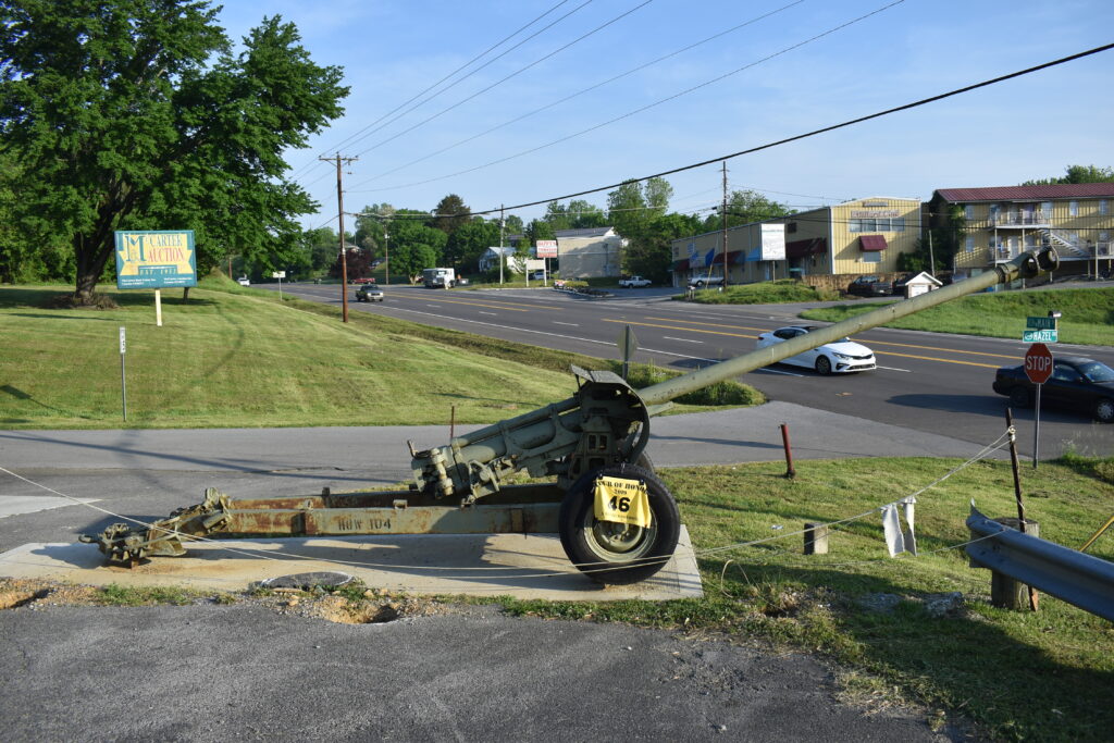
But, alas, no call at breakfast. I load up and make my way to Sevierville, TN. The Tour of Honor site here is the American Legion. Though it is overlooking the main road, the parking lot is a nice level area. I get a picture of the bike and building to meet the requirements, then take one of a howitzer in the parking lot.
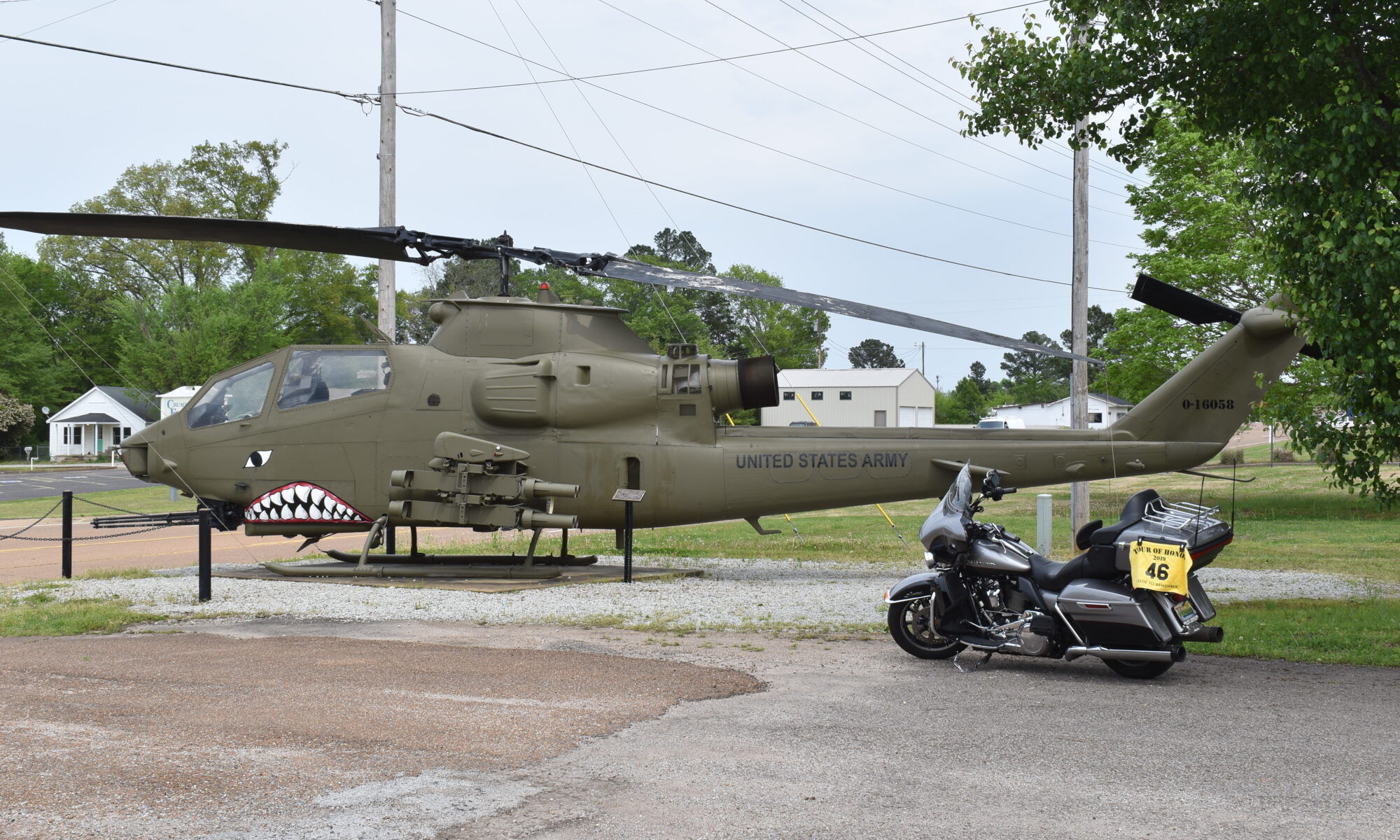
Next stop is Sweetwater, TN to visit a Cobra helicopter. Quiet country roads lead me to town with a left turn onto Veteran’s Drive leading me to the VFW where the Cobra is housed.
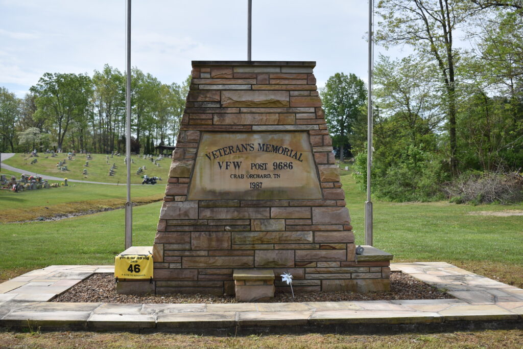
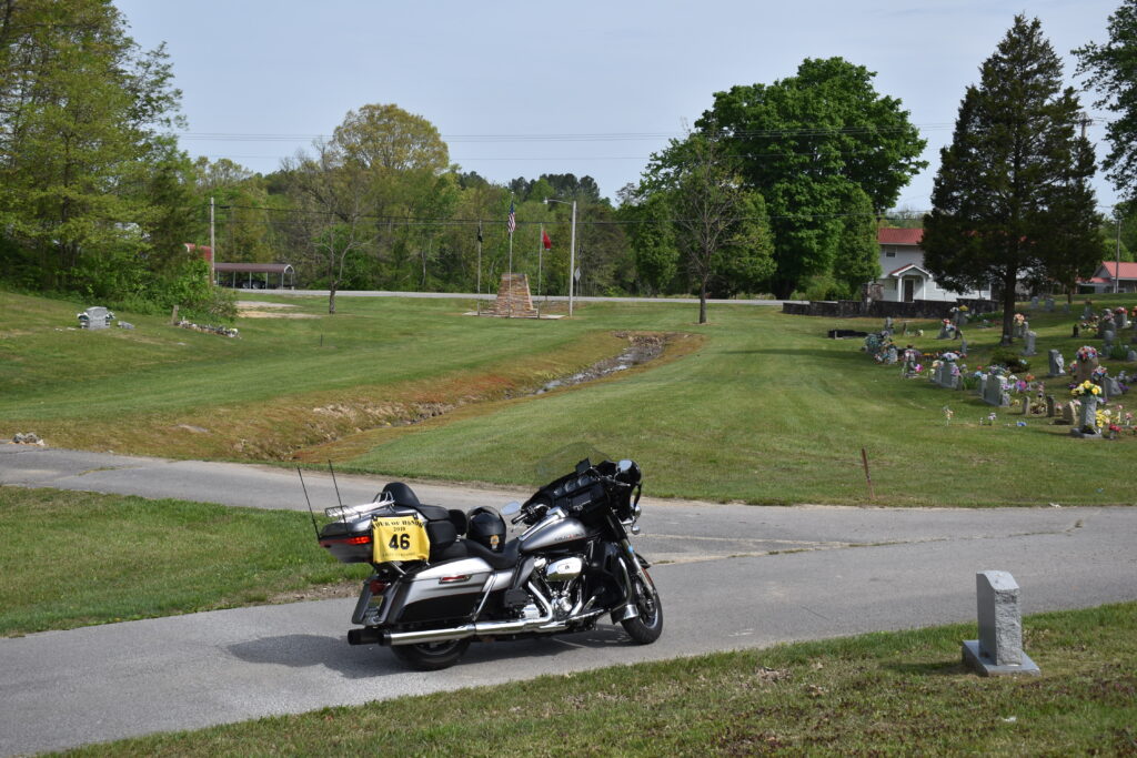
I am west of Knoxville, so I have no issues getting on I-40 for a ride to Crab Orchard. I exit the interstate, make the left onto US-70, then left into the town cemetery. The memorial is facing US-70 with no parking along the road. I opt for the 2 picture format. One with the bike in the area and one at the memorial. I get the bike picture, then take my rally flag to the memorial. There are several cars with people visiting various graves and placing flowers. I take the time to look at some of the older gravestones.
I turn left back onto US-70 as I leave the cemetery to the short trip to Crossville. A quick turn on I-40 then exit a few minutes later at exit 320. I make the left onto Genesis Rd and follow the GPS to turn into an apartment complex. The description did say a small hike was required, but I see nothing here. I get out my phone and check the aerial view. I see that I should be at Centennial Park, a short walk in the woods, but a couple of miles on the road. I turn around a head to the park’s entrance.
I ride around and see a sign for a dog park. This must be the place! I get my rally flag and camera then head down the trail. This wasn’t the usual K9 memorial, this was a plaque, most have a statue. As I walk up, I wake up a dog that had been sleeping in the park while his owner was reading. She was startled at first, then asked why I didn’t have a dog with me. I explained I was there to get a picture of the memorial plaque. She seemed surprised to hear about a memorial, I pointed to the plaque which was above her on the pavilion where she sat. I explained the Tour of Honor to her. I went back to the bike, got my second picture there and was ready to head home.
I was ready to be home. Once I got back on I-40, it is almost autopilot from there. I set the GPS to home, just so I could see when I would get home, but knew I wouldn’t be following those directions.
‘Possum update. Wife went to check on it in the morning. It was gone. She now understand the term “Playing ‘possum.” I am sure it will be back since I think it has been living under our house.
What better way to help ease stress than to take a bike ride. I have a few things on my mind and need a chance to do some clear thinking. Weather is going to be great today, and there are a few sites close by that I could visit. No time frame, so I can spend a little more time.
I hop on the bike a little before 10 as my bride is heading out to her knitting club. I have a full tank of fuel, so no need to stop for gas, but I do need to stop by the bank to get some cash before heading out.
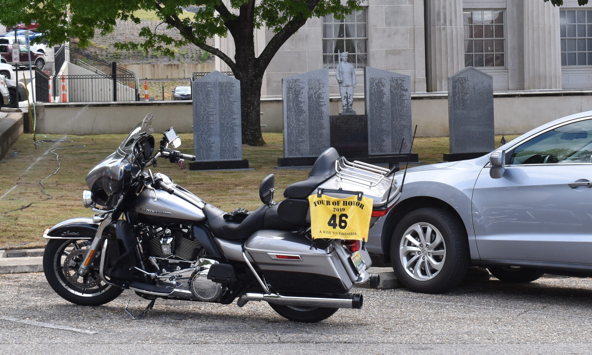
I take one of my usual route to US-72, then head west. I pass through Iuku, then Corinth. I make a turn an head south west toward Ripley. Usually I don’t like being behind farm trucks, but this morning I don’t care. It manages to help keep me focused on riding. I get a chance to enjoy the sights and smells of the country. I ride into Ripley and follow the GPS to the courthouse. At first, I see a statue of a Civil War soldier. I ride around the block and see a pair of Doughboys guarding the main entrance, but I don’t get a chance to stop. I’ll make another loop around the block and find a good spot to park. As I round the back of the courthouse, I see another pair of Doughboys guarding the other entrance. I park next to “Judge Parking” and get my picture.
Doughboys guarding the rear entrance to the Ripley Courthouse
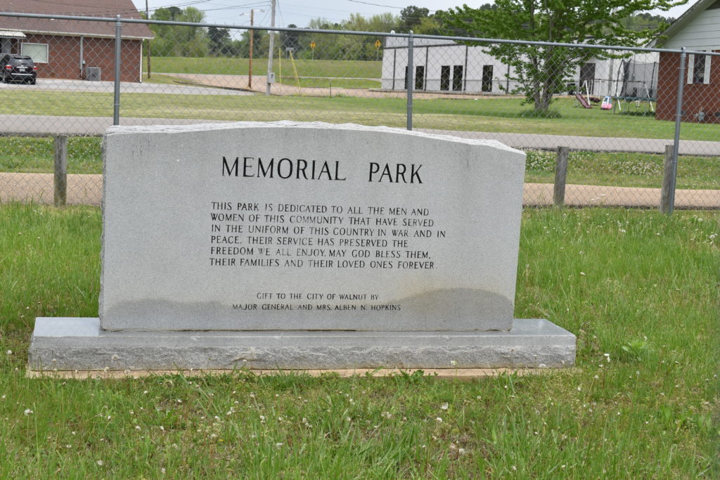
I head toward Walnut, MS. Country roads, slow and enjoyable ride. Listening to Van Zant and Willie Nelson, seems very apropos. The Huey in Walnut is my first repeat visit from last year. This was one of the sites that I visited last year on my first Tour of Honor ride which was interupted, but I did get my picture here last year. As I make the turn through town, I watch some kids from the high school running. I pass them and pull around the Huey, memorial marker, and the tank. As I park, I see the kids running their lap toward me on the other side of the memorial area. Then I hear barking. I had noticed one girl stopped, and other ran past her. Then the first girl started running again, with a dog in chase. The dog was more teasing than attacking, but the girl is too scared to realize that. Then I see the owner calling the dog. The dog runs off and the girl heads to the school. The owner keeps calling Max, who is more interested in not being caught. I call Max, thinking that if might entice him to approach a new voice. Max starts toward me, then runs between the owner and me back toward his home. A brief chat with the owner, then I get my picture and ready to hit the road.
2019 Visit
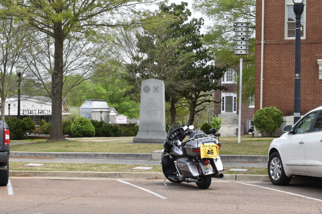
I head north from Walnut toward Bolivar. The 20 or so miles is straight, the few curves seems so minor that it could be considered a straight road. The GPS posts that TN1 is going to be on my right once I get into Bolivar. As I approach, I see the courthouse. With it being lunch, I find a parking spot directly in front of the memorial. I was born about 45 miles from Bolivar in Savannah. Growing up, the draw to Bolivar was the West Tennessee Mental Hospital. I don’t ride toward there since it is on the west side of town and I will be heading east. I walk around the courthouse, I never realized that the courthouse was built in the mid 1800’s. In front of the courthouse, there is also a bust of Simone Bolivar which was a gift from Venezuela at the centennial celebration of the courthouse. I take a few more pictures of the area, then head east.
Over the years since I was traveled US-64 between Savannah and Memphis. Outside Bolivar, I would travel through Hornsby. A well known speed trap in the 70’s and 80’s. Hornsby town limits were only about a mile or so on each side of the highway, but it seemed to go on forever, but actually about 5 miles or so. The issue was that the speed limit was 25 mph, and VERY strictly enforced. Now, the highway is state maintained and patrolled, as well as going around the “downtown” section of Hornsby. I travel this stretch of road at 65mph without fear of blue lights chasing me.
As I reach the outskirts of Selmer, another little town that I would pass through. Instead of taking the bypass, I opt to take the business route through town. I pass a few churches and houses that have a bit of dark history. I see signs that the area has changed. Growing up, I don’t remember any Mexican restaurant in the area.
I continue to Adamsville, the home of Buford Pusser, of Walking Tall fame. I met Sheriff Pusser once as a kid with my Pawpaw when we had to make a stop at the bank. Sheriff Pusser was a big man, as was my Pawpaw. Being a little after lunch, I know it is time to get a bite to eat. I pull into the parking lot for River BBQ Company. Great staff, good food, and a nice place to relax for a few bit. I enjoy a pulled pork platter. River BBQ Company is on the county line for Hardin and McNairy Counties.
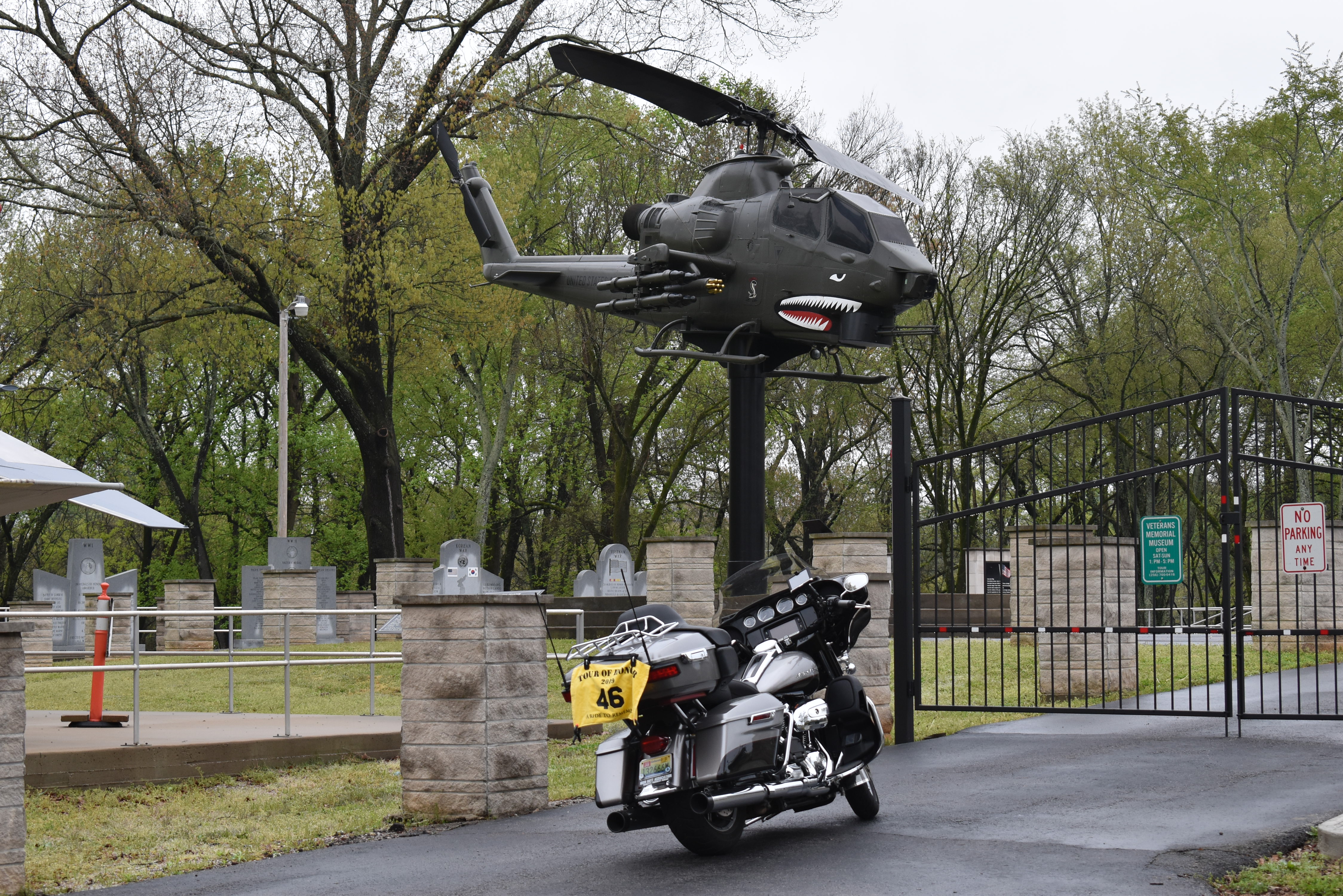
After lunch I head to Crump. My grandmother was living in Crump when she met my grandfather. I never heard how they met, or why she was in Crump since her family were farmers south of Crump closer to Iuka. Last year, the Huey bonuses were just for Huey helicopters, this year the Tour of Honor has added Cobra helicopters to the Huey bonus. In the 1980’s, a Cobra was presented by WWII veterans to honor the Vietnam vets of Crump. It was placed in front of the Crump Police/Fire station. I have been driving and riding past hear for several years, but never stopped to examine the Cobra. Today I take the time to check out the Cobra and read the plaque. I get my picture and head toward Shiloh after a gas stop.
Shiloh is about 5 miles south of Crump. I have been on this road many times. My dad has been in Korea when I was in the 2nd grade and we stayed with my grandmother in Savannah. He came home about the time that the school year ended. He had a little vacation before we had to go to Arizona. I remember the last day of Vacation Bible School. Mom and Dad picked us up from the church and we were heading toward my uncle in Aberdeen. Between Crump and Shiloh, Dad started to pass a farm truck that suddenly made a left turn onto a farm road. There wasn’t much left of that Chevrolet. Other than my Dad having a bloody nose, everyone was fine. The ambulance was driven by my Mom’s uncle, who took us back to my grandmother’s. When we walked in, still in blood covered clothes, my grandmother’s words were “I just cleaned the house, don’t you get any blood on anything” then she fainted.
I make the left turn into Shiloh NMP. I take the required picture then head to the Visitor’s Center to get my passport stamped. I look over the maps on display. I see markers for the Army of Tennessee and the Army of Ohio. Stories about them will be another story. I find out that the stamp is in the bookstore. I head to the bookstore, get my stamps, and ready to head home.
I was expecting to turn left onto TN-22, but the GPS wants me to head back to Savannah. A request I can’t turn down. Whenever I go through Savannah, I have two stops that I have to make. One being to visit my grandmother’s house, I spent so much time here growing up. The other being the family cemetery. Along my ride, I have had dark skies to the east, but the weather map indicates that it is much farther east than Savannah. WRONG! As I cross the Tennessee River, I see that the road is wet. I smell the sweet aroma of a fresh spring rain shower. I have a meeting with a friend this evening, so I decide to just stay straight and head home. With only a few light showers, I make it home.
With just a short ride of about 250 miles, I visit one Tour of Honor Site (TN1-Bolivar), one Doughboy (Ripley, MS), and two helicopters (one Cobra and one Huey). Some of the stress I had to start the day is gone. It was a good day.
Mark and I had registered to attend the Cajun Country HOG Rally in Scott, Louisiana. I had been watching the weather and wasn’t feeling good about the last day of the rally and the ride home the next day. He was a little concerned too, but had a more important commitment, his grandson’s T-Ball game. He and I agreed that the T-Ball game was much more important, there are other rallies that we can attend this year. Another person from our HOG Chapter was going whether Mark and I went down. We decided to cancel the ride.
My plan was to ride down to the rally and take a ride to Grand Isle, LA to visit one of the Tour of Honor sites there on one day. Another day, I was going to see if I could visit a few other Tour of Honor sites in the southern parts of LA, or even try to visit the other six Tour of Honor sites in LA. With us not going to the rally, and there was at least three days with good weather, my bride was agreeable to me taking a few days. Problem was where to go. My thoughts were to try to ride southwest or west of home, the reasoning is that we already have trips planned to the north and east. Already have all of Alabama, so south is done. How far southwest could I go? I mapped out a few options, trying to see if I could get to Grand Isle, LA and some other sites in just three days.
All my manipulations of routes, nightly stops, working around city traffic, and still wanting to enjoy the ride more than just visiting sites on this trip, I finally had a draft. I would take a day visiting sites between home and Jackson, MS. I could manage to get around Jackson before rush hour, visit Vicksburg, then head into downtown Jackson few a couple of sites to finish the first day. The second day head to the Mississippi Gulf Coast and back to Jackson. The third day I would visit some sites on the way back home. Looked like a plan.
Day 1
Wednesday morning, my bride has eggs, bacon, and coffee waiting on me. I had already backed stuff for two nights on the road on Tuesday night. I have decided that I am going to start taking better photos, and the phone just doesn’t give me the options and flexibility that I want, so I have camera, two lenses, back-up battery, and the tripod loaded in the tourpak. I put my clipboard with photos of the memorials from the state sponsor. I hate when I get to a site, take the wrong photo, and have to either go back or not get credit for the site. And I have the route and sites loaded into the Garmin!
All set, I head to my favorite starting point, the CircleK at Cox Creek Blvd. and Darby Drive. Two of the great people are there and we talk for a bit. I must have the reputation as always taking long rides since they both ask where I am headed and will I be back tonight. Nope, this time a relaxing ride through Mississippi. I tell them about this web-site and they ask if I have mentioned them in any of my previous posts. Since I haven’t, and they are great people, I am including them this time! I will not mention any of the people for two reasons: 1) all of the people there are nice; and 2) I don’t want to forget to list anyone by name (especially since there are a few who I don’t know their name, sorry). Bike gassed up and I head out.
First stop is Iuka, MS. My paternal grandparents are buried in Iuka. My maternal grandmother is from the area too. I spent a lot of time in Savannah, TN, which isn’t too far away. I now live in Florence, so most any trip west requires US-72 as the primary route. All this means is that I am familiar with Iuka. When the Tour of Honor listed a site this year in Iuka, I was excited.
I am going to see how accurate the Garmin GPS will be on this trip. I head out US-72, cross the state line into Mississippi and turn on MS-172. I think this was actually the old US-72. I round a curve and see construction. Only a delay of a minute or two and they back the equipment out of the road to let some traffic past. A few miles later, I pull into the National Guard parking lot. I see the tank out front and assume that the GPS wanting me to pull into the parking lot on left is an error. I get out my sheet with pictures and see that I am at the wrong site. I look over the hill across the road and see the American Legion. I get a few pictures of the tank and make my way to the American Legion to get my picture there. AL5 – Iuka is done. First of the seven sites in MS.
I had put in a few extra optional sites, but decided to leave them for days when I want to make a quick ride. I do an overview and see that an optional site is pretty close to my route to Tupelo. I decide that Booneville is my next stop. Quiet back roads, slight curves, and beautiful views on my way to downtown Booneville. I am looking for a Huey helicopter, those are hard to miss. I circle the courthouse and park on the side road. I take the obligatory photo, then go to get a closer look. Not only is there a Huey, I see a Vietnam memorial over to the side. I walk around for a few minutes then head back to the bike. As I get ready to leave, I notice that there are other memorials around the courthouse. Maybe next year one of these will make the cut as a Tour of Honor site in MS.
I continue to Tupelo and see that there is a National Battlefield Site along the way. OK, close enough to make the side trip. I had hopped on US-45 leaving Booneville, Brice Crossroads in right off US-45 in Baldwyn. I take the exit and follow the signs. I take the picture outside and head inside to get my NPS Passport stamped. I talk with the curator for a bit. I tell her about the Tour of Honor and give her one of my cards. She and her husband ride motorcycles. She regrets that she has to work too much right now to get much riding time, especially longer trips to visit sites. As I am talking, another couple come in who are riding a motorcycle. I give them a card too and we all chat for a couple of minutes. I learn that the curator has a friend who worked in DC while I was there, she tells which organization. She says that they never told her anything, I just smiled and said I understand. I head out to the bike, still aiming for Tupelo.
The directions to the Tour of Honor site in Tupelo led me right to the park. I follow the road to the GPS location and park. I get out my clipboard with the memorial pictures. I see the memorial and my heat skips a beat. I lived in the Washington, DC area for 30 years. During that time, I worked only a few blocks from the Vietnam Memorial. On clear days, especially when no tourists are around, lunch walks there were calming. I would always look in awe and wonder how a few simple slabs of granite with names etched could cause such an emotional reaction. I would sometimes look for names that I knew, a friend of my dad is listed there. Ronald Fike. I think I was in 3rd or 4th grade when we knew him and his family. They went to church with us. I remember some other names. Seeing a 3/4 replica of the DC memorial, I feel those emotions starting to come back. I get my pictures, but I can’t go any closer, or stay any longer.
I make the route to the Tupelo National Battlefield site. I find a place to park that is out of the path of traffic for a picture with the sign. I cross the street and start to take a picture when a car pulls up. They are “nice enough” to stop right in the view that I need. I adjust a bit to the side and see that I can still get the picture when another car pulls up. The driver stops a bit back, turns up his stereo, then pulls up next to the bike. No way to get the picture now. That turn light sure took a long time to change, but eventually both cars leave. I quickly get a picture with the bike and the sign before anyone else pulls up. I walk over and talk with the couple tending to the lawn. This site only covers part of one city block. I walk around and the wife of the guy cutting the lawn comes over. She starts by commenting on my bike, they have a Springer and a VW “trike” project. I pass another card to her and tell her about the Tour of Honor. Seems that she also has a friend with a shop near my “home” Harley shop in Tuscumbia. Her husband is a vet and retired from the Park Service. He takes care of this site and the one at Brice Crossroads. I get a few more photos and ready to head to my next stop.
I am enjoying some calm riding on the Natchez Trace. Trees line the road and leaves are starting to fill in the bare spots. The canopy covering is a nice break to help cool me off. I exit the Natchez Trace and get a chance at some higher speed wind therapy on US-82. The GPS tells me that my destination is on the right, but that there is no road. I find the North Mississippi National Cemetery on the right. It is fairly new, so mapping software doesn’t have it yet. I slow as I pull through the gates. I follow the road past the grounds crew who are putting in headstones at new graves. This is a new cemetery, so not many people are buried here. I make my way to the monument. I wonder to myself if the bell is rung during funerals or is it just for appearance. I forget that thought as I enter the office. Ms Lady Nix is at the desk. She is excited that people from the Tour of Honor are stopping in to visit. She gives a little story about the place, we talk about growing up in a small town, I give her one of my Tour of Honor cards, and ask for directions to a place to eat. She tells me about the normal chain food places on US-82 toward I-55. I explain that I would prefer a local place to eat, I can eat chain food anytime. She tells me about Tracks in Winona. I hop on the bike and head west.
Her directions to Tracks was close enough to get me there. For people wanting to give this place a try, from US-82, turn left at the second stop light onto Summit Street. Go to the end and you will see the old train station. It is on the left end of the train station. Or, you can just put 100 N Front Street, Winona, MS 38967 in the GPS and you will get right there. I was a little apprehensive at first when I walked in, but saw that it was a decent place. A couple of businessmen were at one of the small tables. I chose a table next to the window and ordered the beef and feta salad. The beef almost melted in my mouth. Fresh greens and the balsamic dressing really gave it a unique, but fantastic flavor. The menu is extensive, service was great, and the people were wonderful. People came in an asked for their usual, talked about their kids with others. Even small town gossip about “Did you see what so and so’s son/daughter did the other day?” I enjoyed the experience, paid my bill, and ready to hit the road with a full belly. I fill up the bike as I left Winona, $15.50, 5.00 gallons, 215.7 miles. Over 43 mpg, not bad.
I get some serious high speed wind therapy on I-55. I remember the one of the last times I was on this stretch of road, I was in college and was a passenger in my girlfriend’s car. She had a tendency to drive a little fast and got pulled over. I kept my speed closer to the speed limit and didn’t have any problems. I am rushing to get around Jackson before evening rush hour. I use I-220 to pass around Jackson on the west side, west on I-20, and exit in Clinton to get to my home for a couple of nights. I get checked in call my bride to tell her I am safe, though she has been watching the SPOT tracker. I planned to make a quick run to Vicksburg then go to downtown Jackson. I look at the clock and realize that I wouldn’t be able to get to Vicksburg in time to get everything done there before the park closes, and I would still be in downtown trying to find a couple of Doughboys. I talk with the desk clerk who tells me that if I leave the hotel about 6:30, I should be able to get downtown after all the traffic has clear and still have some daylight. I unload the bike, check my plans for the next day, and wait for 6:30pm. As I head out, he wishes me luck and gives me a tip on directions to where I am headed. The directions were perfect! The GPS was able to fill in some details about one-way streets. I pull right up to the memorial in front of the courthouse. Only one other car parked on the street! I get a couple of pictures and head to my next site.
I stay on Pascagoula St, turn left back on State St, and turn right on Amite St, parking near the side of the building. The view of the doughboy carving on the American Legion building is decent, but not perfect. I get a picture with of the bike with the carving in the back ground, then walk over to the carving for a second picture. I look west as the sun is setting and try to get a picture of the sunset and clouds, but the results weren’t as good as I wanted. I head back to the hotel for the night to enjoy the pool and hot-tub.
Day 1 is done. I have four Tour of Honor sites, one Doughboy, one Huey, and two National Battlefield Sites. I scrapped one Doughboy and one Huey, saving them for later.
Day 2
I set the alarm for 5:30am. The desk clerk who gave me the advice about getting into Jackson last night told me about the morning timing. Seems traffic doesn’t start getting bad until about 7:30am. I don’t want to take the chance, so I plan to be on the road about 6:30am. I am in the lobby for breakfast at 6:00am and review my plans for the day. I have a rather aggressive plan. I plan to visit the rest of the Tour of Honor sites, four Hueys, and a Gold Star Family Memorial. An option is to visit a Tour of Honor site and Gold Star Family Memorial in Baton Rouge. I set out just at 6:30. No traffic as I get onto I-20 heading into Jackson. As I get to the junction with I-220, traffic is building, but still flowing at posted speeds. Nearing the merge with I-55 from the south, traffic builds and starts slowing. Passing the downtown exit and I-55 north to Memphis, the traffic starts clearing. As I approach my exit onto US-49, the traffic is normal again at posted speeds. I exit on US-49 and head south.
There are several construction zones along US-49. Lanes closed, grooved payment, and plenty of police watching the everyone stays at the posted construction speed limits. The GPS tells me of the turn into Seminary ahead. I make the left turn and recall the small town environment that the highways have left behind. I follow the GPS instructions toward the memorial. Coming in the opposite direction is an old gentleman in a huge Lincoln doing about 5 miles an hour. He can hardly see over the steering wheel. He waves and tips his cap at me, I wave back. I find the memorial, make a quick U-turn and park in front of the memorial. A couple of pictures and I am back on my way. As I pass where I had seen the gentleman in the Lincoln, I see that he has pulled over. I notice DAV tags on his car. He flags me to stop. I see how old, and frail he seems, hunched over as he walks toward me with a bottle in one hand, a jug with a blue fluid in the other. He offers me a drink and checks if the bike needs any coolant since it is getting hot. I accept his bottle of water, but I decline his offer for coolant. He comments that it must be an air0cooled engine. I confirm. He smiles and says that I must be making sure it gets plenty of air to keep it cool. We smile. I look in his eyes and realize that at one time he was one of the biggest bad-asses around. I wish I had been able to get his picture.
I head south on US-49 towards Hattiesburg. I have a couple of friends who received degrees from the University of Southern Mississippi. One came here right out of high school, the other came as an adult. One was in the Air Force, the other a Marine. I travel down Main Street, the GPS tells me the location is on the left. I turn onto Jackson Street and into the parking lot. I see a statue in the parking lot, but something tells me this isn’t the memorial. I pull out my clipboard and see the picture of the memorial, which is actually across the street. I walk over to the Memorial to see where I could park. I remember that one of the sites had a note to NOT take the temptation to drive on the sidewalk. This must be the site. I get a picture of the bike with the memorial in the distance, then walk across the street to get a better picture of the memorial. I load up and enjoy the quiet little town of Hattiesburg.
The next site is also listed as Hattiesburg, but is south of town about 5 miles. The GPS simply states to turn on “Road” ahead as I approach the road to the next site. I pass a couple of old houses with hand painted signs stating they sew military patches cheap. I wonder where I am headed. I top a hill and see “Welcome to Camp Shelby.” There is a detour sign before the main gate directing me to the temporary gate. I pull up and ask the guard about the Gold Star Family Memorial. He points me over to the side since there are several cars waiting behind me. I pull over to the side, shut off the engine and wait for him. He walks over and tells me that all the memorials and displays are at the museum. The museum is the Mississippi Armed Forces Museum. He points to a building just to the left of where I am parked, he worked in that building until he retired, now he works for the company that provides security at the gates. He talks about Camp Shelby had been a POW camp for German prisoners during WWII. The prisoners had been housed off the area to the east of the museum. The Germans had dug trenches in the shape of a Swastika. The plan had been when the Germans invaded the US, the POWs would fill the trenches with kerosene and set it on fire to alert the German pilots that there were POWs there. I am told that this story is not shared at the museum since there are no one living that can confirm this story.
I start following his directions and the GPS points in another direction. I get to the destination on the GPS and find I am on the back of the museum. I drive around to the other side, realizing that if I had followed the guard’s directions I would have come straight to the museum. The Gold Star Memorial is in front of the museum. I park and take a few pictures. I walk to the memorial and read it. I recall the story of my high school classmate. Her husband had been sent to Beirut. He had been in the barracks when a terrorist drove a truck which exploded in the barracks. She was a young mother, and now a widow. To know her now, one would not believe the story of her life.
As I admire the displays, I see tanks, personnel carriers, and helicopters on the other side of the museum and parking lot. I walk over and see that there are both an Huey and a Cobra helicopters. I write down the information and look the area over for the best place(s) to park for pictures of each helicopter. I go get the bike and park for a picture with the Huey in the background. I move to another spot for a picture with the Cobra in the background. With pictures taken, I head to the Gulf Coast.
Checking the time to get back to the hotel against the current time, I consider altering my plans for the day. The Hueys along the coast will require backtracking. The extra time will have me back in Jackson during afternoon traffic. This will rule out going to Baton Rouge. I check the plan if I were to scrap those Hueys, but go to Vicksburg before heading back to the hotel. I see that the GPS has me turning and going around Jackson to get to Vicksburg. I decide that this option will work. I head straight toward Bay St. Louis. I follow US-49 until I get to US-90, then follow US-90 along the coast until I get to Bay St. Louis. I cross the bridge into Bay St. Louis, turn left on Beach Dr, then right on Main St. I pass the memorial and plan to turn around at the corner. Wrong! It is a one-way street. I go another block, make the left turn and plan to turn left on the next street to get back to the courthouse. WRONG again! Another one-way street. I eventually get to a spot in the road that is wide enough for a quick U-turn then head back to the courthouse. I pull over at the corner, hop off the bike to run across the street for my picture, then moving again.
A few quick turns and I am back on US-90. I follow this until I turn onto I-10. I-10 leads to I-12. I make a gas and Harley poker chip stop in Hammond before turning north on I-55. I put some miles at 70-80mph for a couple of hours. I exit I-55 on MS-27, which takes me into Vicksburg. A turn on US-80 leads me to the Vicksburg National Military Park. I pull into the park. At the booth, I am given the option for a day pass or an annual pass. GREAT! I have tried at several places to purchase an annual pass with no luck. I hand her my debit card and tell her I want to get the annual pass. She tells me their internet is down and they can only accept cash. Ruh-Roh! I pull over to the parking lot and walk back to the booth. I count my cash and have enough for the annual pass. Now I will be running low on cash for the fuel trip home. I buy the annual pass anyway. I then head into the main building to stamp my passport. I talk with the Ranger on duty about my trip. She is excited and tells me that one of the interns also rides. I give her a couple of my Tour of Honor cards. I tell her that I need to find a place to park to get a picture with the bike and the park’s main sign. She tells me that I might want to try pulling over as soon as I turn back onto the main road, I will be right in front of the main sign. If I make it quick, I should be able to get the picture and rolling before anyone can question me. I follow her instructions, get the picture, and I am moving again.
I am across town from the Doughboy monument. I had entered the GPS coordinates and follow the directions of the GPS. I turn on a one-way street and see the monument ahead on my left. The streets are deserted and I park on the left side of the street. I see that there are two Doughboys on the monument, one a soldier and the other a sailor. I take the picture of the Doughboy soldier with the bike in front of it. I move my rally flag to the other side of the bike and take the picture of the Doughboy sailor with the bike in the background.
I take I-20 for about 20 miles back to the hotel. As I walk into the hotel, another clerk is on duty. We talk and I tell her about the pictures I have taken. I give her a quick preview of the pictures, She was excited and I pass out another Tour of Honor card. I also share the web-site with her. I hope she reads this and comments. I head to the pool and hot-tub to relax a bit. Back in the room I start paying attention to the weather. Checking the forecast, a storm front is going to pass through the area early in the morning. If I get up REAL early, as in 4:30am early, I might be able to get ahead of the storm front. I call my bride and we talk about the plan. My count for the day is 3 Tour of Honor sites, two Doughboys, two Hueys, and one Gold Star Family Memorials. I also learned to appreciate WWII vets and learns some history. (I was informed after submitting that the Doughboys in Vicksburg did not count as two, but only as one. OK, still had a great ride.)
Day 3
I wake to thunder at 4:00am. Guess my plan to get ahead of the storm has been shot. I check the TV and see that rain should last a couple of hours. I reset the alarm and get a few more hours of sleep. I get up about 6:00am, take a shower, and head down for breakfast. I watch the weather channel in the lobby for a while. I also keep a watch on the weather outside.
Eventually, the weather radar shows that the rain is about to move out. I look outside and see that there is a break in the clouds. I head out to the bike to grab my rain suit. While I wait for the rain to stop and the roads to dry a little. I take that time to get all packed and the bike loaded. My plan is to gas up and take the Natchez Trace all the way to Florence.
Rain has stopped, traffic is cleared out, previous traffic has helped dry the road a little, and I have the bike ready. I drive across the street to the Kroger gas station and gas up. GPS says it is about 270 miles from the gas station to the house. According to my gas history, I will have to make one stop for just a couple of gallons. It is 8:30am as I pull onto Clinton Parkway and head to the to the Natchez Trace. I turn on the Trace and set the cruise. I don’t need the directions from the GPS, but it does link with the phone to show a weather map. I will be keeping track of the line of rain showers that I am following.
The previous night I had pulled the GPS off the bike since it isn’t designed for motorcycles and isn’t waterproof. But I had left the power connection with the traffic sensor on the bike. On the ride home, the GPS starts giving me messages on the screen that the power source has an error. I also get messages that the traffic sensor is not compatible. I realize my problem, but I still have the weather map from the phone link. I just have to press the “OK” when the messages pop up on the screen.
As I near Tupelo, I have put 170 miles since the gas stop to start the day. It is about noon. My bride calls to check on my progress. She sees where I am and asks how I am doing. I had been on the bike non-stop for 3 1/2 hours. I notice that the fuel gauge shows I still have a half tank. I might be able to make it home without a gas stop. I keep the cruise about 50 mph, which is the speed limit on the Natchez Trace Parkway. I keep watching the fuel gauge and the estimated miles to empty. I might actually make it without a stop! I cross the Tennessee River and the low fuel light isn’t on yet. just past the river, I take the exit to Gunwaleford Rd. It is almost 20 miles from here to AL-20. Shortly after my turn onto Gunwaleford Rd the low fuel light comes on. The gauge now shows a range of about 30 miles. I am going to make it! I turn left on AL-20, a few miles later I make the right onto Cox Creek Pkwy. I could almost coast to the gas station if I needed. I top the hill and see the CircleK station on my left. I make the left and turn into the gas station. I made it! Final gas stop is $15.60, 5.307 gallons, and 269.0 miles. I still have 0.7 gallons left, the closest to empty I have even been was 5.8 gallons. I got over 50 mile per gallon on this tank! Yeah, I know other bikes have bigger tanks and better fuel mileage, but I am very happy with this tank.
I leave CircleK and head home. My bride had called as I turned onto AL-20 and asked what I wanted to lunch. She said she had BBQ and a salad. I said that sounded great, but I would love to have the Jacuzzi ready for dessert! I pull into the garage. It sure is good to be home, and I missed the rain on the entire ride home.
Final count for this trip:
7 Tour of Honor sites
3 Hueys
3 National Parks ( include National Battlefield Sites)
I got my email from the Tour of Honor scorers that my ride on 4-2-2019 met the requirements for the Tour of Honor SaddleSore Extreme. Excited would be an understatement!
During that ride, I had to make a few last minute adjustments. I also realized that there was another picture for AL7 that would have been better. So, I don’t have anything planned, my bride is heading out early to take her aunt to Mass then they were going to run errands, why not take a ride? Besides, I need to get my 25,000 service done before I leave to go to the HOG Rally in Louisiana, and I am just a few miles short of the 25,000 mile mark.
Unlike the first ride of the year, I spend a little more time planning this ride. And it was going to be only 500 miles instead of 1,000 miles like Tuesday’s ride. I will leave when light and should get home while it is still light. Weather should be overcast, but I don’t expect any rain. I keep the rainsuit in the bike “just in case.”
I get ready and head out just before 8:00am. My bride helps open the garage doors for the bike to leave and she locks up behind me as she heads out on her day of activities.
I am going to give the park in Florence a second try. Last time I was there after 6:00am, but they still weren’t open yet. Florence’s Veterns Park is only a few minutes from the house. I get there and see that the gates are open. The is a Police Officer sitting at the entrance. He waves and I wave back. The Cobra helicopter is just inside the park on the left, past an Air Force jet (sorry, I don’t know what type of jet). I pull into the driveway and get a good picture. I look around a bit as the police officer drives past. I load everything back up and head to Anniston.
Cobra Helicopter, Florence, AL
I have been through Anniston many times. I have seen the pictures of the Doughboy statue in Anniston, but never slowed down enough to look for it. Today I have the GPS coordinates in BOTH GPS units, the Harley and the Garmin. The Harley says the entire route will take an hour longer than the Garmin predicts.
I am keeping a watch on the skies. There isn’t supposed to be rain, but the clouds are much darker than I like. A few times I can see the sun trying to break through the clouds, but not enough to relieve my concerns about rain. This route is so familiar. I take 157 to 278, 278 to 431, then follow 431 through Gadsden and into Anniston. Light traffic on the roads, most people are doing the speed limit. Those that aren’t usually turn off the road shortly. I ride past the turn where I visited the Gadsden memorial. I ride on to Anniston. The Doughboy is in the median of US-431 in Anniston. I keep a watch on the traffic and the GPS. I find the Doughboy and quickly try to devise an action plan. I move into the left turn lane past the memorial. The light changes a few times without giving me a turn light. I decide to push the bike back to the start of the turn lane. I keep the bike against the curb and out of the flow of traffic. I put the flag on the front of the bike and manage to get a couple of good pictures. I load everything back up and ready to head to Wedowee.
Doughboy, Anniston, AL
Wedowee was a place I have scrapped on my SaddleSore ride on Tuesday. Wedowee is on US-431. If I had been able to find this place on Tuesday, I wouldn’t have been so frustrated. I enjoy the ride down US-431 through part of the Talledega National Forest. Pleasant country roads lead into Wedowee. Checking the GPS and I see that the Doughboy is in the median in front of courthouse. I get lucky since there is an area where I can park to get a picture. But I am parked behind the memorial. Okay, I put the flag on the bike and take my picture with the bike in the background instead of my usual method with the bike in the foreground of the picture. As long as the flag, bike, and memorial are in the picture, all is good. I take a few pictures to give myself a chance to pick a good one.
Doughboy, Wedowee, AL
I make the turn around the square and head out of town on AL-98. It is only about 10 miles to Lineville. There is a Huey helicopter in the park that I want to photograph. As I ride into town, I see AL-9. Bad memories keep coming back about AL-9 from Tuesday’s ride. It is daylight and I have my Garmin programmed, I am good! I pull into the park and see a family walking around the memorials, the plane, the tank, and the helicopter. I park to get a good angle for a photo. I put the flag on the bike and get the picture that I want.
Huey, Lineville, AL
I leave the park and pull into a gas station nearby. I fill the tank and and get me a snack and drink. I don’t need to keep track of my time, so I enjoy a nice long rest. Sun has finally started to break through the clouds. I change my heavy gloves for the lighter pair.
I follow AL-9 to Wetumpka. I didn’t get a good picture there the other day and wanted to get a better one. AL-9 ends at US-231, just outside of Wetumpka. I turn left onto US-231, then right onto Company Street into Wetumpka. Even in the daylight, the roads and the GPS don’t want to play nice together. I know where I need to go, so I will just follow my instincts. I make a few turns to adjust to one-way streets, make the left turn onto Main Street, then the left onto Commerce Street. I find a spot to park the bike directly in front of the memorial. I get a better picture and ready to hit the road.
Wetumpka, AL
I circle the block, turn onto AL-14, and cross the bridge into the other side of Wetumpka. As I cross the bridge, I remember why the town’s name kept ringing a bell. A few months ago, a tornado had touched down in Wetumpka. The church that took the brunt of the hit looked like someone had just bulldozed one side of the building. The other part looked fine, including the lawn. But the part that got hit, even the lawn looked like a tiller had been used in the lawn. A few house were blocked off due to risk of structural damage.
I follow AL-14 toward Montgomery and I-65. The only other site I wanted to visit on this ride was in Tuscaloosa. I think about scrapping that site and just take a quick ride home on I-65. As I turn onto the ramp for I-65, I see that the interstate is stopped. I decide to go ahead and take the ride through Tuscaloosa since it should only add a few minutes to my route. I zip-zag through Prattville and the merge onto US-82. US-82 is fairly new, the Harley GPS doesn’t have the new road in the maps, the Garmin does. Divided 4 lane road and I enjoy the faster ride. The Huey in Tuscaloosa is at one of the malls near University of Alabama. I just have to follow US-82 until I get to that mall. As I get into Tuscaloosa, I hit traffic. There is construction going on and one of the lanes is closed ahead. Between dodging the pot-holes, the drivers jockeying for a better lane, and drivers paying more attention to their phones than the road, it is slow going through town. I see the Huey about a block away. I turn into the parking lot of the mall and find a nice spot to park. I relax for a couple of minutes before getting back into traffic.
Huey, Tuscaloosa, AL
Once back on US-82/McFarland Road, my next turn will be onto US-43. I’ll follow that the rest of the way home. A few nice little towns that require me to slow down, otherwise I get to enjoy between 55 and 65 mph the rest of the way home. I gas up the bike just outside Tuscaloosa. No need to stop until I pull into our driveway.
As I make the turn onto our street, I see that doors to the garage opening. My bride knows the sound of the Harley and opens the door so I can just pull right on in. She has baked salmon and salad waiting on me. It was a good day.
This will be posted in both the Tour of Honor and Iron Butt sections, so don’t think you have to read it in both, they are the same.
The sites were released at 12:00:01 on April 1. I had several errands that had already been assigned to me that prevented me from taking off right away. The advantage is that I now had a day to plan a couple of routes. Maybe I could get a trophy (the first three riders to complete a state or region), maybe a Tour of Honor Saddlesore, or maybe even both!
Looking over the sites, Mississippi looked to be the easiest to visit all seven sites, add a few additional sites, and I could get the Tour of Honor Saddlesore. Alabama looked like it would be a bit more challenging since almost all of the sites would require back roads between each site. As the evening of 4/1 drew in, I saw that MS had a 1st place trophy winner. 2nd and 3rd were still open. AL still had all three trophy places open.
My plans had been to leave between 2:00am and 3:00am. My Monday meeting went much longer than expected and it was close to 10pm when I home home. Still needing to wind down a bit before bed, I knew that I would not be in any condition to attempt a 1,000 mile ride. I set my alarm for 5:00am.
Alarm goes off as planned. I check the Tour of Honor site and see that all three trophy places have been claimed for Mississippi. Alabama only had the 1st place trophy claimed. I still had a chance for that. I quickly load the route into the bike’s GPS. I had set layover times for each of the stops in the software, marked a few roads that I wanted to use, and set the starting time as 6:00am. With all the information, software showed a finish time of about 2:15am. Once in the bike’s GPS, it shows I should be done by 3:00am. A long ride, each GPS may calculate road speeds differently, so an hour difference over 20 hours wasn’t a big concern. Besides, I have 24 hours and these are both within that time frame.
I get the SPOT tracker set up. Realize that I didn’t have my back-up GPS on the bike. I go back into the house and get it. Since I am only using it as a back-up, I don’t load the route into it. I do need it since it will be used to get a more accurate mileage for the ride. The odometer on many motorcycles are not very accurate. 5% accuracy on a 1,000 mile ride would be 50 miles. That could mean an hour of riding on back roads.
I kiss my sleepy bride, we say a quick prayer, and off I head to the gas station. I already have all the papers ready for my witnesses to sign. My time starts based on the receipt when I fuel up. I explain what I am doing, give him one of my cards, and ask him to sign as a witness. Since I always see him and we chat, he readily agrees. I pay to turn on the pumps, go gas up, then go back for my change and starting receipt. 6:10am, I am on the clock now.
First stop is the Cobra helicopter in Florence’s Veterans Park. Park opens at 6:00am, should be a quick ride in, picture, and on my way to the next stop. As I leave the gas station, I forget that I wanted to visit there first. I turn right, the GPS starts off right away with “recalculating” and “make a legal u-turn when possible” a few times before I remember about the helicopter. I make a quick turn and head to the park.
As I turn onto the road to the park, I see the gate is down and locked. I ride as close as I can to see if I can at least get a picture from the gate. No such luck. There is a plane blocking a clear view of the helicopter. All I can see is the nose of the helicopter, not really enough to claim a visit. I double check the park times and see that it SHOULD be open now. Maintenance building is dark, so I know that no one is around. I don’t want to use too much time waiting, so I scrap the picture for now. This is close to the house so I can visit another time before October 31. I turn and head to the first Tour of Honor memorial.
Leaving at 6:00am means that though it is cool right now, it should warm up quickly, even if riding at 60+ mph.
I head to Haleyville, AL. As I ride through Russellville and Phil Campbell, so little traffic. I manage to make most of the lights green and only have to slow down a few times. Just before I get to Phil Campbell, US-43 and AL-13 split. Haleyville is ahead on AL-13.
I have been through Haleyville many times on various rides. If the ride is to the south, I either pass through Haleyville going out or coming home. I have visited this particular memorial in the past. As I approach, I am very glad that I am here early. The whole row of parking spots are open. I pull in and get a great angle for a picture. A couple of people pass by and wave as I take the pictures. Take a picture with the phone and one with the camera.
Haleyville, AL
I hop back on the bike and make a u-turn, then left turn to get back on my route. I head south on AL-13. A quick right turn, then left turn at Double Springs and US-278 keep me on AL-13. A long straight stretch is so tempting to open the throttle and cut a few minutes off the time, but is it worth getting stopped? I keep it close to the speed limit and enjoy the morning air.
As I approach what I had planned as my turn, the GPS wants me to make a turn earlier. I slow to make the turn and realize the GPS was sending me down a dirt road. I keep straight and listen to “recalculating” for a few miles. I get my planned turn and the GPS and I are back in sync. For now.
I arrive in Fayette, AL and see police in the road ahead. I slow to see if I need to alter my route. There is a crane blocking the lane on my left. I carefully ease past, wave at the officer, and make the turn into the town square. Someone is already in the spot in front of the memorial, but all the other parking spots are open. I turn into the parking spot, get a couple of pictures, back out of the parking spot, and ready to roll again.
Fayette, AL
I head south toward Tuscaloosa, home of the Crimson Tide. Traffic starts picking up as I hit the outskirts of town. The GPS again tells me to make a turn. This time it looks more like a driveway into the woods. No street name, but there is a mailbox at the entrance to the turn. I opt to go straight. A few miles later, the GPS tells me to turn again. Being wary, I go straight. I should have turned. No big deal, only a short detour and I get back on track.
I turn onto the bypass around Tuscaloosa. A few miles later, I see a toll-booth. Not a lot of traffic, but enough that you would expect more than just one of the booths open. As I reach the booth, I take off the glove, pull out my wallet, dig out two dollars, wait for my change, put my change and wallet back in my pocket, put my gloves back on, and finally start rolling again. I glance in the mirror and see a line of cars that had built up while I paid my toll. I think to myself that I didn’t see that $10 bill which was change from my starting gas stop. I had just put it around my wallet instead of in the wallet. I stay on the toll road until the interstate. I get to put some miles behind me quickly for a while to make up for the slower back roads. I think for a minute then remembered that I didn’t have I-20 on my planned route.
I pull into Cuba, AL for a gas stop. 215 miles, 4 hours, 5.4 gallons. Not bad, still within the 50 mile an hour average. This includes the time stopped to take pictures at the two memorials. Averaging 50 mph makes the 1,000 mile ride at 20 hours. I had planned time at each memorial and time delays at gas stops. I walk into this gas station to prepay. As I walk up, a lady runs and puts her stuff on the counter to pay. The clerk starts ringing her stuff up, then she goes back to pick of something else. This goes on for a few more times. She pays for her purchase, then talked with the clerk since he went to school with her son. They are enjoying the time reminiscing. People are lining up. I am afraid I am too low on gas to go to the next exit. She eventually leaves. As she leaves, the clerk goes to the back. He comes out a few minutes later ready to take his smoke break. He walks past me, then acts surprised that there are people waiting. He takes my $20, turns on the pump. I head out to fill up the bike. I go back in and he has my change, but acts like it is a major process to get me a receipt. I take the picture of the receipt with the odometer mileage and the back-up GPS mileage. I head back to the interstate.
As I cross into Mississippi, I realize that the GPS has ignored my desires to stay in Alabama for this entire trip. I had put waypoints along the route in the software to keep me in Alabama. I turn only US-45. At least I can put some serious mile in quick time behind me. I see that the GPS is about to have me exit, but that the main route will continue back on US-45. I zoom out on the GPS and see that all my waypoints are still there. The Harley GPS wants me to stay on US-45, so it plans for me to exit US-45, go west 10-15 miles to the waypoint, then BACK to US-45. OK, I’ll skip that waypoint. I know that my next memorial is in Fairhope which is just east of Mobile. I skip the next few waypoints until I get close to Mobile. I make an exit off US-45 to take a back road to I-65. I-165 ends into downtown Mobile. Only a short trip to I-10. GPS points one direction, too much traffic for me to want to argue with it or try to second guess it. I get one I-10 and quickly get the all too familiar “recalculating.” I am headed west on I-10 and need to be going east. I take the next exit and get back on track.
As I exit the tunnel on I-10, I see the USS Alabama. If I had realized I would be this close, I would have made the stop there with visit the memorial for a few minutes and get a picture of a Huey helicopter that is there.
I exit at US-98/Fairhope. The first slow traffic on my trip. I see lots of cars and lots of stop-lights ahead. The lights don’t seemed to be timed to allow a smooth flow of traffic. It seems that only one light is green at a time, and the drivers ahead of me don’t get in a hurry to get through the light. I check the GPS to see if there are side roads I can use to get to my next stop, nope. I eventually get to the turn through Fairhope. The street takes me down to a park on Mobile Bay. I ride through the loop in the park back out the exit to make a right turn onto the street I want to be on. I guess the GPS thought I needed to relax in the park overlooking the bay. Usually I would have enjoyed the break, but I am on a time schedule.
Speed limit in the area is 25 mph, I am behind a couple that will make sure I don’t speed. They eventually get up to 15 mph, just about the time I get to the American Legion, my next stop.
Fairhope, AL
There are several different sights that would make a good picture, but I am required to take a picture at the spot the sponsor wants. I pull out my paperwork to double check and see that the picture must be taken next to the sign. I pull over to the sign, get the picture and prepare for the journey out of Fairhope.
I get behind an even slower driver as I try to leave. The turn by the park is at a steep angle. He stops and waits. And waits. As he starts rolling, I check the traffic coming up the hill, check that he has moved on through the intersection and start to make the turn. He stops! I am leaning for the turn, headed up a hill, and this guy stops! I follow him to the street where the GPS wants me to turn. He turns and I decide to go straight. I see that it will get me back out to the main road. I wish I had loaded the route into the back-up GPS. I might have been able to avoid some frustration since I would have known to go one more road before turning. Hindsight is 20/20. Next stop Eufaula, AL
I get to I-10 and enjoy watching all the cars get on the interstate. I stay off the interstate for a while, taking a few back roads. I am getting over 200 miles per tank. I wanted to fill up before getting on I-65. I see a gas station on the left, across from the entrance to I-65. I pre-pay, fill the bike, then get my change and receipt. A nice chat with the girl that works there as I take my pictures of receipt and explain what I am doing. 214 miles, 5,1 gallons, just over 4 hours since my last gas stop. Total of 429 miles just over 8hrs. Still keeping my average at 50mph.
I get to I-65 and head north toward Montgomery. Here is where the routing becomes challenging. The advantage of the back and forth will add to the miles, helping me to get to 1,000 miles. I still have that 24 hour time limit. I am still on my time schedule.
I use the time on I-65 to build up my mph average which will help make up for lost time at the last gas stop and when I get on the back roads.
I exit I-65 north of Evergreen. Ah, I remembered Evergreen from last year. As a refresher about last year, I had lost my rally flag in Montgomery. My next stop was in Evergreen. I pulled into the parking lot in Evergreen, opened my tourpak, and didn’t see my rally flag. I had to adjust my trip, order a new rally flag, and use to back-up for a few days. I revisited Evergreen, as well as the other Alabama sites that had been planned for that trip, on a later ride.
Back to this ride, I exit I-65 at Georgianna, Alabama, the hometown of Hank Williams. I take a nice country road for a while. I am in unfamiliar territory, I have to rely on the GPS and hope that it is through playing games with me. I ride, following its direction. I follow the instructions to “turn right.” This country road is a little less traveled than the last, but I trek on. Every mile or so I turn right or left. I approach a “T” in the road. The GPS says to go left, but my instincts tell me that isn’t a good idea. Could it be the narrow road, though it is paved? Could it be the sign that says “State Maintenance Ends”? Could it be the view in the distance where I see that the pavement ends? The deciding factor? The sign that says “No Outlet”. I pull over at a church lot. I look at both GPS units, zoom out and see what lies where. I see a route to a major road and that I can get back on track. I make a right turn and eventually get back on a major road, US-29.
With few concerns, I make it to Eafaula, AL. Civilization! Late afternoon, shops are starting to close, eateries are starting to get busy. I find the memorial and can park right in front of it. I get a great picture. I enjoy the quiet ride through town.
Eufaula, AL
The instructions on my Bluetooth headset says I should get over 13 hours of Bluetooth usage. As I had started off, I turned to Bluetooth on for just GPS and phone usage. I’ll listen to the music through the speakers. I won’t be in crowded area or near a lot of traffic often, so the speakers shouldn’t bother anyone else. I set the volume low, but so the volume will increase with the speed of the bike. Everything seemed to be working as planned, until I see the “Headset Battery Low.” I turn off the headset and adjust the GPS to give prompts through the speakers.
The gas warning light comes on as I leave town. I see a gas station ahead and pull in. There are several pick-ups pulling boats. I go in to pre-pay my gas. The lady at the register is a nice lady, seems to know everybody in town. And she keeps talking on and on with the lady checking out. I finally give her my $20 bill and go fill up the bike. I go in to get my change and there is a line to checkout. Yep, she is getting the full day’s update one the goings on from each of the customers. Usually, I could care less and listen, use some of those social engineering skills that I haven’t used since I retired. A second cashier opens up the other register. She calls over a friend that is in line. She starts a conversation with that customer. I end up working on my patience. My turn in line, I get my change and receipt, smile, thank her, and head out. 210 miles, 5.1 gallons, another 4hours. Still at that valuable 50mph average for the 20hour time. I am at 639 miles, almost 2/3 through the Saddlesore’s 1,000 mile goal.
I take a few minutes to review the route to the next stop, Auburn. Less than 100 miles, mostly 4-lane roads. A chance to build up a little buffer on the time. My back-up GPS keeps track of moving time and the average mph while moving. This shows about 60 mph. I may be able to get that up a little over the next hour and a half. I take off north on US-431. I saw a sign that would have taken me on 2-lane to Opelika, which was on the way to Auburn, but I chose to stay on the route that I had planned. Faster roads, many that I have driven on. I head toward Columbus, GA, then make the turn toward Opelika and Auburn. The GPS lead me right to the K9 Memorial at Auburn Veterinary School/Hospital. I parked nearby and took a few pictures.
K9 Memorial, Auburn, AL
I follow the GPS to get me back to the interstate. I knew where I should be going because I have passed Wetumpka a few times previously. Before I realize, the GPS tells me to exit the interstate. A little sooner than I was expecting, but I thought that this might be a quicker route. I take the exit and follow willingly. A few miles later, GPS says to turn left. The wide 2 lane road turns onto a narrow 2 lane road. I expect that if I were riding here during the day I would see farmland. In the dark, all I see is DARK! The stars are beautiful. I crest a hill and the road narrows. The road is straight, no curves, but in the dark, I keep the speed down. I see my lights being reflected from something ahead. Just as I approach, I see that the sign stating that the road is closed.
I stop, think a few minutes to cool off. No happy right now. I think fr a few minutes about my errors and misfortunes so far.
I didn’t load my route into my Garmin GPS which I use as a back-up to the Harley GPS.
I didn’t put my map back into the bike the last time I took it out. Yes, I know how to navigate with a map and compass.
I didn’t plan for a power loss on my headset.
I will admit that I was rushed when planning this route and didn’t put all the waypoints on the route to fine tune the route.
Pity Party time is over. I need to get back on track. I need to get back on the road and see where I can make up some lost time. I turn around and retrace my tracks to the interstate. I have set the GPS to give prompts through the stereo speakers. I take the exit for US-231 and head north. Light traffic on the outskirts of Montgomery. About 8:00pm, so not many people are out. I see signs for Wetumpka and a sense of calm comes over me, I take a deep breathe. The GPS loudly announces to turn left ahead. I slow, as I am in the middle of my turn, my panic starts to come back. The road drops. The road is steep, loose gravel, and no street lights. I ignore two commands from the GPS to turn right. Hard to turn right when there is no street! There is no road to turn at the first command. A quick “recalculating,” I get the second command to turn right. I don’t think these people would want me to turn through their driveway. The GPS falls silent. The Harley’s screen has a map of the area and I see the marker for my next stop. I make a couple of right turns and I hear the GPS announce “you have reached your waypoint.” A few lights on the courthouse, but the grounds are dark. I use the flashlight to give me a little light to view the area. There is a memorial right next to me, and what appears to be one a bit in the distance. I take a couple of pictures using some of the techniques that I recently learned. Thank you Liz!
Wetumpka, AL
My next stop is Wedowee. I have no idea where it is, nor how to get there. I have to place my trust in the GPS. But the GPS and I aren’t starting off this stretch on a good note. The route has me going back the way I came in. That isn’t happening. I look at the map on the screen and it looks like I can get back on US-231 if I go on another route. I decide to use my instincts and ignore the GPS for a few minutes. As I drive through historic Wetumpka with the GPS switching between “make a U-turn,” ” turn right,” and “recalculating.” It is after 9:00pm, most lights are out in the homes I pass.
My instincts were right. I make a curve and there is US-231. And I am at a stop light! I make the left turn only US-231. I stay straight as US-231 makes a left turn. I am on AL-9. Road sounds familiar, I hope it isn’t the road that had all the bridges out last year. I have to trust the GPS. I get to Central, AL and the GPS pipes up and guides me left. Both roads are wide 2 lane roads. I take the left turn. A few miles later I turn right. I soon see that I need to turn left back onto AL-9.
I ignore a few instructions to turn either right or left onto what looks like a less than desirable road, especially in the dark. I do make the right turn onto AL-22. I pass through Alexander City and notice I am low on gas. All this time and I have been ignoring the fuel gauge. I pass a few places where I would usually stop during the day, but these little towns are closed. I see a gas station ahead. Seems to be in the middle of no where. I pull up to the pumps and wait. No one in the area accept the clerk and me. I sit on the bike for a few minutes. I am getting cold. As it sun set, the temps dropped. I go inside, prepay for gas, fill the tank, and go in for change and my receipt. I ask the clerk “where am I?” Seems I am in New Site, AL. Great information, but I should have been more specific. I get the Garmin GPS. I look at my phone and see that I finally have a cell signal. I pull up the other two Tour of Honor sites, Gadsden and Athens. I put their locations into the Garmin GPS. I order a cup of coffee. Not to drink, but to warm my hands. I do take a few sips. I enjoy the heat of the coffee in my hands until the cup is lukewarm. I have three locations in the Garmin GPS, Gadsden, Athens, and home! I decide to scrap the stop in Wedowee, wherever that may be. I check the mileage for that route and expected time to final location. I will have over 1,000 miles and still be under the 24 hrs. I have been watching as the expected time to completion gradually increase to 4:00am. That means my average mph will be under my 50mph goal. Just under 200 miles and it has only been 4 hours since my last gas stop. It sure seems like a lot longer. It is 10:00pm. Right now I have been on the road 16 hours, 800 miles. I am right at the magic 50mph average.
I adjust the two GPS units, the Harley and the Garmin. I set the Harley GPS to skip the next waypoint, the stop in Wedowee. The Harley GPS goes silent, recalculates, and shows that I should be at my final destination about 4:00am. The Garmin GPS shows I should get home about 3:00am. I wonder where the Harley GPS plans to try to send me.
I start the bike and immediately see the difference in proposed routes. I choose to follow the Garmin GPS. In about 15 miles, I make a right turn back onto AL-9. In another 15 miles, I make a left on US-431. I can find my way from here! I start to relax and enjoy the twisting roads on US-431. Then a quick run on I-20 and back on US-431. Now it is mostly 4 lane roads. Gadsden is ahead. The Harley GPS has been silent since I left New Site, AL. Not a peep. Stereo has been keeping me company. My Garmin GPS leads me to the memorial in Gadsden. My calculations estimate that I should be real low on gas by the time I get to Florence Circle K, my end of trip fuel stop. It is just after midnight. Gadsden from the house is about 3 hours. Garmin GPS shows getting home at 3:15am, Harley GPS now shows 3:45am.
Gadsden, AL
Back on the bike and north on US-431. I make the left onto US-278 just outside Gadsden. A couple of options that I know to get me to Athens. I’ll follow the Garmin GPS to get to Athens. I get to US-231, make the turn north, then a right onto AL-69. These have been nice 2 lane and 4 lane roads. Light traffic, but no feeling of seclusion. I get into Decatur and make the turn to get onto I-65. A quick ride and I take the Athens exit. I haven’t been watching either GPS for a while. I now check to see exactly where I will find the last memorial of this ride. I usually travel through Athens when going to Huntsville from Florence, never venturing off US-72. I make the turn and head toward the courthouse. Music is playing, courthouse is lit with blue lights. The memorial I want is well lit. I take my required picture and get take a huge sign of relief. Time is 1:45am, about an hour from home, straight shot from Athens to Florence on US-72.
Athens, AL
I follow the Garmin GPS back to US-72. Both GPS units show that time to final destination is 3:00am. The Harley is still set to end at the gas station, the Garmin is set to take me home from here. I pull into the Circle K. I put the kickstand down and take a minute to relax. I go in, give the clerk a $20, tell him which pump, and ask if he will sign as a witness. He agrees and I leave my clipboard with him while I go gas up the bike. I get my change, receipt, and clipboard. Ending time: 2:40am. Total miles (as per Garmin GPS): 1053.6 miles. I kept at my 50 mph goal. I am DONE!
I take a few minutes to turn off all my tracking devices, take my odometer pictures, file my receipts, and double check everything.
By 3:00am I am home. Now it hits that I am cold. REAL cold! I had put on my insulated liner, that helped a little. But my fingers are numb. I get into bed and start shivering. Within minutes, those flannel sheets warm me enough that I am fast asleep.
At 12:00:01 on December 1, 2018 (EST), the 2019 Tour of Honor registration opens. That makes it 11:00:01 here in Alabama since we are on Central time! Here it is, 5:00pm and I have to wait…
I have been talking with my bride. Since we got another motorcycle for her, I have suggested that she register too. Then we could both ride together. As of last night, she isn’t ready to join me on this yet. Looks like it will be just me registering this again this year.
This will be my second year. Last year I had number 506. I asked for input from others who have ridden many years about getting the same number the following year. Seems that the opinions are about 50/50. Half get new numbers each year, trying to get a lower number. The other half request a specific number, whether it is the number they had the previous year or a number that means something to them. I have decided to just register and get whatever number I get.
Now I sit here and wait…
Update: 7:15pm.
Checked with my bride she is sure she will pass on registering this year. I explained that registration is at 11:00 tonight and that I will wait up. She just rolled here eyes and said okay.
I’ll watch TV, work on the laptop reviewing the various options for 2019, and wait…
Update: 10:00pm
Got one more hour. Last year, I had the K9 memorial, doughboy, and Huey locations all loaded into the mapping software on the laptop. The last few hours, I have loaded the Madonna of the Trail locations into the mapping software. Even set out a route from home, to Bethesda, visit all 12 Madonna of the Trail sites, then a 50CC from Los Angeles to Jacksonville, FL, back home.
My bride has seemed to have fallen asleep, dog has been out for a while. Just one more hour…
10:55pm…
Ok, get the laptop fired up, load the browser, and at the Tour of Honor page. My laptop is set to a time server because of some of my other hobbies. Clock says 10:58. Time to refresh browser. Home page still says registration starts at 12:01 December 1. I click the Registration link. Just a blank page. Laptop and phone both say 11:00pm. Refresh a couple of times and finally! There it is! The registration page!
In my haste and excitement I really fat finger everything. Double check all the information, hit the check out button and off to PayPal. I enter my payment information and press “SUBMIT.” I hear my phone “ding” twice, meaning I just got two e-mails. I check them and one congratulates me for registering, the other is my payment receipt.
I go to the 2019 Rider List page. Page says showing 1-45. I look and don’t see my name. I go to the Facebook page and see a couple of others have registered. A few comments that people are registering, but not seeing anything. Replies that we need to refresh the page. I go back and try that a few times, no luck. I read more comments and it seems that we are being impatient. All registrations are manually checked before issuing their Rider Number. I guess that it will not be done right away, so I call it a night and head off to bed.
Update: 7:00am, December 1
Alarm goes off since this is one of the few days that I have something to do early. I hit the snooze button. I load the Tour of Honor site on the phone. Still only showing 1-45. I am registered, I’ll be happy to have 100-199. REAL happy if below 100. I head out for my meeting.
Update: 11:00am, December 1
Last update. No need to keep updating. I am registered. I have my number. Before I note what number I was assigned, just remember a few things. Numbers 1-10 are reserved for the top 10 point earners from the previous year. State sponsors are allowed to preregister. And there are those that make special requests. I know there were a LOT of people that were trying to register in the first few initial numbers.
I get out of my meeting and pull up the page on my phone. I check the rider list and see that there are over 100 riders listed. I go to the second page which shows 51-100 and look for my name. Not there. I go to the last page, not there either. I select to sort by state. Alabama only had a few people last year, so I should see may name near the top. I see only one person from Alabama and scroll over to the name. There I am.
I got #46!
I feel extremely lucky to have gotten a number this low. I wasn’t seriously expecting a number under 100, but I am not going to give it back!
Now to wait for April 1 when the sites are announced. I had a pretty good score my first year, I was in the top 10% (tied at 73rd with one other person out of 796 riders).
I will set serious goals in the next few days. But here are a few goals I am setting.
I will visit more ToH sites in 2019 (I visited 32 in 2018).
I will visit more total sites in 2019 (I visited a total of 59 in 2018).
I will completed more states in 2019 (I completed 4 states, AL, GA, KY, and TN).
I will visit more states in 2019 (in addition to the 4 I completed, I also visited IN, MS, and NC)
Certain National Parks will give bonus points in 2019. I will visit at least 2 (being conservative since I have no idea if any will be even close to me).
I will do one Iron Butt Tour of Honor.
I will earn one trophy (goal will be AL and/or MS)
So, pretty lofty goals, but I think they are all doable. In 2018 I was off the bike for about 3 months due to shoulder surgery and sprained ankle. In 2019, I will have two bikes to spread the miles between.
Until April 1, I guess I will plan routes using the Doughboys, Hueys, K9 Memorials, and the Madonna of the Trail Memorials
All of this to fit in between Little League which will be a week or two in Georgia in July/August and other rides with my bride and the Harley Chapter.
Update: December 3
One of the other riders had asked about having a link to their own status page. The website admin made it happen in a matter of less than an hour! Here is mine: Gary Allmond (Rider 46)